

MnDOT relies on estimates of annual average daily traffic volumes to plan and maintain safe, effective transportation network infrastructure for all travelers. Estimating traffic volumes for nonmotorized road users such as bicyclists and pedestrians has been challenging because monitors are limited compared to vehicle traffic counters. Data from mobile devices, routinely collected through a variety of platforms, offers a potential source of traveler routes. Using monitored nonmotorized traveler data to validate mobile datasets, researchers produced a data visualization tool to estimate bicyclist and pedestrian counts within the Twin Cities area.
Continue reading Using Mobile Device Data to Estimate Bicyclist and Pedestrian TrafficTag Archives: technology

Improving Winter Maintenance: Pilot Testing New Snowplow Technologies
![[Infographic] Testing Snowplow Technologies: Slurry Spreader (target direction of salt, reduce salt use, reduce corrosion on trucks), Two-Way Reversible Plow (located on side of plow, providing more mobility in plowing and directing snow), Underbody Scraper (located under plow, clears compacted snow and ice from roads), True-Float Wind (mounted on front or side of plow, providing more mobility in plowing and directing snow)](https://mntransportationresearch.org/wp-content/uploads/2020/12/snowplowinfographic.jpg)
Every winter, MnDOT ensures Minnesotans can travel safely by plowing more than 30,000 lane miles with approximately 800 snowplows.
In a new research implementation project jointly funded by the Office of Research & Innovation and Office of Maintenance, MnDOT is pilot testing five new pieces of snowplow equipment: two slurry spreaders (one from Henke, one from Swenson), a two-way reversible plow, an underbody scraper and a true-float wing (all from Henke).
Continue reading Improving Winter Maintenance: Pilot Testing New Snowplow Technologies
New Project: Use of Innovative Technology to temporarily Deter Bat-Bridge Use Prior to and During Construction
MnDOT has funded a study to evaluate the use of non-lethal ultrasonic acoustic devices to temporarily deter bats from bridges before and during construction projects.
Continue reading New Project: Use of Innovative Technology to temporarily Deter Bat-Bridge Use Prior to and During Construction
Nanotechnology Reduces Cold-Weather Cracking in Asphalt Pavements
Adding graphite nanoplatelets (GNP) to asphalt binders and applying the methodology developed in a new MnDOT study could provide a cost-effective approach to reducing cold-weather cracking and increasing the durability of Minnesota pavements.
“This project gives MnDOT a low-cost way to incorporate the latest nanotechnologies into our asphalt mixtures, reducing cold-weather cracking and increasing the durability of Minnesota pavements,” said Shongtao Dai, Research Operations Engineer, MnDOT Office of Materials and Road Research.
What Was Our Goal?
The objective of this project was to develop a cost-effective method to determine the optimum mix design of GNP-reinforced asphalt binders and mixtures. This method would predict the fracture behavior of these materials using a combination of simple laboratory testing and computer modeling.
What Did We Do?
Researchers developed a method for determining the quantity of GNP to add to an asphalt binder to achieve optimal asphalt mixture performance. The method used a computer model to predict the low-temperature fracture behavior of mixtures based on bending beam rheometer (BBR) tests on fine aggregate mixtures. This test applies a load to the center of a thin, rectangular specimen that has been cooled to a low temperature while its edges rest on two elevated supports, and then measures how the specimen bends over time. The results of this test determine the stiffness of materials and their ability to relax the stresses of contraction.
The BBR test is simpler, less expensive and less labor-intensive than the more accurate semicircular bend (SCB) test, which measures fracture resistance—the way cracks in a material form—by loading a semicircular sample from its apex. However, the SCB test can determine the properties of all the particles within a mixture; the BBR test can only evaluate the mechanical properties of coarse aggregates. To obtain the accuracy of the SCB test without the labor and expense, the computer model developed by researchers in this study uses BBR results as inputs to simulate SCB tests and infer the properties of fine aggregates.

What Did We Learn?
Researchers validated their computer model by comparing its results with those of actual SCB tests. They found that the model was able to predict the results of SCB tests for both conventional and GNP-modified mixtures. By performing only a BBR test on the fine aggregates mixture and inputting the results into the computer model, researchers obtained a reasonable prediction of the fracture response of the final asphalt mixtures.
In turn, the model showed that using GNP in asphalt binders can significantly improve the strength and fracture resistance of a mixture compared to mixtures with unmodified asphalt binders. The model can be used as a design tool to determine what percentage of GNP is needed to achieve the necessary tensile strength for a target value of fracture energy.
What’s Next?
Using GNP in asphalt binders, in combination with the methodology developed in this project, could potentially provide MnDOT with a cost-effective approach to improving the cold-weather performance of Minnesota pavements, preventing cracking and increasing pavement durability. MnDOT will continue to evaluate the use of GNP in its asphalt mixes.
This post pertains to Report 2018-02, “A Mechanistic Design Approach for Graphite Nanoplatelet (GNP) Reinforced Asphalt Mixtures for Low-Temperature Applications.” Further GNP research is underway. Find related projects at MnDOT.gov/research.

Smartphone prototype app warns drivers of high-risk curves
Lane-departure crashes on curves make up a significant portion of fatal crashes on rural Minnesota roads. To improve safety, solutions are needed to help drivers identify upcoming curves and inform them of a safe speed for navigating the curve.
“Traditionally there are two ways to do this: with either static signage or with dynamic warning signs,” says Brian Davis, a research fellow in the U of M’s Department of Mechanical Engineering. “However, while signing curves can help, static signage is often disregarded by drivers, and it is not required for roads with low average daily traffic. Dynamic speed signs are very costly, which can be difficult to justify, especially for rural roads with low traffic volumes.”
In a recent project led by Davis on behalf of MnDOT and the Minnesota Local Road Research Board, researchers developed a method of achieving dynamic curve warnings while avoiding costly infrastructure-based solutions. To do so, they used in-vehicle technology to display dynamic curve-speed warnings to the driver based on the driver’s real-time behavior and position relative to the curve. The system uses a smartphone app located in the vehicle to provide the driver with visual and auditory warnings when approaching a potentially hazardous curve at an unsafe speed.
“Highway curves [make up] 19 percent of the total mileage of the paved St. Louis County highway system, yet these curves account for 47 percent of all severe road departure crashes,” says Victor Lund, traffic engineer with St. Louis County. “In-vehicle warnings will be a critical strategy to reduce these crashes.”
To begin their study, researchers designed and tested prototype visual and auditory warning designs to ensure they were non-distracting and effective. This portion of the study included decisions about the best way to visually display the warnings and how and when audio messages should be used. “To create the optimal user experience, we looked at everything from how to order the audio information and when the message should play to the best length for the warning message,” says Nichole Morris, director of the U’s HumanFIRST Lab and co-investigator of the study.
Next, a controlled field test was conducted to determine whether the system helped reduce curve speeds, pinpoint the best timing for the warnings in relation to the curves, and gather user feedback about the system’s usefulness and trustworthiness. The study was conducted with 24 drivers using the test track at the Minnesota Highway Safety and Research Center in St. Cloud, Minnesota. The selected course allowed drivers to get up to highway speeds and then travel through curves of different radii, enabling researchers to learn how sensitive drivers are to the position of the warnings.
Based on the study results, the system shows both feasibility and promise. “Our in-vehicle dynamic curve warning system was well-liked and trusted by the participants,” Davis says. “We saw an 8 to 10 percent decrease in curve speed when participants were using the system.”
The project was funded by MnDOT and the Minnesota Local Road Research Board.

Enhanced WIM Reporting Software to Improve Commercial Traffic Weight Monitoring and Data Sharing
An update to BullConverter allows MnDOT’s statewide weigh-in-motion (WIM) system to adopt systems from more manufacturers. The BullReporter upgrade adds new reporting functions, including a View Vehicles function that provides an image of a vehicle along with a graphical representation of WIM data, such as weight and speed.
This upgrade, developed through a research study, expands the commercial traffic information that the Office of Traffic System Management can provide to the MnDOT Office of Bridges and Structures, local and state permitting agencies, the Minnesota State Patrol and other Minnesota authorities.
“With BullReporter, now we can produce daily, weekly and monthly reports of the overweight vehicles that cross over WIM sensors,” Benjamin Timerson, Transportation Data and Analysis Program Manager, MnDOT Office of Transportation System Management.
What Was the Need?
Weigh-in-motion (WIM) systems measure characteristics of individual vehicles on the road, generating records of data that include vehicle type, speed, axle weights and spacing. When a vehicle crosses WIM sensors in the pavement, it triggers electrical signals that are transmitted to a WIM controller, which converts the signals into usable WIM vehicle data. A number of manufacturers produce WIM sensors and controllers, and each vendor employs its own methods of processing signals and producing proprietary WIM data.

In 2009, MnDOT began using BullConverter/BullReporter (BC/BR) software with heterogeneous WIM systems. BC converts incompatible, proprietary data into a uniform comma-separated values (CSV) format. BR generates reports from the converted CSV data, allowing the analysis of WIM data over different systems.
Currently, MnDOT’s Office of Transportation System Management (OTSM) uses WIM systems from International Road Dynamics (IRD), but recently began evaluating systems from Kistler and Intercomp. In a current study, investigators are evaluating the use of Intercomp WIM controllers with Intercomp sensors, IRD controllers with Kistler sensors, and Kistler controllers with Kistler sensors. These new WIM system combinations require new conversion functions in BC.
What Was Our Goal?
The goal of this project was to upgrade the BC/BR software package by improving existing functions and incorporating new functions that will convert Intercomp and Kistler formats to the Bull-CSV format and refine export functions in BC. MnDOT also wanted to expand data reporting capabilities and analytical options in BR, including a View Vehicles capability for analyzing individual vehicles.
What Did We Implement?
MnDOT funded enhancements to the BC/BR software package to include Kistler and Intercomp formats and develop new data retrieval, statistical assessments and report generation applications, including View Vehicles.
How Did We Do It?
MnDOT provided the original BC/BR developer with a detailed list of enhancements and new conversion and reporting functions. The team developed a new WIM data downloading tool for Kistler controllers that would connect the controllers through the Internet and download and archive the raw data. Developers added two new conversion functions in BC to support conversion from Kistler and Intercomp formatted data to CSV-formatted data. The team also updated the export function in BC.

The software team then added View Vehicles report, a new reporting function, to BR. View Vehicles allows queries of vehicle records under any combination of parameters, including lane numbers, date and hour ranges, class numbers, gross vehicle weight (GVW), speed range, axle weight ranges and warning flags. Retrieved vehicle data are then displayed in web or PDF formats with a digital photo of the vehicle and graphics of selected WIM parameters.
The team added histogram functions for GVW and equivalent single-axle load (ESAL), which would retrieve a set of vehicle data based on user-selected parameters and then plot a graph or produce a spreadsheet. Developers enhanced a few other elements of BC/BR, wrote a manual for editing classification schemes and trained OTSM staff on the editing procedures.
What Was the Impact?
Deploying the updated BC/BR software package has significantly helped MnDOT and other state agencies. OTSM now can produce many different reports with a range of user-selectable data queries that can be customized to share with the MnDOT Office of Bridges and Structures, the Minnesota State Patrol and overweight permitting offices.
Expanded GVW and ESAL data generated with the updated software can be used in evaluating designs for new bridge construction. Permitting offices can draw upon BR reports to request changed axle configurations of overweight vehicles to prevent bridge damage. OTSM can also provide reports and vehicle images for compliance activities to the MnDOT Bridge Office, permitting offices and the State Patrol.
In addition, the updated BC/BR can provide data on traffic volume and vehicle class to the Office of Traffic Safety and Technology, can inform design decisions by the Office of Materials and Road Research, and can offer a wide range of useful information to the Office of Freight and Commercial Vehicle Operations.
“This software allows us to use different WIM systems and generate reports and analysis by integrating incompatible systems. We added more capabilities in BullConverter and increased BullReporter functions from 40 to more than 60,” Taek Kwon, Professor, University of Minnesota Duluth Department of Electrical Engineering.
What’s Next?
BC and BR are now fully updated for current needs and are in use by OTSM. The upgraded software will be used until industry changes or new analytical needs arise at MnDOT.
This posting pertains to Report 2017-34, “Enhanced Capabilities of BullReporter and BullConverter,” published September 2017. The full report can be accessed at mndot.gov/research/reports/2017/201734.pdf.

MnDOT Chooses EasyMile for Autonomous Shuttle Bus Project
ST. PAUL, Minn. – The Minnesota Department of Transportation chose EasyMile, a France-based company specializing in driverless technology, to lead its autonomous shuttle bus pilot project. MnDOT announced in June it will begin testing the use of an autonomous shuttle bus in a cold weather climate.
“We’re excited to partner with EasyMile to help MnDOT test autonomous technology,” said Jay Hietpas, MnDOT state traffic engineer and project manager. “Their expertise will help us learn how these vehicles operate in a winter weather environment so we can advance this technology and position MnDOT and Minnesota as a leader.”
EasyMile, which has a location in Colorado, has conducted driverless technology cold weather tests in Finland and Norway. Minnesota will be their first cold weather test site in the U.S. EasyMile will use its EZ10 electric shuttle bus that has already transported 160,000 people more than 60,000 miles in 14 countries. The shuttle was tested in various environments and traffic conditions. During these tests, the shuttle operated crash-free.
The shuttle operates autonomously at low speeds on pre-mapped routes. It can transport between six and 12 people.
Initially, it will be tested at MnROAD, which is MnDOT’s pavement test facility. Testing will include how the shuttle operates in snow and ice conditions, at low temperatures and on roads where salt is used.
Testing is scheduled to start in November and go through February 2018. The shuttle will also be showcased during the week of the 2018 Super Bowl.
Hietpas said 3M will also be a partner in the project so the company can research various connected vehicle concepts including sensor enhancement and advanced roadway safety materials. When optimized, these materials would aid in safe human and machine road navigation.
Read more about the autonomous shuttle bus pilot project:
- MnDOT press release
- MnDOT Autonomous Bus Pilot Project website
- MnDOT Research project page
- EasyMile website
- MnDOT’s MnROAD facility
Related MnDOT research:
- Development and Demonstration of a Cost Effective In-Vehicle Lane Departure and Advanced Curve Speed Warning System (active)
- In-Vehicle Dynamic Curve Speed Warnings at High Risk Rural Curves (active)
- Transportation Futures Project
- Fog lines project
- Bluetooth low energy technology
- Collision avoidance
- Snowplow Driver Assist System
- In-Vehicle Work Zone Messages: Examining Signing Options for Improving Safe Driving Behaviors in Work Zones
- In-Vehicle Sign Systems May Improve Safety When Supplementing Road Signs

New Project: Phase 3 of Drone Bridge Inspection Research Focuses on Confined Spaces
MnDOT recently entered into a contract with Collins Engineers Inc. to complete a third phase of research testing drones for bridge inspections, with a new focus on confined spaces.
This Phase 3 project is titled “Improving Quality of Bridge Inspections Using Unmanned Aircraft Systems.” Jennifer Wells, MnDOT maintenance bridge engineer, will serve as the project’s technical liaison. Barritt Lovelace, regional manager for Collins Engineering, will serve as principal investigator.
“Phase 3 will allow us to utilize a new drone specific to confined space inspections,” Wells said. “This new drone is meant to reach places the prior drones could not, which will supplement our efforts nicely. Also, Phase 3 will include more bridge inspections in order to get a more comprehensive feel for cost and time savings.”
The increasing costs of bridge inspections are a concern for MnDOT. The use of unmanned aircraft systems (UAS) has been shown to reduce costs, improve the quality of bridge inspections, and increase safety. The UAS can deploy a wide range of imaging technologies including high definition still, video, and infrared sensors, and data can be analyzed using 3D imaging software.
MnDOT completed a small research project in 2015 to study the effectiveness of UAS technology applied to bridge safety inspections. The project team inspected four bridges at various locations throughout Minnesota and evaluated UAS’ effectiveness in improving inspection quality and inspector safety based on field results.
A second research effort demonstrated UAS imaging on the Blatnik Bridge and investigated UAS use for infrared deck surveys. Additionally, a best practices document was created to identify bridges that are best suited for UAS inspection.
It is the goal, based on this next phase of research, to implement a statewide UAS bridge inspection plan, which will identify overall cost effectiveness, improvements in quality and safety, and future funding sources for both state and local bridges.
Collins Engineering will also investigate a collision tolerant drone — the Flyability Elios — for confined space inspections.
As part of the Phase 3 project, Collins Engineering will:
- Review current Federal Aviation (FAA) rules, technical literature, owners and industry experiences, and ongoing UAS research.
- Develop bridge inspection list based on Phase II research regarding best practices. Approximately 20-25 bridges will be inspected under this contract depending on location and size.
- Develop a field work plan for the bridge inspection list. If approvals for these bridges cannot be obtained, suitable alternatives will be chosen. This field work plan will address safety concerns, FAA, and other agency requirements.
- Establish a work schedule and deliverable submission schedule.
- Establish methods of access and schedule equipment.
- Receive training on the Flyability collision tolerant drone for use in the study.
- Perform field work at the selected bridges to collect imagery and evaluate the technology to accomplish the project goals.
- Inspect known deficiencies identified during previous inspections with the use of the UAS to evaluate the ability to identify deficiencies using photos and video.
- Enter bridge inspection data in Minnesota’s Structure Information Management System (SIMS) providing element condition ratings, photos, videos, etc. based on UAS imagery and information.
- Prepare a draft report to document project activities, findings and recommendations.
The Phase 3 project is scheduled to be complete by July 2018.

New manual helps agencies count bike, pedestrian traffic
As part of an ongoing effort to institutionalize bicycle and pedestrian counting in Minnesota, MnDOT has published a new manual designed to help city, county, state, and other transportation practitioners in their counting efforts.
The Bicycle and Pedestrian Data Collection Manual, developed by University of Minnesota researchers and SRF Consulting Group, provides guidance and methods for collecting bicycle and pedestrian traffic data in Minnesota. The manual is an introductory guide to nonmotorized traffic monitoring designed to help local jurisdictions, nonprofit organizations, and consultants design their own programs.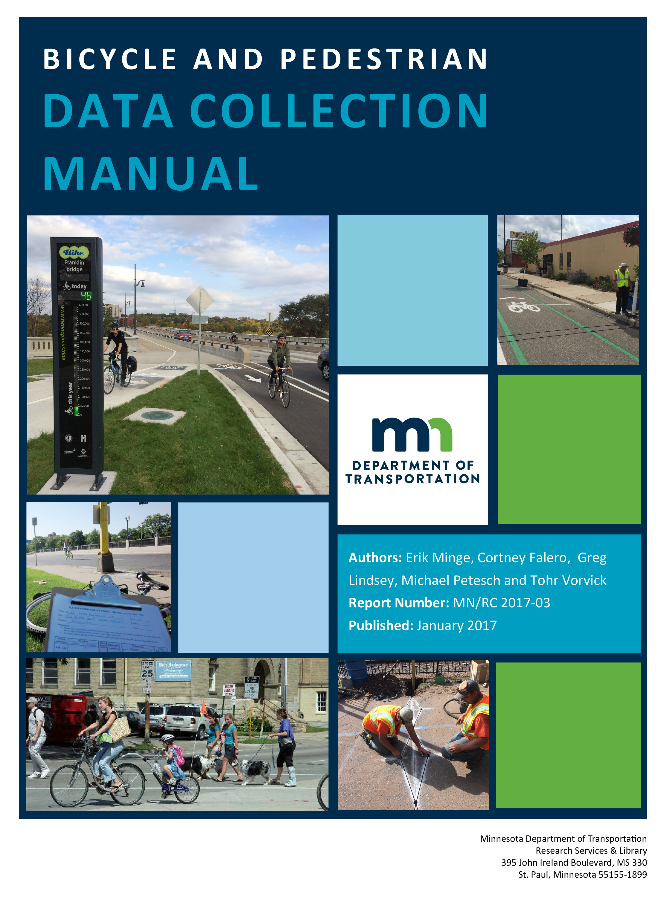
Topics covered in the manual include general traffic-monitoring principles, bicycle and pedestrian data collection sensors, how to perform counts using several types of technologies, data management and analysis, and next steps for nonmotorized traffic monitoring in Minnesota. Several case studies illustrate how bicycle and pedestrian traffic data can be used to support transportation planning and engineering.
The manual was completed as part of the third in a series of MnDOT-funded projects related to the Minnesota Bicycle and Pedestrian Counting Initiative, a collaborative effort launched by MnDOT in 2011 to encourage nonmotorized traffic monitoring across the state. U of M researchers, led by professor Greg Lindsey at the Humphrey School of Public Affairs, have been key partners in the initiative since its inception.
In addition to the manual, U of M researchers have published a final report outlining their work with MnDOT on this project. Key accomplishments include:
- A new statewide bicycle and pedestrian traffic-monitoring network with 25 permanent monitoring locations
- A district-based portable counting equipment loan program to support MnDOT districts and local jurisdictions interested in nonmotorized traffic monitoring
- Minnesota’s first Bicycle and Pedestrian Annual Traffic Monitoring Report
- A MnDOT website for reporting annual and short-duration counts that allows local planners and engineers to download data for analysis
- Provisions added to MnDOT equipment vendor agreements that enable local governments to purchase bicycle and monitoring equipment
- Annual training programs for bicycle and pedestrian monitoring
- Provisions in the Statewide Bicycle System Plan and Minnesota Walks that call for bicycle and pedestrian traffic monitoring and creation of performance measures based on counts
“This is an excellent resource that steps through all aspects of managing a count program, and I think it will be very helpful to other states and organizations that want to implement their own programs,” says Lisa Austin, MnDOT bicycle and pedestrian planning coordinator. “Since Minnesota is a leader in counting bicycle and pedestrian traffic, it also fulfills what I think is an obligation to share our story with others.”

Work-zone warnings could soon be delivered to your smartphone
Imagine that you’re driving to work as usual when your smartphone announces, “Caution, you are approaching an active work zone.” You slow down and soon spot orange barrels and highway workers on the road shoulder. Thanks to a new app being developed by University of Minnesota researchers, this scenario is on its way to becoming reality.
“Drivers often rely on signs along the roadway to be cautious and slow down as they approach a work zone. However, most work-zone crashes are caused by drivers not paying attention,” says Chen-Fu Liao, senior systems engineer at the U’s Minnesota Traffic Observatory. “That’s why we are working to design and test an in-vehicle work-zone alert system that announces additional messages through the driver’s smartphone or the vehicle’s infotainment system.”
As part of the project, sponsored by MnDOT, Liao and his team investigated the use of inexpensive Bluetooth low-energy (BLE) tags to provide in-vehicle warning messages. The BLE tags were programmed to trigger spoken messages in smartphones within range of the tags, which were placed on construction barrels or lampposts ahead of a work zone.

The researchers also developed two applications for the project. First, they designed a smartphone app to trigger the audio-visual messages in vehicle-mounted smartphones entering the range of the BLE work-zone tags. A second app allows work-zone contractors to update messages associated with the BLE tags remotely, in real time, to provide information on current conditions such as workers on site, changes in traffic, or hazards in the environment.
Field tests proved the system works. “We found that while traveling at 70 miles per hour, our app is able to successfully detect a long-range BLE tag placed more than 400 feet away on a traffic barrel on the roadway shoulder,” Liao says. “We also confirmed the system works under a variety of conditions, including heavy traffic and inclement weather.”
“This was a proof of concept that showed that smartphones can receive Bluetooth signals at highway speeds and deliver messages to drivers,” says Ken Johnson, work-zone, pavement marking, and traffic devices engineer at MnDOT. “Future research will look into how we should implement and maintain a driver alert system.”
This future work includes using the results of a human factors study currently under way at the U’s HumanFIRST Laboratory to create recommendations for the in-vehicle message phrasing and structure. Then, researchers plan to conduct a pilot implementation with multiple participants to further evaluate the system’s effectiveness.
According to MnDOT, another phase of the project may investigate how to effectively maintain the BLE tag database. This phase could also investigate implementation options, such as how MnDOT can encourage drivers to download and use the app.
