MnDOT installed network dash cameras and ceiling-mounted cameras on 226 snowplows, approximately one-quarter of MnDOT’s snowplow fleet. The cameras, integrated with the onboard mobile data computer and automated vehicle location equipment, automatically captured snapshots of road conditions during plowing. The snapshots were incorporated into several facets of MnDOT’s 511 traveler information system: the desktop and mobile versions of the website and the 511 app. Motorists and MnDOT alike found the project to be valuable, with the up-to-the-minute imagery helping members of the public and MnDOT’s maintenance staff make well-informed decisions during winter storm events.
“The largest barrier to implementation involved the development of the software package for integrating snowplow cameras into the current AVL system. It required a great deal of back-and-forth to get things right,” said oe Huneke, Maintenance Decision Support Systems (MDSS)/AVL Section Manager, MnDOT Office of Maintenance.
“We did research to make sure the cameras did not block drivers’ views, taking state and federal regulations into consideration, and we tested the cameras to make sure they were capturing images at the right resolution,” said Jon Bjorkquist, Maintenance Technology Development/ Implementation Coordinator, MnDOT Office of Maintenance.
What Was the Need?
Reliable information about road conditions during winter weather allows motorists to make informed travel decisions and helps MnDOT responders maintain roads. While meteorological updates on a winter storm and automated status reports on Minnesota’s snowplow fleet are important sources of data, they do not provide visual information about road conditions.
In 2015, a pilot project allowed MnDOT to take road condition pictures from cameras mounted on selected snowplows during winter storms. The system was limited, however. Few snowplows were outfitted with these cam-eras, images were not available to the public, and network infrastructure did not allow for easy scaling. A larger scale program was needed to capture road imagery taken from snowplows across Minnesota and to share the pictures with Minnesota motorists.
What Was Our Goal?
MnDOT sought to install cameras on a sizable portion of MnDOT’s snowplow fleet. In addition to making hardware and network enhancements to collect and compile the image data, MnDOT also set out to make the photos avail-able in near-real-time to its internal maintenance staff and the traveling public.
To capture images of road conditions, MnDOT mounted cameras in the cabs of one-quarter of MnDOT’s snowplow fleet.
What Did We Do?
In 2015 and 2016, MnDOT installed network dash cameras and ceiling-mounted cameras on 226 snowplows, approximately one-quarter of the agency’s total snowplow fleet. The cameras, integrated with the onboard mobile data computer and automated vehicle location (AVL) equipment, automatically captured snapshots of road conditions during plowing. This system included the following key operational features:
The dash cameras automatically recorded images whenever the computer-AVL system was on.
The cameras recorded an image of the road ahead of the plow.
Images were taken once every five minutes and were only retained if the plow was moving at least 10 mph.
The cameras were capable of taking operator-initiated snapshots and video clips.
Video clips could be classified into three categories: accident, general interest or work zone.
The system sent the plow camera images and metadata (geolocation, plow, camera and conditions) to a MnDOT server upgraded to accommodate the data. MnDOT set a data retention schedule for mobile snapshots and video segments as well as the data server.
Plow images were incorporated into several facets of MnDOT’s 511 traveler information system, including the desktop and mobile versions of the website and the 511 app. Plow images plotted at 10-minute intervals on the 511 maps provided motorists with up-to-the-minute, easily accessible information on road conditions. The images were also incorporated into MnDOT’s internal website called Condition Acquisition and Reporting System.
What Did We Learn?
The project demonstrated the successful integration of various hardware, software and network systems, carrying the road weather imagery step by step from the cameras to the public 511 interface. The project also succeeded in scaling up an earlier, modest effort to furnish snowplows with cameras.
In addition, MnDOT collected input on the value of the cameras from a range of interested parties: the public, snowplow operators and supervisors, and MnDOT management staff.
The public response was overwhelmingly positive, with 319 Facebook users responding to a MnDOT post about the cameras. All the respondents used positive emote icons (“heart” or “thumbs up”). Several members of the public provided responses through Facebook and MnDOT’s “Contact Us” Web page about the value of being able to view actual road conditions, though others expressed concern about the cost of the system.
Surveys of MnDOT snowplow drivers and supervisors and interviews of MnDOT managers revealed that supervisors and managers had a largely positive view of the program as well. Drivers provided mixed reviews. Comments from these groups yielded the following recommendations about implementing a program of this nature:
Perform outreach efforts that clearly communicate benefits to achieve broad buy-in from snowplow drivers. Provide training and follow-up instruction on use of the cam-era’s features to encourage drivers to use the manual snapshot and video features.
Address drivers’ concerns about privacy (such as “Big Brother is watching”) directly, and understand that these concerns have lessened over time. Supervisors should be advised not to react too quickly to privacy concerns.
Address concerns about in-cab distraction by adjusting the system configuration or hardware. This might include making dash camera screens dimmable at the driver’s option, or placing screens and cameras out of critical sightlines.
What’s Next?
This project was a success, with snowplow camera images providing significant benefits to MnDOT staff and the traveling public. Based on this work, MnDOT plans to install camera systems on additional snowplows in the state fleet—as deemed necessary by district management—and to continue displaying snowplow images on MnDOT’s 511 system.
Winter weather events have a regional and often national impact. “Storms never stop at the state line,” said Tom Peters, research and training engineer, MnDOT Maintenance Operations. “That’s why it’s so important for us to know about winter maintenance efforts around the country, and particularly at neighboring states with similar climates.”
MnDOT leads the Clear Roads Transportation Pooled Fund Project (clearroads.org), a national winter maintenance research consortium. In 2015, Clear Roads launched a national survey to collect and report the annual winter maintenance operations of state DOTs. The effort included nearly 50 data points related to equipment, materials and costs.
The results, which are available at clearroads.org/winter-maintenance-survey as a Microsoft Excel-based spreadsheet, are available at no cost for users to examine, analyze and parse as needed. Beyond the raw data, the spreadsheet includes calculated statistics and an interactive map for plotting key metrics.
The results quantified much of what was known only anecdotally and provided useful, actionable data. “Data trends by geographic region and over time let us make more informed operations decisions,” Peters said. “We can also draw on this information to communicate with management, elected officials and the public about how MnDOT’s winter operations fit in a national context.”
As the lead state, MnDOT commits significant administrative time and attention across the agency to Clear Roads. “It’s rewarding and satisfying to see such a useful product as one of the payoffs for all this effort,” Peters said.
Additional data collection for the 2015-2016 winter season is already complete. Look for an update to the online database later this year.
Research in Progress
Clear Roads has nearly a dozen research projects in progress, including:
At its September meeting in Omaha, Nebraska, the Clear Roads Technical Advisory Committee funded five new projects:
Utilization of GPS/AVL Technology: Case Studies
Standards and Guidance for Using Sensor Technology to Assess Winter Road Conditions
Emergency Operations Methodology for Extreme Winter Storm Events
Weather Event Reconstruction and Analysis Tool
Training Video for the Implementation of Liquid-Only Plow Routes
What is Clear Roads?
Clear Roads is a 33-member pooled fund program dedicated to winter road maintenance research. Led by MnDOT, Clear Roads projects evaluate winter maintenance materials, equipment and methods; develop specifications and recommendations; study and promote innovative techniques and technologies; and develop field guides and training curricula. Learn more at clearroads.org.
Darryl Oeltjenbruns, snowplow driver in District 7, operates the only driver assist system, or DAS, equipped snowplow in the state. The system helps snowplow operators see road alignments and features such as turn lanes, guardrails and road markings. (Photo by Chase Fester)
By Sue Roe, MnDOT Communications
Southwest Minnesota has the highest average wind speeds in the state—bad news for MnDOT snowplow operators who often drive in low visibility to clear roads.
“We have more days when the wind blows than when it doesn’t,” said Chase Fester, MnDOT District 7 transportation operations supervisor. “We struggle with the wind.”
That’s why District 7 is piloting a snowplow driver-assist system (DAS) developed by University of Minnesota researchers to combat the blowing snow and fog that often cause zero visibility. The DAS helps snowplow operators see the road alignment and features, such as turn lanes, guardrails, and road markings. Even in less extreme winter weather, snowplow operators gain assurance of their lane location using the system.
The driver assist system displays a white box on the screen when an obstacle, or in this case a mailbox, is located. If the object appears in the lane, such as a car stuck in a snow drift, the box turns red and gets bigger as the snowplow gets closer to the object. (Photo courtesy of MnDOT District 7)
The DAS was developed and refined over the past 20 years under multiple research projects funded by MnDOT and the USDOT’s University Transportation Center program. Professor Max Donath, director of the University of Minnesota’s Roadway Safety Institute, led the work. In addition to plows, the DAS technology has also been applied in other specialty vehicles such as patrol cars and ambulances. Numerous vehicles using the system have been deployed in both Minnesota and Alaska.
The DAS uses GPS technology and a front-mounted radar to provide an image of the road and any obstacles in front of the operator. The image is displayed on a monitor inside the cab of the plow. The system also vibrates the operator’s seat as a warning if the plow veers too close to the roadway’s centerline or fog line.
“If the driver gets within one foot of the fog line on the right side, the right side of the seat vibrates. If the driver gets too close to the centerline on the left side, the left side vibrates,” said Fester.
The vibrations continue until the driver moves back into the center of the lane. The driver can also turn off the warning feature to clear snow from the shoulder.
The DAS is currently installed in one truck in District 7. The $75,000 cost makes it difficult to install in every truck in the district or the state, although having at least one system in every district may be possible, Fester said.
Fester said the system proved its worth one day in February when blizzard conditions caused zero visibility and forced many road closures in southwest Minnesota. He was called out at 2 a.m. Feb. 8 to assist a stranded state trooper and several motorists on a 12-mile stretch of Hwy 60 between Windom and Heron Lake. Fester drove a pickup behind the DAS-equipped snowplow, driven by Darryl Oeltjenbruns, to reach them.
As the DAS identified stranded vehicles on the way to Heron Lake, Fester and Oeltjenbruns checked to make sure they weren’t occupied with people. Once they made it to Heron Lake, they stopped at the community center, where the state trooper and the stranded motorists he brought in were located.
On the way back to Windom, Fester and the state patrolman continued to check on stranded vehicles as the DAS-equipped snowplow led the way. If the vehicles weren’t in the ditch, motorists drove behind the two MnDOT vehicles. If their vehicles were in the ditch, motorists rode in a Suburban that was also being escorted to Windom. After returning to Windom, the motorists were dropped off at motels or truck stops.
“When we first went out, there were about six stranded vehicles. Coming back from Heron Lake, there were about 15,” Fester said. “At one time, we had 12 vehicles in line as we drove back to Windom, driving about 10 to 15 miles per hour.”
Later that morning the DAS system was used again to locate other motorists.
“We continued to use it until about 10 a.m. or 11 a.m. that day,” Fester said. “The system worked great and kept everyone safe. It was an interesting morning.”
(Reprinted and adapted with permission from an article by Sue Roe in MnDOT’s Feb. 17, 2016 Newsline.)
The results of last season’s deicing study are in — just in time for our next snow.
Last winter, Minnesota State University researcher Steve Druschel set up experimental lanes at two Shakopee entertainment parks and a test site on a Mankato bridge to examine the life cycle of winter maintenance, from plowing and the application of chemicals to the drainage of chemical residue after the roadway has been treated.
What the Study Found
The majority of chloride appears to leave the roadway by plow ejection, vehicle carry-away or tire-spray spreading, rather than through storm drainage, even in warmer storms.
Pavements don’t hold chloride very long in a precipitation event, even after anti-icing/pre-treatment.
Deicer effectiveness. Warmer temperatures provide more melt from the deicer. Little melt was observed below
10 degrees Fahrenheit unless sunlight provided warming, and prewetting produced no significant difference in deicer performance.
Dry pavements may be better candidates for pretreatment, with researchers noting that any wetness on the pavement ahead of a storm limited anti-icer effectiveness.
Truck traffic after deicer application was found to significantly improve deicer performance, resulting in both a wider and quicker melt.
Plow effectiveness. Even with different snow and temperature conditions, the evaluation of plow speed provided the same findings: snow rises higher in the curvature of the plow at higher speeds, creating a broader spray off the plow ends, and higher speeds decrease scrape quality.
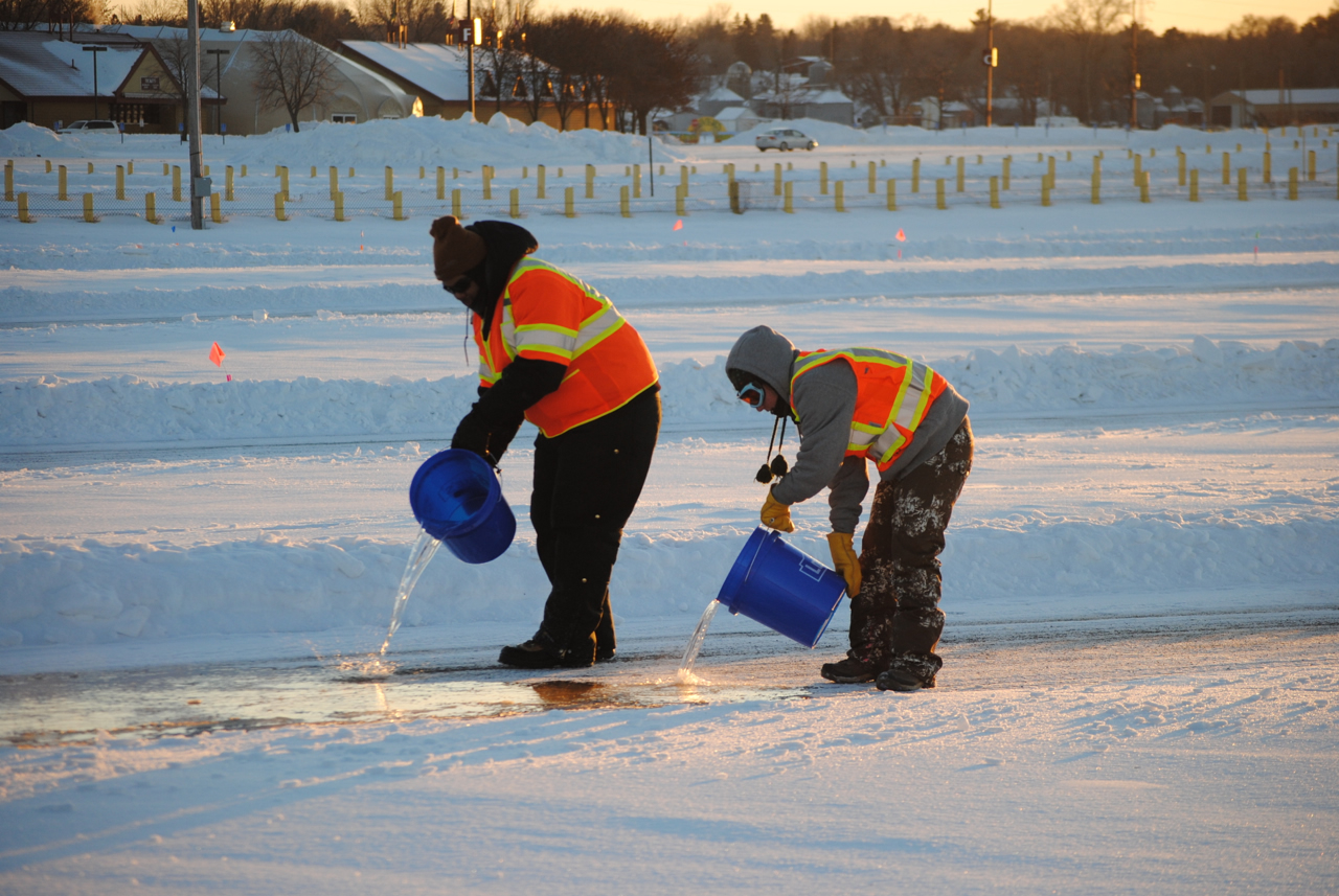
Students pour water to form ice on a test lane in Shakopee.
What’s Next?
The research team has proposed a third phase of this project to continue their work in the field, which is expected to include further examination of the impact of truck traffic on deicer effectiveness, variations in plow setup and expanded testing under varying weather conditions and snow structure.
Related Resources
Field Effects on Deicing and Anti-Icing Performance – Technical Summary (PDF, 1 MB, 2 pages); Final Report (coming soon)
Salt Brine Blending to Optimize Deicing and Anti-Icing Performance –Technical Summary (PDF, 1 MB, 2 pages) and Final Report (PDF, 11 MB, 151 pages) (previous study)


![[Infographic] Testing Snowplow Technologies: Slurry Spreader (target direction of salt, reduce salt use, reduce corrosion on trucks), Two-Way Reversible Plow (located on side of plow, providing more mobility in plowing and directing snow), Underbody Scraper (located under plow, clears compacted snow and ice from roads), True-Float Wind (mounted on front or side of plow, providing more mobility in plowing and directing snow)](https://mntransportationresearch.org/wp-content/uploads/2020/12/snowplowinfographic.jpg)