Tag Archives: Construction

New Project: Design guidance and best practices for the use of light fill for sustainable road construction

Lightweight Fill (LWF) materials—including Tire Derived Aggregates (TDAs), expanded shale/clay, foamed glass, and recycled glass aggregates—show strong potential for sustainable road construction, yet important knowledge gaps remain. Their environmental impacts, long‑term performance, and construction requirements are not fully understood, especially under Minnesota’s freeze‑thaw cycles and high groundwater conditions. Concerns such as leachate production, potential trench settlement, and challenges faced by local road departments highlight the need for further investigation.

This research seeks to address these gaps by reviewing existing practices, evaluating both environmental and mechanical performance, and developing data‑driven recommendations for using LWF materials in road construction. A detailed assessment will help clarify how these materials behave in pavement structures and embankments and how they interact with water‑sensitive environments. A decision matrix will be used to compare LWF materials and support future project planning.

To achieve these goals, the study will evaluate environmental impacts such as leachate risks, analyze long‑term structural integrity, and conduct Life Cycle Assessment (LCA) and Life Cycle Cost Analysis (LCCA) to assess sustainability and financial feasibility. The research will also develop recommended construction techniques that improve performance and support Minnesota’s climate goals and broader sustainability initiatives.

“Lightweight fill materials show promise for sustainable road construction, and Minnesota looks to learn from what has been done previously,” said Andrew Witter, Sherburne County Public Works Director and County Engineer. “This project will evaluate how these materials behave in local conditions and develop guidance for local counties and cities. The results will help agencies make informed decisions for the benefit of the transportation infrastructure in Minnesota.”

The Objectives:

  1. Document existing research and practices related to LWF materials in road construction.
  2. Evaluate the environmental impacts of LWF materials, focusing on leachate risks and interactions with water-sensitive environments.
  3. Analyze the long-term performance and structural integrity of LWF materials in both pavement structures and embankments.
  4. Compare LWF materials in a decision matrix to guide future project decisions.
  5. Perform Life Cycle Assessment (LCA) and Life Cycle Cost Analysis (LCCA) to assess the sustainability and financial feasibility of LWF materials.
  6. Provide recommendations to develop construction techniques that optimize the use of LWF materials and align with Minnesota’s climate goals and broader sustainability initiatives.

Project Details:

  • Estimated Start Date: 06/25/2025
  • Estimated Completion Date: 06/30/2027
  • Funding: Local Road Research Board
  • Principal Investigator: Michele Lanotte
  • Co-Principal Investigators: Angela Farina
  • Technical Liaison: Andrew Witter

Details of the research study work plan and timeline are subject to change.

To receive email updates about this project, visit MnDOT’s Office of Research & Innovation to subscribe.

New Project: Are Current Rigid Pavement Roundabout Designs Working in Minnesota?

As roundabouts become more commonplace in Minnesota, the role they play in the improvement of traffic flow and safety increases. Although rigid roundabouts were originally designed with the assumption that they would behave like rigid pavements on motorways, their performance can be affected by the unique traffic patterns and stresses they experience. The irregular shapes of their concrete slabs face distinct braking, stopping, accelerating, and drainage conditions, which increase the likelihood of cracking and other forms of pavement distress. Heavy trucks navigating sharp curves add additional strain. While concrete pavements are generally durable, pavement wear is greatly affected by elements characteristic of roundabout design.

This research seeks to evaluate and improve the performance of concrete roundabouts in Minnesota, with the aim of extending their service life and increasing their overall effectiveness. The project will start with a comprehensive field survey throughout the state, collecting information on different roundabout designs and documenting the types and levels of pavement distress present. The data will be analyzed to identify performance trends and gain a clear understanding of each design’s advantages and shortcomings. In addition to the field investigation, the study will conduct an in-depth structural review of factors such as joint spacing, dowel bar placement, slab geometry, and drainage features.

Using insights from both the field observations and structural analysis, researchers will propose design strategies to improve the durability of Minnesota’s roundabouts. These recommendations have the potential to strengthen roundabout design practices and contribute to a safer, more dependable transportation system.

“With the rapidly growing number of concrete roundabouts being constructed throughout Minnesota, it is important that we monitor their performance and adjust our design methodologies to ensure that the traveling public can utilize them safely, while maximizing the investments spent on their construction and maintenance,” said Thomas Burnham, research operations engineer with MnDOT’s Office of Materials and Road Research. “This research project is set up to accomplish these goals.”

The Objectives:

  1. To measure rigid pavement roundabout performance for various traffic loads and design features.
  2. Using pavement system performance data, identify any design changes that could minimize maintenance.
  3. Create state-of-the-art guidelines and recommendations for improving the design, function and lifespan of concrete roundabouts in Minnesota.

Project Details:

Details of the research study work plan and timeline are subject to change.

To receive email updates about this project, visit MnDOT’s Office of Research & Innovation to subscribe.
Putting Research Into Practice: New Tool Estimates Bridge Construction Time

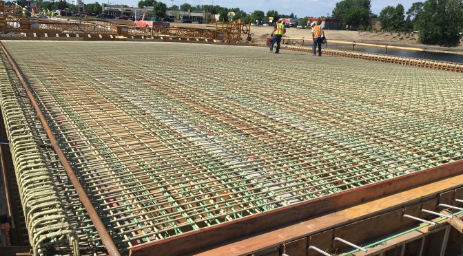
A new spreadsheet tool developed by the Minnesota Department of Transportation draws on historical data to help project engineers better estimate bridge construction time. The method allows users to project time-frames based on bridge design elements, work scheduling and other inputs, utilizing estimates from comparable projects in a 10-year database of bridge-building data.

Continue reading Putting Research Into Practice: New Tool Estimates Bridge Construction Time

New Project: Use of Innovative Technology to temporarily Deter Bat-Bridge Use Prior to and During Construction

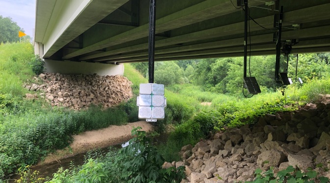
MnDOT has funded a study to evaluate the use of non-lethal ultrasonic acoustic devices to temporarily deter bats from bridges before and during construction projects.

Continue reading New Project: Use of Innovative Technology to temporarily Deter Bat-Bridge Use Prior to and During Construction

New Project: Creating a Tool to Estimate Bridge Construction Time and Costs

MnDOT recently executed a contract with WSB & Associates Inc. to begin work on a research project titled “Bridge Construction Time and Costs.”

The research project will help the State of Minnesota’s Bridge Office develop a guidance document and a tool for bridge construction time estimation to be used by MnDOT District project managers and construction staff. The tool will provide a range of production rates based on specific design criteria, being more concise based on the level of information available and will aid in evaluating the potential benefit for accelerated bridge construction (ABC) techniques.

“This research will enable District project managers, who may not have bridge knowledge or background, to complete project planning and scoping more effectively,” said Paul Johns of MnDOT’s Office of Construction and Innovative Contracting.

Mike Rief of WSB & Associates will serve as the project’s principal investigator. Johns will serve as technical liaison.

According to the initial work plan, the project is scheduled to be completed by early March 2018, and WSB & Associates will complete the following tasks:

  1. Conduct an existing practices literature review of current departments of transportation processes around the United States for bridge time and cost estimation.
  2. Review and compile actual case study bridge construction production rates and cost data for major bridge components from state-provided diaries, schedules and bridge plans.
  3. Evaluate and select the best software format and style for a bridge construction time estimation tool. Load state case study production rate data into estimation tool and run validation using bridges currently under construction.
  4. Produce a research report summarizing the literature review on best practices. Produce a user guide for bridge time estimation tool and training presentation.
  5. An optional task, if the budget allows, will include the development of a cost estimating tool. Cost estimation data would be gathered from the literature review and case study analysis during the development of bridge construction time estimation tool for efficiency.

Work-zone warnings could soon be delivered to your smartphone

Imagine that you’re driving to work as usual when your smartphone announces, “Caution, you are approaching an active work zone.” You slow down and soon spot orange barrels and highway workers on the road shoulder. Thanks to a new app being developed by University of Minnesota researchers, this scenario is on its way to becoming reality.

“Drivers often rely on signs along the roadway to be cautious and slow down as they approach a work zone. However, most work-zone crashes are caused by drivers not paying attention,” says Chen-Fu Liao, senior systems engineer at the U’s Minnesota Traffic Observatory. “That’s why we are working to design and test an in-vehicle work-zone alert system that announces additional messages through the driver’s smartphone or the vehicle’s infotainment system.”

As part of the project, sponsored by MnDOT, Liao and his team investigated the use of inexpensive Bluetooth low-energy (BLE) tags to provide in-vehicle warning messages. The BLE tags were programmed to trigger spoken messages in smartphones within range of the tags, which were placed on construction barrels or lampposts ahead of a work zone.

17245-NR20F5

The researchers also developed two applications for the project. First, they designed a smartphone app to trigger the audio-visual messages in vehicle-mounted smartphones entering the range of the BLE work-zone tags. A second app allows work-zone contractors to update messages associated with the BLE tags remotely, in real time, to provide information on current conditions such as workers on site, changes in traffic, or hazards in the environment.

Field tests proved the system works. “We found that while traveling at 70 miles per hour, our app is able to successfully detect a long-range BLE tag placed more than 400 feet away on a traffic barrel on the roadway shoulder,” Liao says. “We also confirmed the system works under a variety of conditions, including heavy traffic and inclement weather.”

“This was a proof of concept that showed that smartphones can receive Bluetooth signals at highway speeds and deliver messages to drivers,” says Ken Johnson, work-zone, pavement marking, and traffic devices engineer at MnDOT. “Future research will look into how we should implement and maintain a driver alert system.”

This future work includes using the results of a human factors study currently under way at the U’s HumanFIRST Laboratory to create recommendations for the in-vehicle message phrasing and structure. Then, researchers plan to conduct a pilot implementation with multiple participants to further evaluate the system’s effectiveness.

According to MnDOT, another phase of the project may investigate how to effectively maintain the BLE tag database. This phase could also investigate implementation options, such as how MnDOT can encourage drivers to download and use the app.

Behind the bridge slide: dish soap and a lot of planning

Using Dawn dish soap to grease the rails, MnDOT crews inched the new Larpenteur Avenue Bridge into place two weeks ago using an innovative construction method.

As the bridge reopens to traffic tonight over I-35E, MnDOT celebrates the success of its first slide-in place bridge construction.

“The slide-in worked very well,” said David Herzog, MnDOT’s project manager for the I-35E Corridor – MnPass Project. “I think the process has given us the confidence to possibly use it again in the future.”

Slide-in technology

The slide-in method has been used in the past for railroad bridges and large bridges with high traffic and limited construction options. Now, state agencies and the Federal Highway Administration are applying the method to smaller, more routine bridges to minimize impacts to the traveling public.

Whereas the typical phased construction of a bridge builds one-half of the structure at a time, slide-in bridge technology allows the entire superstructure to be built at once, requiring just a brief, temporary closure of the highway.

Crews constructed the 3.5-million-pound Larpenteur Bridge right next to the existing bridge and then slowly slid it into place during the course of two nights. This effectively sped up construction from 110 days to 47 and reduced traffic impacts to drivers. (Watch video of the slide.)

The quality of the bridge also improves with this method, since it eliminates the deck construction joints and girder camber problems associated with phased construction, according to the FHWA. The pressure to use faster concrete cure times is also reduced.

History

With a quarter of the nation’s bridges in need of repair or replacement, the FHWA is pushing the slide-in method as a cost-effective technique that can cut construction time in half. It has previously been used in Oregon, Utah, Missouri, Michigan, Colorado and Massachusetts.

The concept has been around for more than a century, but slide-in technology is relatively new for small or medium-sized bridges, and it’s the first time MnDOT has attempted it on a state bridge.

Although MnDOT staff had flown out to Utah to view a slide-in, it was Burnsville-based Ames Construction that proposed reconstructing the Larpenteur Avenue bridge that way when it made its successful bid for the corridor project.

The slide-in method is about 15 percent more expensive, Herzog said, but it allowed the bridge to re-open in 47 days, versus 110 days.

Earlier this summer, Ames replaced the Wheelock Parkway and Arlington Avenue bridges in conventional fashion, although they were only closed for 65 days because they were constructed on a very accelerated timetable.

“Larpenteur is more of a major thoroughfare and we thought shortening the duration of its closure would be more valuable to  MnDOT,” said Steve McPherson of Ames Construction, who was brought in from Utah to oversee the corridor project.

The fast reconstructions will allow the company to complete the bridge replacements and highway reconstruction in just 120 days. Next year it’ll finish the other half of the corridor.

All three bridges are being replaced to make room for the new MnPASS lane on I-35E.

One of the drawbacks to slide-in technology is that it requires ample room to build the bridge on-site. An alternative is to construct off-site.

The new Maryland Avenue/I-35E bridge was built off-site, as was the Hastings Hwy. 61 bridge. It was then loaded onto a barge, floated down the Mississippi River and lifted into place.

Related Resources

Video: 3D Technology Enhances Underwater Bridge Inspection

A new technology that uses 3D-imaging sonar will enable MnDOT engineers to visualize the substructure of a bridge in a way they never have before.

Until now, MnDOT has relied on human divers and depth finders to identify problems beneath the water.

Divers are limited by what they can see and feel in murky waters, however, and depth finders can only look down, not around.

“With this new technology, we will be able to provide high resolution three-dimensional images of underwater areas, structures and objects to show what is occurring, regardless of water clarity,” said MnDOT Bridge Waterway Engineer Petra DeWall, who has received funding from MnDOT’s Transportation Research Innovation Group to purchase the equipment.

Video imagery from a sonar inspection of Minneapolis’ Third Avenue bridge is above.

Currently, MnDOT hires engineer divers to physically inspect about 500 bridges every five years. They look for cracked concrete, exposed reinforcement and other detrimental conditions.

Although divers can spot issues, they can’t always thoroughly assess the scope of a problem, such as the amount of sediment being washed out around a bridge pier, a problem called bridge scour.

It can also be difficult — or dangerous — for divers to venture down for an inspection.

This was the situation last winter with the Third Avenue Bridge in downtown Minneapolis, where the streambed has degraded around a bridge pier, causing erosion to the pier.

“The Third Avenue inspection was not totally detailed. We knew there was a void under the bridge, but it was very hard to visualize,” DeWall said.

Early ice build-up halted further inspection in November, so MnDOT asked 3D sonar scanner manufacturer Teledyne BlueView to scan the area as a demonstration of its equipment.

A video of the inspection is below:

Multiple holes were cut in the ice sheet to deploy the sonar, which provided an image of the bridge scour by emitting sound-waves that created a point cloud.

“It gives you a large data set of where the sound reaches and comes back to the equipment,” DeWall explained.

The 3D image provides a level of detail that will enable repair and construction contractors to make more accurate bids, saving MnDOT money on projects.

Although dive inspectors are also beginning to invest in this new technology, MnDOT wants its own equipment to perform quick assessments of troublesome spots without going through the lengthy contracting process.

The Federal Highway Administration is conducting a pooled fund study to see if the technology eliminates the need for dive inspectors all-together.

MnDOT also plans to use its 3D scanning sonar to inspect repair projects and assess bridge construction.

One of DeWall’s first goals is to take a scan of the Hastings bridge after construction is complete, which will provide a baseline scan that can be compared against future inspections. The old bridge has had problems with the loss of rocks at its piers. It is unclear if the rock just sinks or is washed away downstream. Monitoring will let MnDOT see what is happening over time.

“Inspection is just one part of it,” DeWall said of the sonar equipment. “The big interest in this project is coming from our construction folks.”

Post-Construction

Imagine building a new house and not being able to complete the final walk-through.

This is the situation that transportation departments face when they build a new bridge, due to the limitations of underwater inspections.

“With 3D technology, you can go back afterward and check to make sure things were done the way they were supposed to,” DeWall said.

DeWall wishes the state had the scanner many years ago when a bridge was built that required expensive correction.

A bridge construction crew left construction material behind under the water, which wasn’t discovered until the redirected water flow caused significant erosion to the bridge pier.

Divers picked up that something was going on during a routine inspection, but engineers still had to bring in depth finders to get a better look. Due to the water current, they were limited in how close they could get to the bridge pier, and turbulence crashed their boat against the pier, damaging the transducer.

Not only would this 3D technology have provided a more thorough assessment than the depth finder, it also could have captured the imagery from a safe distance away.

New LRRB videos focus on work zone safety

The Minnesota Local Road Research Board is a major source of funding for transportation research in the state. Occasionally, it also produces educational videos designed to raise public awareness of important transportation topics.

Two new video offerings from the LRRB (embedded above and below) are focused on save driving in work zones. While not directly research-related, they might prove a useful resource to transportation professionals. More importantly, they serve to remind us all of the very real and dramatic consequences of work zone crashes, of which there are approximately 2,000 per year in Minnesota.

You might want to also check out some of their other recent YouTube offerings, including explanations of why we need stop signs and speed limits, as well as a fascinating look at how potholes are patched.

What happens when you incentivize transit use during construction projects

In 2010, MnDOT began a three-year long, $67 million repair and upgrade project on I-35 in Duluth. Dubbed the “Mega Project,” it created a serious disruption for Duluth-area commuters. To help mitigate the impact, the Duluth Transit Authority stepped up its bus services, offering free rides in newly established bus-only express lanes as well as access to new park-and-ride lots and various other enticements. Perhaps not surprisingly, many area residents took advantage of their new transit options to avoid construction-related travel delays. But what’s really interesting is what happened after the construction ended.

As described in a recently published MnDOT/University of Minnesota study, commuters who started taking the bus to avoid traffic caused by the construction ended up continuing to ride the bus even after the construction ended. Researchers surveyed riders during and after the 2010 and 2011 construction seasons and found that, even after bus fares went back to normal levels, only 15 percent of the new bus users switched back to driving. Researchers concluded that once riders developed a habit of using transit, the habit tended to stick.

The report author sums up the phenomenon quite nicely in her executive summary:

Human beings are creatures of habit. Most of us travel the same route every day to the same destination. Sometimes, however, something comes along to push us to examine our habits and possibly change them. A major highway construction project can be such an event. (…) This provides a very good opportunity to examine our travel patterns and possibly change our habitual modes.

Of course, this change didn’t just happen on its own. As the technical summary notes, the DTA marketed its services aggressively during this period. (The above photo is just one example.) The study also noted that the elimination of expanded bus services in the winter had a negative impact on ridership.

Read more: