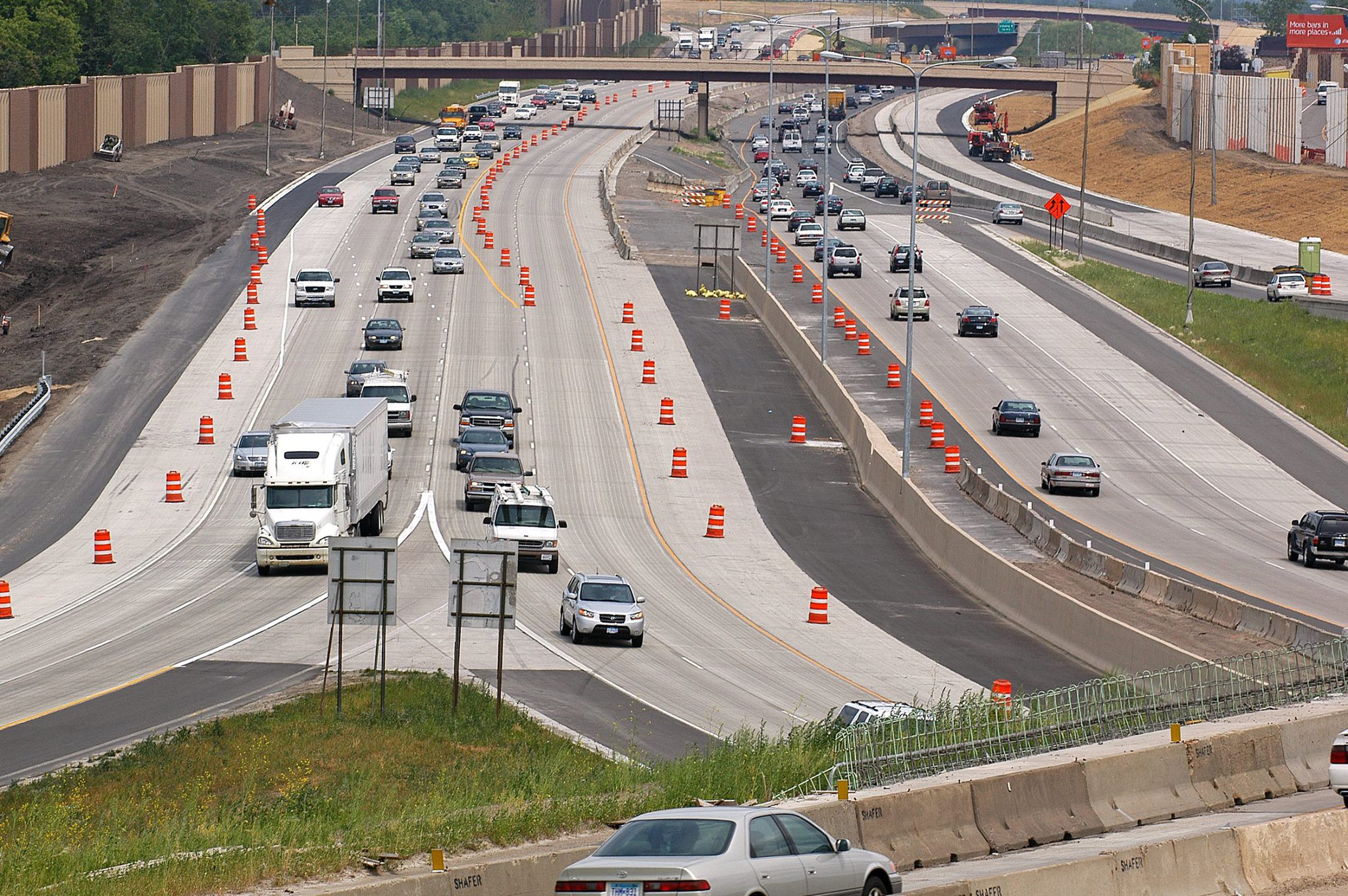
In 2019, the Minnesota Legislature passed a law reducing barriers for cities to systematically lower speed limits. The City of St. Louis Park followed this guidance by reducing speed limits in 2021, but initial speed data collected before and 6–8 months after the changes showed little to no short‑term impact. Because driver behavior is habitual and may change slowly, advocates suggest that greater reductions in operating speeds may emerge over time, highlighting the need for repeat monitoring between 2025 and 2027.
This study aims to evaluate whether longer‑term changes have occurred 2–4 years after the initial reductions, while also examining other Minnesota agencies that have implemented or are considering reduced speed limits. The research will gather both measured and anecdotal data, assess “after” speed conditions where needed, and analyze how effectiveness varies based on roadway characteristics and any accompanying speed reduction countermeasures. These efforts address lingering questions about how speed limit changes influence driver behavior and roadway safety over time.
Understanding speed is critical because it directly affects the safety of all road users. According to Minnesota Motor Vehicle Crash Facts 2022, speeding was the leading cause of traffic fatalities, contributing to 130 of the state’s 444 deaths. By identifying agencies that have reduced speed limits, evaluating short‑ and long‑term impacts, and analyzing site‑specific factors, this research will produce guidance to help Minnesota road agencies assess and implement effective speed limit reductions.
“There is renewed interest in lower speed limits on municipal-type streets,” said Victor Lund, traffic engineer with St. Louis County’s Public Works Department. “The objective of this research is to better understand the intersection of speed limit policy, driver behavior and safety, which will result in guidance to better inform policies, practices and speed limits that support safer streets.”
The Objectives:
Identify local agencies in Minnesota that have implemented reduced speed limits or may consider implementation along with any speed reduction countermeasures that have been implemented with the reduced speed limits.
Evaluate the short-term and long-term effects of speed limit reductions implemented in Minnesota through the collection and analysis of speed data.
Assess how these effects vary based on site characteristics or speed reduction countermeasures that were implemented in coordination with the reduced speed limit.
Based on the findings, develop a summary document to aid Minnesota road agencies in assessing potential speed limit reductions.
As roundabouts become more commonplace in Minnesota, the role they play in the improvement of traffic flow and safety increases. Although rigid roundabouts were originally designed with the assumption that they would behave like rigid pavements on motorways, their performance can be affected by the unique traffic patterns and stresses they experience. The irregular shapes of their concrete slabs face distinct braking, stopping, accelerating, and drainage conditions, which increase the likelihood of cracking and other forms of pavement distress. Heavy trucks navigating sharp curves add additional strain. While concrete pavements are generally durable, pavement wear is greatly affected by elements characteristic of roundabout design.
This research seeks to evaluate and improve the performance of concrete roundabouts in Minnesota, with the aim of extending their service life and increasing their overall effectiveness. The project will start with a comprehensive field survey throughout the state, collecting information on different roundabout designs and documenting the types and levels of pavement distress present. The data will be analyzed to identify performance trends and gain a clear understanding of each design’s advantages and shortcomings. In addition to the field investigation, the study will conduct an in-depth structural review of factors such as joint spacing, dowel bar placement, slab geometry, and drainage features.
Using insights from both the field observations and structural analysis, researchers will propose design strategies to improve the durability of Minnesota’s roundabouts. These recommendations have the potential to strengthen roundabout design practices and contribute to a safer, more dependable transportation system.
“With the rapidly growing number of concrete roundabouts being constructed throughout Minnesota, it is important that we monitor their performance and adjust our design methodologies to ensure that the traveling public can utilize them safely, while maximizing the investments spent on their construction and maintenance,” said Thomas Burnham, research operations engineer with MnDOT’s Office of Materials and Road Research. “This research project is set up to accomplish these goals.”
The Objectives:
To measure rigid pavement roundabout performance for various traffic loads and design features.
Using pavement system performance data, identify any design changes that could minimize maintenance.
Create state-of-the-art guidelines and recommendations for improving the design, function and lifespan of concrete roundabouts in Minnesota.
MnDOT relies on estimates of annual average daily traffic volumes to plan and maintain safe, effective transportation network infrastructure for all travelers. Estimating traffic volumes for nonmotorized road users such as bicyclists and pedestrians has been challenging because monitors are limited compared to vehicle traffic counters. Data from mobile devices, routinely collected through a variety of platforms, offers a potential source of traveler routes. Using monitored nonmotorized traveler data to validate mobile datasets, researchers produced a data visualization tool to estimate bicyclist and pedestrian counts within the Twin Cities area.
Inadequately timed traffic signals at intersections are a major contributor to traffic congestion and increased travel times. Adaptive signal timing can detect and respond to real-time vehicle queues, resulting in more efficient vehicle movement through a corridor than traditional traffic signals. A revised max-pressure traffic signal controller could decrease delays and increase vehicle throughput at intersections.
Providing consistent freeway travel times for Twin Cities area drivers requires careful traffic management and well-planned freeway projects. To effectively respond to incidents and identify the most needed renovations, MnDOT traffic managers need to know precisely where, when and why congestion is happening.
In a recent study, researchers leveraged previous MnDOT research and existing traffic monitoring infrastructure to refine inductive loop signature technology that counts and classifies vehicles. Positive results have given MnDOT a feasible and cost-effective way to collect vehicle classification data throughout the state for planning and decision-making.
Light rail transit and bus rapid transit in the Twin Cities provide urban residents with fast, safe and reliable transportation. These transitways have the potential to attract more riders and further reduce automobile traffic, relieving the growth of congestion on nearby roads as people decide to be transitway passengers rather than motorists.
Video and statistical analyses showed that arterial bus rapid transit (ABRT) along Snelling Avenue in Minneapolis-St. Paul had no significant impact on traffic volume and wait times at intersections. Survey results demonstrated that users prefer the A Line over local bus service and consider it roughly equivalent to express bus, light rail and commuter rail service. Though ABRT has not converted automobile drivers to transit riders, users enjoy its easy payment format, cleanliness, route service and convenience. This study also provided recommendations for future ABRT line design considerations.
MnDOT sought to determine the full range of intersection control information (ICI) currently used in the state and how it could best be made accessible for state transportation system needs. Researchers created the Regional Database of Unified Intersection Control Information, a machine-readable, cloud-based unified ICI system. They determined steps MnDOT could take toward more effective use of its central traffic signal control system, such as mitigating traffic disruption around construction zones and participating more fully in emerging technologies such as vehicle information systems and vehicle automation.
MnDOT is exploring different software options for developing a “mesoscopic dynamic traffic model” that can more accurately predict road construction impacts than current macroscopic models like the Twin Cities Regional Travel Demand Forecasting Model.
“Dynamic traffic assignment is an emerging model type, and there are a lot of software platforms with different methodologies. MnDOT was interested in reviewing their pros
and cons,” said Jim Henricksen, Traffic Forecaster, MnDOT Metro District, who helped lead a recent research project that analyzed different software packages.
“A team maintains the Twin Cities Regional Travel Demand Forecasting Model. Any mesoscopic model would require a similar maintenance effort to keep the model from becoming obsolete as construction adds new lanes,” said John Hourdos, Director, Minnesota Traffic Observatory, University of Minnesota, and principal investigator for the study.
What Was the Need?
Traffic modeling is a valuable tool used in transportation planning to predict the impacts of new construction or maintenance projects. MnDOT currently has modeling tools available in two scales: macroscopic and microscopic. Macroscopic-scale planning level tools such as the Twin Cities Regional Travel Demand Forecasting Model predict driver route choice and the number of drivers that will travel on a given road at a given time. Microscopic-scale traffic simulation, on the other hand, models driver behaviors such as gap acceptance or acceleration rates. MnDOT uses microscopic-scale simulation to plan capacity-increasing projects, but the tool is only feasible on the corridor level because generating the simulation requires a large amount of data and computing power.
To bridge these two scales, MnDOT is developing a mesoscopic-scale dynamic traffic assignment (DTA) model for the Twin Cities. This model falls between microscopic- and macroscopic-scale modeling in scope and complexity. It simulates the movement of individual vehicles based on traffic flow equations rather than driving rules, which requires less detail and computing time than a microscopic simulation and can be used over a wider area. MnDOT will use this model for applications such as staging construction seasons to minimize the disruption caused by multiple large projects, or coordinating traffic modeling across the road networks operated by MnDOT, counties and cities.
To assist in developing this system, MnDOT needed information about the capabilities of available modeling software packages in addition to the needs, desires and restrictions of the agencies and consultants who will be using the model.
What Was Our Goal?
The goal of this project was to better understand the capabilities of commercially avail-able modeling software packages to address MnDOT’s modeling and simulation needs.
What Did We Do?
Investigators interviewed stakeholders about their understanding of and need for mesoscopic traffic simulation and DTA. Stakeholders included individuals who have used or requested data from the Twin Cities Regional Travel Demand Forecasting Model maintained by the Metropolitan Council. Investigators also reviewed four case studies of mesoscopic DTA models used in Manhattan; San Francisco; Detroit; and Jacksonville, Florida.
To supplement the findings from the interviews and case studies, investigators conducted a comprehensive review of the claimed capabilities of six commercially avail-able traffic simulation software packages: TransModeler, Aimsun, DynusT/DynuStudio, Dynameq, Cube Avenue and Vissim. Investigators didn’t test the software, but instead reviewed manufacturers’ documentation and literature to identify limitations of their methods and whether those methods are applicable to MnDOT’s needs.
DTA can aid in staging multiple major construction projects in the Twin Cities to minimize the disruption they cause to travelers.
What Did We Learn?
To compare the capabilities of the various simulation software packages, investigators created a matrix that included comprehensive notations about a software package’s claimed features that may not fully meet MnDOT’s simulation needs. For example, some software packages claim to model actuated signals, but they create models based on Highway Capacity Manual assumptions rather than real-world conditions.
DynusT is the most commonly used simulation program, possibly because it is open-source and the easiest software to use, although it requires DynuStudio, a commercial graphical user interface and data management system. DynusT also has some limitations, such as not considering the individual lanes in each roadway segment, which would limit its effectiveness in modeling roads where individual lanes have imbalanced densities.
Most interviewees had only limited experience with mesoscopic modeling. Incorporating traffic signals in a simulation network is a significant challenge, according to interviewees, because currently a database of signal timings isn’t available.
While all four of the DTA case studies reviewed required more data, calibration and validation than older models, each of the developers reported that these challenges had been mitigated, and the models created could answer complex questions that previous models couldn’t.
What’s Next?
Traffic simulation and modeling is a fast-developing field, particularly mesoscopic-scale modeling. Each of the software packages reviewed in this project has had at least two new versions in the past 18 months, and while their modeling approaches are fundamental to the software in some cases, in other cases capabilities will be added or improved as software develops.
The foundation of a mesoscopic model for the Twin Cities has been built and tested in Transmodeler (with significant pro bono work from the software developer). However, MnDOT has also used its existing DynusT model for several projects beyond its initial purpose, and the agency will use the information gathered in this project to determine which approach is more practical for MnDOT and its consultants based on cost, capabilities and data availability. Transmodeler is generally more powerful, but it will also incur greater costs, particularly since every consultant would need to acquire its own copy of the software.