

Providing consistent freeway travel times for Twin Cities area drivers requires careful traffic management and well-planned freeway projects. To effectively respond to incidents and identify the most needed renovations, MnDOT traffic managers need to know precisely where, when and why congestion is happening.
What Was the Need?
Consistent freeway travel times are crucial to the quality of life and economic health in the Twin Cities metropolitan area. Such reliable travel times require timely responses and effective mitigation of freeway congestion, which are key goals of MnDOT’s Regional Transportation Management Center (RTMC). Recent research into travel-time reliability produced a software tool to help MnDOT effectively and efficiently manage traffic congestion and incidents. The tool will also support the agency in identifying and prioritizing future freeway improvement projects.
To respond to incidents and identify the most needed renovations, traffic managers need to know precisely where, when and why congestion is happening. Travel-time reliability—a key indicator for transportation system operations and management—measures the consistency or dependability in travel times from day to day or across different times of the day.
“These tools will help us identify not only the most problematic corridors for traffic congestion in the metro area, but the factors causing the problems. The data will be invaluable for our business and planning processes,” said Brian Kary, director, MnDOT Regional Transportation Management Center.
In a previous MnDOT research project, investigators developed the Travel-Time Reliability Estimation System (TeTRES), which integrates data from multiple sources and estimates reliability measures for specific corridors under various operating conditions, such as weather, incidents and work zones. The tool proved useful in assessing the effectiveness of traffic control and incident management strategies during the 2018 Super Bowl event in the Twin Cities.
Further enhancements were needed, however, to broaden its usefulness and create a comprehensive system that can be used by MnDOT traffic managers and planners in assessing reliability and traffic flow performance of the freeway corridors in an integrated manner.
What Was Our Goal?
The goal of this project was to expand TeTRES developed in previous research by adding a new module to calculate traffic flow performance measures and analyze the reliability variation trends of individual corridors in the Twin Cities metropolitan freeway system under different operating conditions. The enhanced TeTRES can be used by MnDOT in developing optimal responses to various levels of traffic, weather and incident conditions and also for prioritizing corridor improvement strategies.
What Did We Do?
Starting with TeTRES, investigators added a new module that calculates measures of traffic flow effectiveness—how well traffic is flowing on a specific corridor at a given time. These measures include, for example, vehicle miles traveled, speed variations, miles of congested roadway and delayed vehicle hours, which represent the total delay experienced by all vehicles on a given route during given time periods.
Next, they populated the TeTRES database with historical traffic flow, weather, work zone and special event data, which allowed them to calculate travel times on 116 identified routes for every five-minute interval from 2012 to 2020. Investigators linked these travel times to external operating conditions, such as weather or incidents, and stored information in the database.
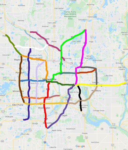
Then they analyzed the travel-time reliability trends from 2016 to 2020 of 48 routes on 23 corridors, identified in collaboration with RTMC. Each corridor has two directional peak routes, while one corridor has two directional routes for both morning and evening peak periods. For each directional route, investigators estimated monthly and yearly reliability and traffic flow performance trends under different operating conditions.
In particular, investigators combined two reliability measures–the buffer index (a ratio representing additional time above the average travel time for a specific corridor) and the travel rate (a function of the travel time and route length)–and created a new combined index called the vulnerability index, which indicates the combined level of reliability and congestion. This index can be used to rank the individual corridors for needed improvements or other management treatments. The vulnerability index was also applied to identify and prioritize bottleneck sections for each individual freeway corridor in the Twin Cities freeway network.
“The system we developed can very efficiently calculate travel-time reliability for any given corridor. Further, it can be used for applications like identifying and prioritizing bottlenecks on Twin Cities freeways,” said Eil Kwon, professor, University of Minnesota Duluth Department of Civil Engineering.
Finally, investigators explored a method to quantify the operational resilience of a highway corridor. This measure refers to the capability of a given corridor to adapt and recover from abnormal disturbances that lead to congestion.
What Did We Learn?
Investigators’ comprehensive efforts culminated in a software system that efficiently calculates travel-time reliability and analyzes key operational measures for any corridor in the metro area. In calculating travel-time reliability trends under various operating conditions in the 23 corridors, they drew conclusions for each corridor, including:
- If congestion is improving or worsening.
- The impact the pandemic had on freeway congestion.
- What effect different weather events such as snow have on traffic.
- How work zones alter travel times.
- Traffic changes resulting from large population events such as football games.
From their exploratory work on calculating a highway corridor’s resilience, investigators developed a model to quantify corridorwide operational resilience. Testing it on three freeway segments, they identified a clear relationship between operational resilience and geometric factors, such as number of weaving sections, where merging and exiting lanes intersect, and the number of entrance and exit ramps on a given corridor.
What’s Next?
MnDOT can already use the data produced from this study in planning future projects. To make the software more broadly accessible to traffic planners and managers, the agency will develop staff expertise and process protocols. In addition to ongoing enhancements and improvements to the operation and maintenance of TeTRES, further testing and refinement of the resilience model could be expanded with additional research.
