Managed lanes, like Minnesota’s E-ZPass express lanes, are designed to improve mobility and travel time reliability for transit users, carpoolers and other motorists during peak travel hours. The lanes provide many societal benefits such as increased transit ridership, higher vehicle occupancies, more reliable travel options, and reduced traffic congestion and pollution.
However, because the lanes use pricing to deliver these benefits, they must be designed, constructed and operated equitably. The key is striking a balance that’s fair for everyone.
Researchers have developed a more comprehensive, standardized method for evaluating and selecting MnPASS managed lane projects. The new methodology uses a return on investment (ROI) and benefit–cost analysis framework that includes a more extensive set of factors, variables and perspectives than earlier methods. After applying the broader range of impact categories from the new methodology to an earlier study of a MnPASS corridor, researchers found that the MnPASS projects provide more benefits than previously reported.
In the past, MNDOT used a series of evaluation methods—cost estimation, performance measures and travel demand forecasting—to select new MnPASS corridors. While the recommendations and results from these assessments were adequate, each evaluation used a different set of objectives and assumptions. The range of benefit–cost factors in earlier evaluations was also limited to travel time savings, operating costs and crashes.
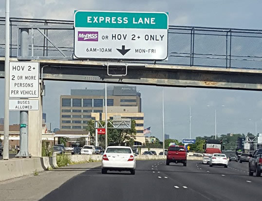
An overhead sign above a MnPASS express lane explains that drivers must have MnPASS or two or more occupants in a vehicle to use the lane during peak travel time of 6 a.m. to 10 a.m., Monday through Friday.
“Our previous corridor studies each had different benefit–cost elements, making direct comparisons difficult. This project makes it possible to quantify the transit, environment and travel time reliability benefits that we knew were there all along,” John Wilson, Economic Policy Analyst, MnDOT Office of Transportation System Management
MnDOT needed a more thorough and consistent benefit–cost analysis methodology to help decision-makers better assess MnPASS project alternatives; compare potential MnPASS corridors; and communicate why MnPASS is a financially effective, long-term strategy for addressing mobility and congestion issues.
What Was Our Goal?
The goal of this project was to develop a refined, standardized methodology to more accurately assess the ROI of MnPASS programs and projects. A refined assessment framework would include a broader range of financial and performance measures, allowing MnDOT to more thoroughly evaluate MnPASS investments.
What Did We Do?
Using ROI as the central framework, the research team set out to generate a more comprehensive method for estimating benefits and costs. To begin, team members identified limitations in the existing benefit–cost analysis methodology and developed a list of factors to include in the refinement process. Then they interviewed stakeholders from various agencies to better understand MnPASS planning and operations needs, as well as the data required to support the research and system benefits and costs.
Next, they began to develop the enhanced framework by defining economic, environmental and social ROI categories for MnPASS investments, and mapping the relationship between these categories and their associated benefits and costs. Benefit– cost analysis methods then were used to build the refined framework and to estimate benefit–cost ratios for projects. Finally, researchers applied the new framework to an earlier benefit–cost analysis of the Interstate 35 West (I-35W) North Managed Lanes project to compare the results of the new framework with the results from the earlier analysis.
What Did We Learn?
Researchers used additional benefit factors such as transit use, travel time reliability, emissions and noise to refine the ROI calculation methods. When they applied the new ROI framework to the I-35W project, they found that the MnPASS benefit–cost ratio significantly improves with the inclusion of transit and travel time reliability benefits.
“Benefit–cost analysis had not changed for a long time; we had looked at travel time, vehicle operating costs and safety. Now we have added travel time reliability, which is important because we are moving people, not just vehicles.”—Paul Morris, Senior Associate, SRF Consulting Group, Inc.
What’s Next?
The results from the comparative analysis yielded a notably higher benefit–cost ratio of 3.40 for the test corridor compared to a benefit–cost ratio of 2.11 in the original study, indicating that MnPASS projects have more positive effects than previously identified. Based on these findings, MnDOT will revise its benefit–cost guidance for evaluating MnPASS investments.
The research team was also able to measure the impacts of specific categories on the overall outcome of the calculations. Team members found that while the measures for reliability and transit impacts produced a meaningful change in the overall benefits, those for emergency response, emissions and noise impacts were very small relative to overall project costs. MnDOT will consider these findings in establishing updated procedures.
Until recently, Minnesota drivers could only enter or exit high-occupancy toll (HOT) lanes via select ramps and access points. But MnDOT has changed most of its MnPASS express lanes to an open-access system to allow more movement between general purpose and high-occupancy toll (HOT) lanes.
Although MnDOT prefers this open access system, there could safety concerns for allowing lane changes in certain locations, especially if traffic patterns change. A new design tool developed by MnDOT-sponsored research enables traffic engineers to evaluate existing or prospective HOT corridors and determine the impact of open or closed access. When data shows changes in traffic patterns and congestion, the software also allows technicians to model and design changes in MnPASS access to improve drive mobility and safety.
“Nothing like this has been developed anywhere else. There is a lot of debate around the country about high-occupancy designs. This tool helps us develop designs and monitor existing corridors,” said Brian Kary, Director of Traffic Operations, MnDOT Regional Transportation Management Center.
Background
In Minnesota, high-occupancy toll (HOT) lanes are used by buses, carpools and motorists with transponders that trigger payments for rush hour use. During rush hour, fees increase as congestion increases; at other times, the lanes are free for all users.
MnDOT research in 2014 concluded that both closed and open HOT lane configurations effectively and safely improve traffic capacity. But researchers anticipated that roadway sections on an HOT lane corridor may eventually experience safety and mobility problems if toll prices are lowered or traffic volume increases. During heavy traffic, driving speeds often vary dramatically between HOT and general purpose lanes. Drivers moving into MnPASS lanes may force other drivers to brake suddenly to avoid collisions and trigger shockwaves of slowed or stopped traffic behind them. MnDOT prefers open-access designs for the increased options they offer road users, but it was not clear how best to manage access to reduce the incidence of shockwaves and the safety and mobility problems they create.
MnDOT has changed most of its MnPASS lane markings from double solid lines to skipped double lines to allow more open movement between general purpose and HOT lanes. A new software tool allows RTMC engineers to reassess MnPASS access to respond to changing traffic patterns.
The goal of this research implementation effort was to develop a software tool that the Regional Transportation Management Center (RTMC) could use to assess corridor operations and design. Based on design recommendations from earlier research, the tool would allow RTMC users to predict the safety and mobility impacts of a change from open to closed HOT lanes, and estimate where in the corridor such changes could be implemented safely and effectively.
Investigators developed this system with links to MnDOT’s database to draw on historical data to identify patterns of traffic demand over time and generate predictions of points in the MnPASS lanes at which shifts from open- to closed-access HOT lanes will offer the most benefit. The program’s code integrates the various models, data sets and tools mentioned above into software that integrates smoothly with the RTMC’s current software and capabilities for collecting speed and volume data, developing interfaces to model impacts of changing open designs at certain points in the freeway corridor to closed designs. The tool includes a module for access design, a module for generating data and a web application.
“This tool is calibrated for the Twin Cities. It takes real-time data and diagrams each location separately for lane changes and reaction time. It took theoretical ideas and made them usable,” said John Hourdos, Director, Minnesota Traffic Observatory, University of Minnesota.
What Was the Impact?
After receiving training in using the new software, RTMC engineers have embraced the MnPASS design tool to regularly report MnPASS performance to the Federal Highway Administration and to generate quarterly and annual analyses and recommendations for changing specific locations from open access to closed access. Closing requires restriping and changing signage—operations that allow MnDOT to respond quickly and easily to shifts in traffic patterns and potential mobility and safety impacts.
The project also offers data for the broader transportation community in which experts debate the relative merits of open- and closed-access HOT designs. With MnPASS, MnDOT has emerged as a leader in open design; this software allows sophisticated modeling of design impacts for the national traffic operations community.
What’s Next?
The MnPASS design tool effectively monitors corridor behavior and design changes. Improvements may yet be made to allow data calibration and validation for slower traffic speeds that represent mobility breakdowns, and to refine aspects of car-following and shockwave models. Increased density scenarios can also be further improved to better accommodate traffic density increases in regular lanes alongside HOT lanes.
In its current form, the tool will be used to analyze open- and closed-access designs on the Interstate 394 corridor to determine the best locations for changes to MnPASS lanes, and positions MnDOT and the RTMC to respond to traffic demand changes in the future.
This post pertains to Report 2018-11, “A Tool for Designing MnPASS
Access Spacing,” published March 2018. The full report can be accessed at mndot.gov/research/reports/2018/201811.pdf.
Based in part on a planning study conducted by U of M researchers at the Humphrey School of Public Affairs, MnDOT is extending MnPASS Express Lanes on Interstate 35E in the northeast Twin Cities. The extension will build on the project currently adding MnPASS lanes from Cayuga Street to Little Canada Road.
The study, funded by MnDOT and the Federal Highway Administration (FHWA), examined the feasibility of extending these MnPASS lanes from Little Canada Road north to County Road 96. During peak periods, MnPASS lanes provide a congestion-free option to transit vehicles, carpools, and motorcycles at no cost—and to single-occupant vehicles for a fee.
Led by Director Lee Munnich and Associate Director Frank Douma of the Humphrey School’s State and Local Policy Program, the U of M research team worked with Parsons Brinckerhoff to develop and evaluate several concepts for the MnPASS extension. The goal was to provide an option that reduced congestion for all users, including drivers in the general-purpose traffic lanes and transit users. The team also included Mary Vogel from the U’s Center for Changing Landscapes.
The primary challenge was how to handle MnPASS traffic through the recently reconstructed I-694/I-35E interchange. After going over several design options, the team recommended what it termed a “hybrid” option, which creates a continuous southbound MnPASS lane and a discontinuous northbound MnPASS lane through the interchange.
Researchers also engaged community stakeholders and corridor users to gather feedback about the proposed alternatives and worked to illustrate options that could facilitate greater transit, carpool, and vanpool use in communities along this section of I-35E.
Additional recommendations developed by the team—in partnership with representatives from MnDOT, the FHWA, and the Metropolitan Council—included continuing to educate community motorists about the MnPASS program as well as expanding transit options by creating more park-and-ride sites, encouraging mixed land uses, and building better walking and biking connections.
Based on these recommendations, MnDOT is moving forward with the hybrid option for the project, says Brad Larsen, director of the MnPASS Policy and Planning Program. MnPASS lanes will be added to southbound I-35E between County Road 96 and Little Canada Road; through the I-35E/I-694 commons area, the existing inside lane will be designated as a MnPASS lane during peak periods. There will be no MnPASS lane northbound through the commons area, but a lane will be added north of the interchange from County Road E to County Road J.
Construction on the extension project is expected to begin in March 2016, with the lanes slated to open in late 2016.
Minnesota’s transportation research governing boards put a new emphasis on financial benefits when selecting next year’s round of transportation research projects.
MnDOT’s Transportation Research Innovation Group (TRIG) and the Local Road Research Board announced their Fiscal Year 2016 funding awards this week after hearing proposals from researchers in several states. They selected 20 research proposals hall-marked by novel approaches to improving the environment, increasing transportation safety, improving construction methods and boosting the bottom line.
“We asked the principal investigator to present the safety and financial benefits up front, and how they can be implemented to improve the transportation system and economic viability of Minnesota,” said MnDOT Research Management Engineer Hafiz Munir. “We’re making a point early in the process to identify those potential benefits, quantify them and document them in our tracking system.”
Researchers will test new technology that could make crack-free pavements; find better, faster and less expensive ways to reclaim roads; and even explore how to use waste material from road construction projects as part of the landscaping to absorb water runoff.
Links are provided below to brief descriptions of each of the projects:
Using Dawn dish soap to grease the rails, MnDOT crews inched the new Larpenteur Avenue Bridge into place two weeks ago using an innovative construction method.
As the bridge reopens to traffic tonight over I-35E, MnDOT celebrates the success of its first slide-in place bridge construction.
“The slide-in worked very well,” said David Herzog, MnDOT’s project manager for the I-35E Corridor – MnPass Project. “I think the process has given us the confidence to possibly use it again in the future.”
Slide-in technology
The slide-in method has been used in the past for railroad bridges and large bridges with high traffic and limited construction options. Now, state agencies and the Federal Highway Administration are applying the method to smaller, more routine bridges to minimize impacts to the traveling public.
Whereas the typical phased construction of a bridge builds one-half of the structure at a time, slide-in bridge technology allows the entire superstructure to be built at once, requiring just a brief, temporary closure of the highway.
Crews constructed the 3.5-million-pound Larpenteur Bridge right next to the existing bridge and then slowly slid it into place during the course of two nights. This effectively sped up construction from 110 days to 47 and reduced traffic impacts to drivers. (Watch video of the slide.)
The quality of the bridge also improves with this method, since it eliminates the deck construction joints and girder camber problems associated with phased construction, according to the FHWA. The pressure to use faster concrete cure times is also reduced.
History
With a quarter of the nation’s bridges in need of repair or replacement, the FHWA is pushing the slide-in method as a cost-effective technique that can cut construction time in half. It has previously been used in Oregon, Utah, Missouri, Michigan, Colorado and Massachusetts.
The concept has been around for more than a century, but slide-in technology is relatively new for small or medium-sized bridges, and it’s the first time MnDOT has attempted it on a state bridge.
Although MnDOT staff had flown out to Utah to view a slide-in, it was Burnsville-based Ames Construction that proposed reconstructing the Larpenteur Avenue bridge that way when it made its successful bid for the corridor project.
The slide-in method is about 15 percent more expensive, Herzog said, but it allowed the bridge to re-open in 47 days, versus 110 days.
Earlier this summer, Ames replaced the Wheelock Parkway and Arlington Avenue bridges in conventional fashion, although they were only closed for 65 days because they were constructed on a very accelerated timetable.
“Larpenteur is more of a major thoroughfare and we thought shortening the duration of its closure would be more valuable to MnDOT,” said Steve McPherson of Ames Construction, who was brought in from Utah to oversee the corridor project.
The fast reconstructions will allow the company to complete the bridge replacements and highway reconstruction in just 120 days. Next year it’ll finish the other half of the corridor.
All three bridges are being replaced to make room for the new MnPASS lane on I-35E.
One of the drawbacks to slide-in technology is that it requires ample room to build the bridge on-site. An alternative is to construct off-site.
The new Maryland Avenue/I-35E bridge was built off-site, as was the Hastings Hwy. 61 bridge. It was then loaded onto a barge, floated down the Mississippi River and lifted into place.