

To enhance pedestrian safety at intersections, transportation agencies may install temporary or permanent infrastructure such as curb extensions or pedestrian refuge islands. While more permanent infrastructure with concrete is generally considered effective, specific details about temporary infrastructure with flexible delineators (or bollards), such as installation, use and safety impact, would be valuable to optimize cost-effectiveness. This project evaluated both temporary and permanent pedestrian infrastructure at crossing sites to measure the effects on pedestrian safety and driver behavior.
Continue reading Evaluating the Safety Impacts of Select Pedestrian InfrastructureTag Archives: Pedestrian

Enhancing Safety for Pedestrians and Bicyclists at Roundabouts
Compared to traditional intersections, roundabouts have been proven to decrease serious crashes. However, because drivers yield rather than stop upon entering roundabouts and at crosswalks, public concerns about pedestrian and bicyclist safety remain. Research and field evaluations into driver yielding and speed behaviors generated insights to guide local transportation agencies and MnDOT to further enhance pedestrian safety at roundabouts.
Continue reading Enhancing Safety for Pedestrians and Bicyclists at Roundabouts
Modeling and Predicting the Deterioration of Pedestrian Assets
Transportation agencies closely monitor and evaluate roads for needed repairs, but pedestrian infrastructure such as sidewalks receive less attention. When left in disrepair, this infrastructure is susceptible to deterioration and can have significant negative impacts on communities. This project collected and integrated pertinent data and developed a model that measured the deterioration of pedestrian assets to predict the effects of aging. With this additional information, agencies can better prioritize areas of need and allocate resources more effectively to maintain and repair pedestrian assets.
Continue reading Modeling and Predicting the Deterioration of Pedestrian Assets
Understanding Factors That Influence Driver Yielding to Pedestrians
Vehicle speeds, type of pedestrian, road characteristics and other variables can impact whether drivers yield to pedestrians attempting to cross a road at an unsignalized intersection. An analysis of data collected from 18 intersections identified human and site attributes that correlate to higher rates of driver yielding. Knowledge of these potentially influential factors will help local engineers build safer crossings at intersections.
Continue reading Understanding Factors That Influence Driver Yielding to Pedestrians
New Project: Designing and Implementing Maintainable Pedestrian Safety Countermeasures
In Minnesota, one challenge with installing safety countermeasures for people walking and ensuring year-round access to pedestrian infrastructure is winter maintenance.
Continue reading New Project: Designing and Implementing Maintainable Pedestrian Safety Countermeasures
Understanding Rural Pedestrian Travel Behavior and Safety Issues
In collaboration with the Advocacy Council for Tribal Transportation and other tribal members, University of Minnesota researchers monitored 10 roadway sites specified as safety risks for pedestrians on four rural Minnesota reservations. Analysis of videos and group brainstorming produced a shortlist of potential countermeasures that could be incorporated into future highway projects.
Continue reading Understanding Rural Pedestrian Travel Behavior and Safety Issues
New Project: Pedestrian User Experience at Roundabouts
Roundabouts reduce the severity of crashes at intersections, but transportation agencies have received some feedback from pedestrians indicating that roundabouts, especially larger multi-lane roundabouts, can be difficult to navigate.
Continue reading New Project: Pedestrian User Experience at Roundabouts
MnDOT, LRRB Pick New Research Projects with Financials in Mind
Minnesota’s transportation research governing boards put a new emphasis on financial benefits when selecting next year’s round of transportation research projects.
MnDOT’s Transportation Research Innovation Group (TRIG) and the Local Road Research Board announced their Fiscal Year 2016 funding awards this week after hearing proposals from researchers in several states. They selected 20 research proposals hall-marked by novel approaches to improving the environment, increasing transportation safety, improving construction methods and boosting the bottom line.
“We asked the principal investigator to present the safety and financial benefits up front, and how they can be implemented to improve the transportation system and economic viability of Minnesota,” said MnDOT Research Management Engineer Hafiz Munir. “We’re making a point early in the process to identify those potential benefits, quantify them and document them in our tracking system.”
Researchers will test new technology that could make crack-free pavements; find better, faster and less expensive ways to reclaim roads; and even explore how to use waste material from road construction projects as part of the landscaping to absorb water runoff.
Links are provided below to brief descriptions of each of the projects:
Bridges and Structures
Environment
- Concrete Grinding Residue: Its Effect on Roadside Vegetation and Soil Properties (MnDOT)
- Comparing Properties of Water Absorbing/Filtering Media for Bioslope/Bioswale Design (MnDOT)
Maintenance
- Salt Brine Blending to Optimize Deicing and Anti-Icing Performance and Cost Effectiveness, Phase III (MnDOT)
- Expanding the Success of Salt-Tolerant Roadside Turfgrasses through Innovation and Education (LRRB)
- Pothole Prevention and Innovative Repair (LRRB/MnDOT)
Materials and Construction
- Evaluation of Stabilized Full Depth Reclamation (LRRB/MnDOT)
- MnPAVE-Rigid 2.0 (MnDOT)
- A Mechanistic Design Approach for Novel Graphene Nanoplatelet (GNP) Reinforced Asphalt Pavements for Low Temperature Applications (MnDOT)
- Performance Monitoring of Olmsted County CR 117/104 (MnDOT)
- Slope Stabilization and Repair Solutions for Local Government Engineers (LRRB)
- Life-Cycle Cost Analysis Tool for Minnesota Pavements (LRRB)
Multimodal
- Exploring the Walking Tolerance of Transitway Users (MnDOT)
- Refining Return on Investment Methodology/Tool for MnPASS (MnDOT)
Policy and Planning
- The Futures Project: Planning for Technology Change (LRRB/MnDOT)
Traffic and Safety
- Examining Signing Options for Improving Safe Driving Behaviors in Work Zones (LRRB/MnDOT)
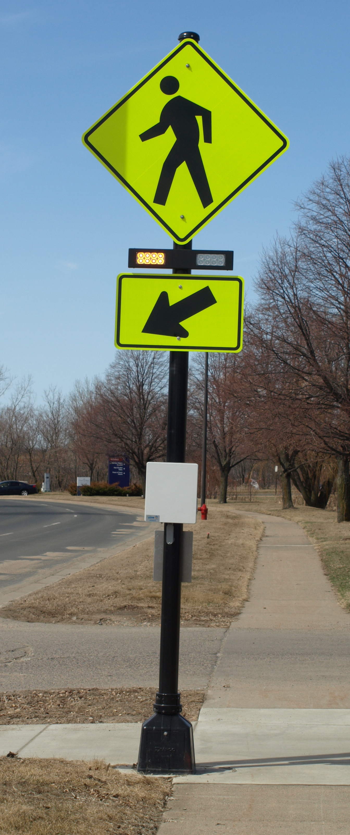
- Assessing the Impact of Pedestrian-Activated Crossing Systems (MnDOT)
- Development of Travel Time Reliability Measurement System (MnDOT)
- Weigh-In-Motion (WIM) Sensor and Controller Operation and Performance Comparison (MnDOT)
- Investigate the Effectiveness of Bluetooth Low Energy (BLE) Technology to Trigger In-Vehicle Messages At Work Zones (MnDOT)

Video: Minnesota – Where Every Step Counts

New guidebook, training to facilitate safer pedestrian crossings
City and county engineers often struggle with how to respond to safety concerns about pedestrian crossings, with no scientific method for evaluating them.
In Long Lake, for example, the police department received numerous complaints about the safety of a particular pedestrian crossing. But when the crossing was videotaped, no one was observed using it.
This example — which was part of a research project funded by the Local Road Research Board — exemplifies the difficulties local governments face when they receive requests for a stop sign or signals at a crossing.
A new manual and June 5 training workshop being held by the Minnesota Local Technical Assistance Program will provide cities and counties with step-by-step tools for evaluating a pedestrian crossing and identifying whether improvements are warranted.
The soon-to-be released guidebook* recommends when to install marked crosswalks and other enhancements based on the average daily vehicle count, number of pedestrians, number of lanes and average vehicle speed. It guides users how to rate a crossing for pedestrian service, and includes a flow chart to assist in decision-making.
The training is unique because it is based on actual video footage of existing crosswalks and the pedestrians which use them.
No guidance
Although vehicles are legally required to stop for pedestrians crossing at intersections and within marked crosswalks, they don’t always yield the right-of-way. And areas with high traffic volumes may not have adequate gaps for pedestrians to cross safely, leading to risk-taking.
Alan Rindels, a MnDOT research engineer, had previously looked for a methodology to evaluate a crosswalk’s effectiveness, but could not find an appropriate engineering analysis.
“What I kept coming up with were results based on the experience of an engineer or planner for what they ‘felt’ was a better crosswalk, such as additional pavement markings, lights or maybe a signal system,” he said.
Rindels finally found guidance in a Transportation Research Board webinar two years ago. Based on that, he asked the LRRB to develop a training methodology for Minnesota practitioners.
Uncontrolled pedestrian crossings
Unless specifically marked otherwise, every intersection is a pedestrian crossing, regardless of the existence of crosswalk markings or sidewalks. At mid-block locations, crosswalk markings legally establish the pedestrian crossing. Uncontrolled pedestrian crossings (which the guidebook focuses on) are locations that are not controlled by a stop sign, yield sign or traffic signal.
Defining where to place pedestrian crossing enhancements — including markings, signs and or other devices — depends on many factors, including pedestrian volume, vehicular traffic volume, sight lines and speed.
The LRRB developed a worksheet that engineers can use to evaluate an uncontrolled pedestrian crossing location in a systematic way, in accordance with the 2010 Highway Capacity Manual. Users note the level of lighting, distance from the nearest all-way stop and whether another location might serve the same pedestrian crossing more effectively.
The guidebook’s 11-step evaluation can identify what level of treatment is appropriate, ranging from overhead flashing beacons and traffic calming devices, such as curb bump-outs, to more expensive options like building overpass or underpass.
Hennepin County Senior Transportation Engineer Pete Lemke, who went through pre-training, said the guidebook will help engineers measure the pedestrian experience by “quantifying the delay at non-signalized intersections.”
“It will inform how we respond to concerns — whether that response is ‘the crossing fits the needs of what’s there’ or ‘we need to make changes or enhancements,'” he said.
Further Resources
Putting Research Into Practice: A Guide for Pedestrian Crossing Treatments at Uncontrolled Intersections – Technical Summary (1 MB, 2 pages); Final Report.
Training workshop – June 5 (register here)
* Consultant Bolton & Menks prepared the guidebook with guidance from a 21-member project team that included University of Minnesota researchers and engineers from the city of Eagan, Hennepin County, Carver County, Scott County, MnDOT, the Center for Transportation Studies and the Federal Highway Administration.
