Tag Archives: Pedestrian

New guidebook, training to facilitate safer pedestrian crossings

City and county engineers often struggle with how to respond to safety concerns about pedestrian crossings, with no scientific method for evaluating them.

In Long Lake, for example, the police department received numerous complaints about the safety of a particular pedestrian crossing. But when the crossing was videotaped, no one was observed using it.

This example — which was part of a research project funded by the Local Road Research Board — exemplifies the difficulties local governments face when they receive requests for a stop sign or signals at a crossing.
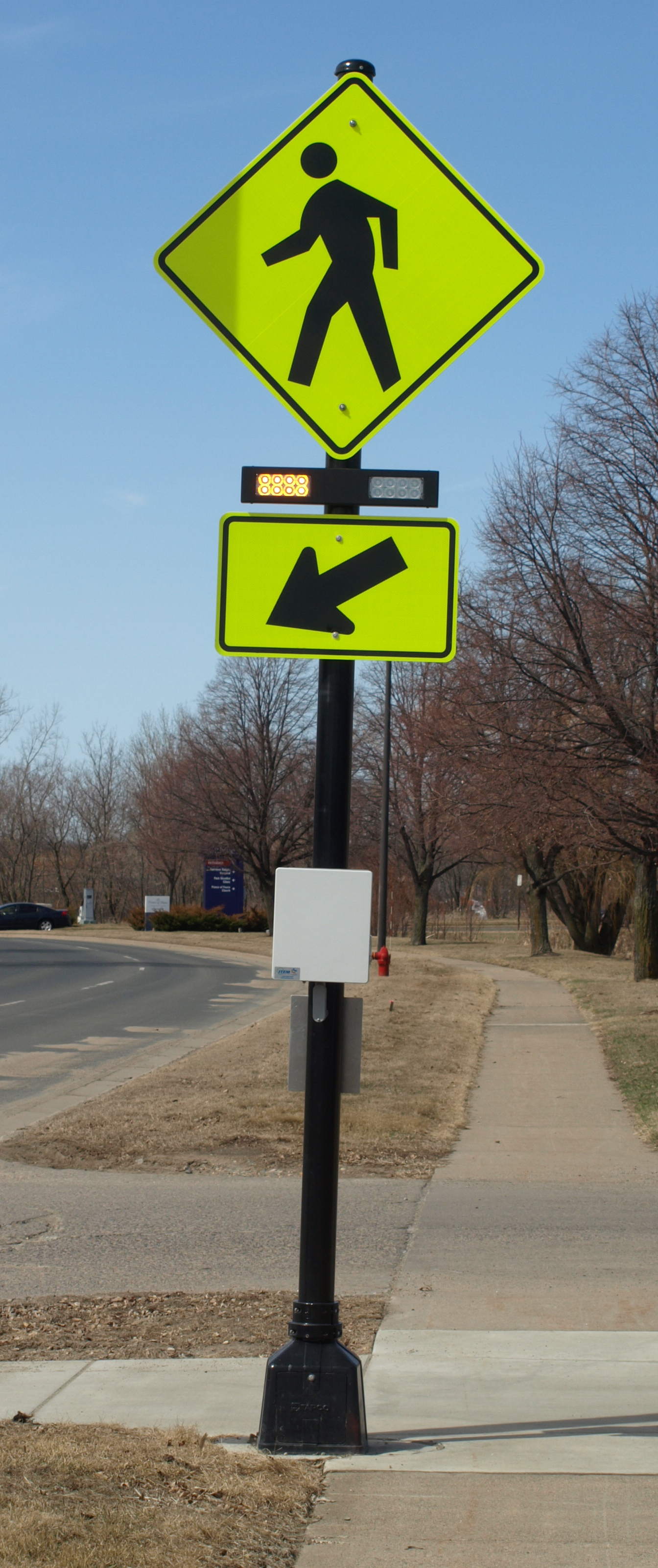
A pedestrian crossing control device.

A new manual and June 5 training workshop being held by the Minnesota Local Technical Assistance Program will provide cities and counties with step-by-step tools for evaluating a pedestrian crossing and identifying whether improvements are warranted.

The soon-to-be released guidebook* recommends when to install marked crosswalks and other enhancements based on the average daily vehicle count, number of pedestrians, number of lanes and average vehicle speed. It guides users how to rate a crossing for pedestrian service, and includes a flow chart to assist in decision-making.

The training is unique because it is based on actual video footage of existing crosswalks and the pedestrians which use them.

No guidance

Although vehicles are legally required to stop for pedestrians crossing at intersections and within marked crosswalks, they don’t always yield the right-of-way. And areas with high traffic volumes may not have adequate gaps for pedestrians to cross safely, leading to risk-taking.

Alan Rindels, a MnDOT research engineer, had previously looked for a methodology to evaluate a crosswalk’s effectiveness, but could not find an appropriate engineering analysis.

“What I kept coming up with were results based on the experience of an engineer or planner for what they ‘felt’ was a better crosswalk, such as additional pavement markings, lights or maybe a signal system,” he said.

Rindels finally found guidance in a Transportation Research Board webinar two years ago. Based on that, he asked the LRRB to develop a training methodology for Minnesota practitioners.

Uncontrolled pedestrian crossings

Unless specifically marked otherwise, every intersection is a pedestrian crossing, regardless of the existence of crosswalk markings or sidewalks. At mid-block locations, crosswalk markings legally establish the pedestrian crossing. Uncontrolled pedestrian crossings (which the guidebook focuses on) are locations that are not controlled by a stop sign, yield sign or traffic signal.

Defining where to place pedestrian crossing enhancements — including markings, signs and or other devices — depends on many factors, including pedestrian volume, vehicular traffic volume, sight lines and speed.

The LRRB developed a worksheet that engineers can use to evaluate an uncontrolled pedestrian crossing location in a systematic way, in accordance with the 2010 Highway Capacity Manual. Users note the level of lighting, distance from the nearest all-way stop and whether another location might serve the same pedestrian crossing more effectively.

The guidebook’s 11-step evaluation can identify what level of treatment is appropriate, ranging from overhead flashing beacons and traffic calming devices, such as curb bump-outs, to more expensive options like building overpass or underpass.

Hennepin County Senior Transportation Engineer Pete Lemke, who went through pre-training, said the guidebook will help engineers measure the pedestrian experience by “quantifying the delay at non-signalized intersections.”

“It will inform how we respond to concerns — whether that response is ‘the crossing fits the needs of what’s there’ or ‘we need to make changes or enhancements,'” he said.

Further Resources

Putting Research Into Practice: A Guide for Pedestrian Crossing Treatments at Uncontrolled Intersections – Technical Summary (1 MB, 2 pages); Final Report.

Training workshop – June 5 (register here)

* Consultant Bolton & Menks prepared the guidebook with guidance from a 21-member project team that included University of Minnesota researchers and engineers from the city of Eagan, Hennepin County, Carver County, Scott County, MnDOT, the Center for Transportation Studies and the Federal Highway Administration.

Bicycle and pedestrian-counting project wins CTS partnership award

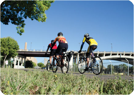
(Feature image courtesy Michael McCarthy, Center for Transportation Studies.)

Earlier this year, we wrote about the Minnesota Bicycle and Pedestrian Counting Initiative, a project that developed guidelines and protocols to help transportation planners accurately count non-motorized traffic. This groundbreaking research involved a diverse partnership of state and local officials, University of Minnesota faculty, and private and nonprofit organizations.

On Wednesday, April 23, the project team (photo above) was honored with an award from the Center for Transportation Studies. Team members accepted the CTS Research Partnership Award in a ceremony at the McNamara Alumni Center in Minneapolis. The award is given each year to projects that have resulted in “significant impacts on transportation” and that draw on “the strengths of their diverse partnerships” to achieve their results.

The video below, produced by CTS, explains the importance of the project. MnDOT is now in the process of implementing the research results by installing permanent counters and using portable counters in select locations around the state. MnDOT plans to use the information for a variety of purposes, including planning, safety analysis, investment planning and quality-of-life analysis.

Project team members will present their research findings at the North American Travel Monitoring Exposition and Conference in July. The conference’s focus is on “Improving Traffic Data Collection, Analysis, and Use.”

*Bonus: Read about last year’s Research Partnership Award-winner, a MnDOT-led, multi-state effort to reduce low-temperature cracking in asphalt pavements.

Learn more about the project:

Best practices for trail crossings – webinar and draft report

Last week, MnDOT Research Services hosted a workshop on a forthcoming report, “Decision Tree for Identifying Alternative Trail Crossing Treatments.” It was broadcast as a webinar, the recording of which is now available online via Adobe Connect:

http://mndot.adobeconnect.com/p8hlfripuwe/

The final report is coming soon, but in the meantime you can see the draft version on our website (link), along with case studies and other related documents.

Bicycle and pedestrian counting initiative monitors nonmotorized traffic in Minnesota

In a continuing effort to better understand nonmotorized traffic patterns in Minnesota, researchers from the Humphrey School of Public Affairs have partnered with the Minnesota Department of Transportation (MnDOT) to develop guidelines and analyze information collected in bicycle and pedestrian traffic counts throughout the state.Image

The research team, led by Professor Greg Lindsey, aims to develop consistent methods for monitoring and assessing bicycle and pedestrian traffic that can be used in both permanent, automated traffic counts and short-term manual counts. The goal is to provide evidence for decision making that Minnesota cities have historically lacked, Lindsey says. “We’ll have practical, useful information about bike and pedestrian traffic that can help local jurisdictions as they plan and invest in infrastructure,” he says.

As part of the 18-month project, the research team created a set of tools and methods for short-duration manual counts of nonmotorized traffic, held training workshops, and organized a statewide counting effort involving 43 Minnesota municipalities last fall. The overall response was positive, Lindsey says, and some communities are already using their collected data to submit grant proposals for projects related to nonmotorized traffic.

In addition, Lindsey and his team have examined traffic information from six permanent counters on Minneapolis trails. The continuous counts collected at these locations help the researchers understand traffic patterns and the factors that affect them, Lindsey says. For example, the team found that bike and pedestrian traffic vary by trail type, time of day, day of week, and season.

“Once we know the patterns at permanent sites, we can develop factors that help us expand short-term counts from other locations with similar conditions,” Lindsey says. The factors could be used to estimate anything from total daily traffic to annual traffic, as long as the short-term count location is similar to an existing model.

Based on the overall results of the study, the research team developed recommendations for MnDOT. These include continuing to coordinate statewide short-term field counts, demonstrating the feasibility of automated counting technologies, and beginning to integrate nonmotorized and vehicular traffic databases.

Based on these recommendations, MnDOT is moving forward with a new project that will collect more short- and long-duration counts throughout Minnesota, says Lisa Austin, ABC Ramps coordinator at MnDOT. The next phase of work aims to collect counts for pedestrians on sidewalks, bicyclists on shoulders and in bike lanes, and pedestrians and bicyclists on multiuse trails. MnDOT plans to install more permanent, automated counters in suburban and midsize cities and to conduct additional manual counts in smaller cities around the state, Austin says.

“We’re really excited that this bike and pedestrian counting project is moving into wider implementation,” Austin says. “This next phase will help us see which automated counting technologies work well and make recommendations for moving forward on a broader scale.”

Reprinted from the CTS Catalyst, May 2013.

U of M transportation research highlights video

U of M transportation research highlights during 2012-2013 include a smartphone app for visually impaired pedestrians, pedestrian and bicyclist safety in roundabouts, methods for counting bike and pedestrian traffic on trails, and a filter that takes phosphorous out of storm water.