Bike to Work Day: progress in Minnesota, but miles to go

By Greg Lindsey

This blog post by University of Minnesota Professor Greg Lindsey was originally posted on the CTS Conversations blog.

April 9 is national Bike to Work Day, a day to celebrate those who choose bicycling as their principal mode of transportation for commuting, and a time to encourage more people to consider this healthy, efficient transportation option. Minnesota has much to celebrate in terms of bicycle commuting. Bike-Walk Twin Cities and Transit for Livable Communities are wrapping up the National Non-Motorized Pilot Program, a federally funded program to demonstrate the potential to increase biking and walking through focused investment in infrastructure and other interventions. Bicycle commuting rates in Minneapolis have climbed to 4.5%, and Minneapolis now ranks 20th in the nation in bicycle commute share. This is a noteworthy achievement, especially considering our notorious winter weather. These achievements, along with others such as the success of Nice Ride, our pioneering bike share program, have contributed to Minneapolis being named America’s most bike-friendly city by Bicycling Magazine. Celebration of these achievements – which represent hard work by hundreds of individuals and thousands of commuters – certainly is warranted.

But we only need look across municipal boundaries to know we had better put more energy into encouraging bicycling than into celebration. Bicycle commute rates in St. Paul remain below 2% less than half the Minneapolis rate, and rates in most suburban, exurban, and rural communities remain even lower. And the story remains essentially the same for all types of bicycle trips. Jessi Schoner, a doctoral candidate in the Department of Civil Engineering, is analyzing non-motorized mode shares for all trips recorded the Metropolitan Council’s recent Travel Behavior Inventory. Her analyses show that bicycling remains an urban phenomenon, with the share of all trips taken by bicycling highest in Minneapolis, followed by St. Paul, and then suburban and outlying communities. Why is this so? Better infrastructure no doubt is part of the reason, but there likely are other reasons, including housing patterns, access to employment, socio-demographic factors, and culture. Additional research is needed.

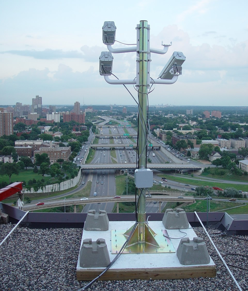
But this leads to additional reasons to be optimistic this Bike to Work Day: the commitments made by the Minnesota Department of Transportation (MnDOT) to foster multi-modal transportation systems and the agency’s investments in research to increase understanding of bicycle traffic patterns. In 2013, as part of the Minnesota Bicycle and Pedestrian Counting Initiative, MnDOT funded the installation of the state’s first two automated, continuous in-street bicycle counters. These counters, which monitor bicycle traffic around the clock, 365 days per year, will provide new insights into the bicycle traffic volumes and their daily and seasonal patterns. While bicycle traffic monitoring in Minnesota is only in its infancy, it represents progress towards establishing the evidence base we need to determine how to make bicycling safer and to invest in bicycle infrastructure.

And so celebrate this Bike to Work Day and thank your fellow Minnesotans for all they have accomplished. But also take time to reflect on the work that needs to be done to improve opportunities for cycling throughout the state, for we have miles to go.

Greg Lindsey is a professor at the University of Minnesota Humphrey School of Public Affairs. His areas of specialty include environmental planning, policy, and management. His current research involves studies of the relationship between the built environment and physical activity, specifically factors that affect the use of pedestrian and cycling infrastructure. Lindsey presented some of his bicycle and pedestrian data collection research at the 2014 Minnesota Transportation Conference held March 4-6.

Deicing treatments tested at Valleyfair, Canterbury Park

Excalibur and the High Roller may be closed for the season, but Valleyfair Amusement Park still has one attraction open for the season: a driving track for Minnesota snowplow drivers.

MnDOT-funded researchers are studying the effects of weather and vehicle traffic on different deicing treatments in the parking lots of Valleyfair and Canterbury Park in Shakopee, Minn.

It’s been a busy winter, but each week MnDOT Metro District snowplow drivers make one last stop before heading home, to apply different combinations of salt and anti-icing chemicals to nine 1,000-foot driving lanes. They also drive over each lane multiple times to test the effect of traffic.

“We’re running trucks up to 30 miles per hour with different speeds, wind conditions, traffic conditions and pre-wetting chemicals,” said Steve Druschel, a researcher with the Minnesota State University, Mankato. “Each lane is its own experimental unit.”

Professor Steve Druschel speaks with MnDOT snowplow driver John Hokkanen.

Professor Druschel’s students will review more than 17,000 photos from time-lapsed cameras to document how the snow melted in each experimental run.

“The influence of factors like pavement type and age, traffic volume, truck proportion, weather conditions and sun presence will be assessed to evaluate which techniques have special advantages for certain situations or roadways,” said Maintenance Research and Training Engineer Tom Peters.

In 2010, Druschel tested 25 anti-icing compounds in 1,500 different combinations in a laboratory to study the effectiveness of different deicers.

“Public work superintendents commented, ‘Great work. It looks good, except it’s all in the lab. Beakers aren’t what people drive on,’ ” Druschel said. “So we’re taking it from the two-inch ice cup to the real world in phase two of this study.”

With rock salt prices quadrupled, finding the most cost-effective methods of treatment is important.

This latest research will help determine the best times for applying anti-icing treatments and examine whether certain chemicals — such as a pre-storm liquid treatment that costs twice as much — melt enough snow to be worth the extra cost.

Test runs in Shakopee are strictly experimental, but in Mankato students are analyzing how real-world salting treatments are working on the North Star Bridge.

An article in the Mankato Free Press tells how Druschel’s team is collecting road melt runoff and documenting bridge traffic. (Big trucks, for instance, squeeze more water out of the snow.)

MnDOT snowplow driver John Hokkanen makes a test run at the research site at Canterbury Park.  (Photo by Nick Busse)
MnDOT snowplow driver John Hokkanen makes a test run at the research site at Canterbury Park. (Photo by Nick Busse)

Students plan to use time-lapsed photos, along with weather data and snowplow records, to determine what chemical treatments worked best – and when.

With the multi-pronged research project, Druschel hopes to put definitiveness to what some snowplow drivers have already tried in the field.

“The key to it is not so much that we’re so smart and we have a better idea or are inventing something new,” he said. “We’re just trying to enhance what they are already doing.”

Helpful resources

Salt Brine Blending to Optimize Deicing and Anti-Icing Performance –Technical Summary (PDF, 1 MB, 2 pages) and Final Report (PDF, 11 MB, 151 pages) (previous study) 


Smartphone app guides blind pedestrians through work zones (updated)

Each year, approximately 17 percent of road construction work zone fatalities nationwide are pedestrians.

At special risk are the visually impaired, who rely on walking and public transportation to get around.

A major challenge  for them is crossing the street — which is even more difficult if an intersection is torn up.

MnDOT has invested significant effort to accommodate pedestrians, particularly those with disabilities, in temporary traffic control situations. This includes requiring temporary curb ramps and alternative routes when a sidewalk is closed.

Researchers, funded by MnDOT, have now developed a cell phone application to guide blind pedestrians around a work-zone.

Illustration of Bluetooth beaconplacement at decision points around a work zone.
Illustration of Bluetooth beacon placement at decision points around a work zone.

Building on previous work to provide geometric and signal timing information to visually impaired pedestrians at signalized intersections, the smartphone-based navigation system alerts users to upcoming work zones and describes how to navigate such intersections safely.

The smartphone application uses GPS and Bluetooth technologies to determine a user’s location. Once a work zone is detected, the smartphone vibrates and announces a corresponding audible message. The user can tap the smartphone to repeat the message, if needed.

The federal government strongly encourages states to provide either audible warnings or tactile maps at work zones where visually impaired pedestrians are expected to be impacted.

“The smartphone application is a step in that direction,” said MnDOT technical liaison Ken Johnson. “It’s a way to see if this type of way-finding device would work.”

Since smartphone use is still limited, the state is also interested in special equipment that could relay the audible warnings at affected work zones.

“However, smartphone use is increasing in the general population, as well as with persons with disabilities, and there will likely be a day when it will be rare to not have a smartphone and this tool could meet road agency needs,” Johnson said.

Before developing the smartphone application, researchers surveyed 10 visually impaired people about their experiences at work zones and what types of information would be helpful in bypass or routing instructions.

The University of Minnesota research team, led by Chen-Fu Liao, tested the smartphone application by attaching four Bluetooth beacons to light posts near a construction site in St. Paul.

Additional research is now needed to conduct experiments with visually impaired users and evaluate system reliability and usefulness.

*Update 4/29/2014: Check out this story from KSTP on the app.

More information

Development of a Navigation System Using Smartphone and Bluetooth Technologies to Help the Visually Impaired Navigate Work Zones Safely — Final Report (PDF, 1 MB, 86 pages)

Flume research simulates Red River flooding to test road protections

Flooding in the Red River Valley is an almost annual occurrence, and the cost to roads, property and lives is huge.

Highway 1 gets torn up year after year, only to be rebuilt in time for next year’s flood, joke residents in the little town of Oslo, which becomes an island whenever the roads close.

While not much can be done to prevent swollen farm fields from overflowing, what if a road embankment itself could be bolstered to prevent physical damage to the underlying structure of the road?

“We can’t just raise the road because it would create backwater upstream,” explained JT Anderson, Assistant District 2 Engineer. “Our best bet is to let the water over-top the road and try to protect the road when it does.”

Researchers have built a flume inside the University of Minnesota’s St. Anthony Falls Laboratory to test six methods of embankment protection specific to the needs of towns like Oslo.

“It is not uncommon for one over-topping site to have a half-mile long stretch of road being damaged,” said university research engineer Craig Taylor. “One road being protected should cover the cost of the study and the cost of deploying the erosion control product for that road.”

Nationally, research of this kind has mostly been restricted to high-intensity flooding.

“Those really high-depth, short duration events, you can only protect an embankment with concrete and boulders,” Taylor said. “With longer duration, low-depth floods, we may be able to protect roads with soft armoring, like reinforced vegetation.”

The damage in northern Minnesota has been the worst on east-west roads, where the river flow runs perpendicular to the center of the road, causing the road to act like a dam and the water to jump at the edges.

“It eventually eats through that road embankment and makes the road collapse,” Anderson explained.

Researchers will examine how a cross-section of a road holds up under various erosion control methods at different levels and speeds of water-flow.

The damage from flooding was less in 2010 after engineers added rocks and vegetation to the side of Highway 9, near Ada.
The damage from flooding was less in 2010 after engineers added rocks to the side of Highway 9, near Ada, Minn.

One test will be to slow the flow of water by covering the road shoulder with a rubberized membrane and temporary water-filled tubes.

Permanent schemes — such as turf reinforcement mats and rocks — will also be tested.

“These methods have been deployed in the field, but you never really know under which conditions they survived or failed,” Taylor said.

In the Red River Valley, MnDOT engineers have tried a combination of vegetation and boulders, as well as concrete blocks covered with topsoil, to protect highways. Flattening a slope is another option.

“I expect that a single erosion protection technique will not cover every situation our road embankments may be exposed to at any given location,” Anderson said.  “Rather, I expect we would look at using several different techniques in concert to develop an effective erosion protection system for the expected velocities.”

Funding highway projects with value capture could speed project completion

There’s broad agreement that the U.S. transportation system cannot continue to be funded with existing financing and revenue-generation methods. What’s unclear, however, is how to pay for highway projects in the future. The current transportation funding system emphasizes user fees, but there is growing interest in alternative funding strategies. One promising strategy is value capture, which aims to recover the value of benefits received by property owners and developers as a result of infrastructure improvements.

In recent years, University of Minnesota researchers have helped lead the way in value capture research with a series of reports identifying value capture strategies. In a newly published study, the research team applied their previous work to a real-world scenario, with impressive results.

The new research, sponsored by the Minnesota Department of Transportation, focused on the planned development of Trunk Highway 610 (TH 610) in Maple Grove, Minnesota—a stretch of planned state highway delayed for years by state transportation funding shortages. Researchers set out to discover how the value of the enhanced accessibility provided by the planned improvements could be predicted and captured to help fund the project’s completion.

To accomplish their goal, researchers first defined a study area of about 10 square miles surrounding the unfinished highway segment. Then, they modeled property values based on five factors using parcel-level data. This model was designed to isolate the so-called “highway premium” by controlling for other factors that affect land value including water views, open space, railroads, transit stops, and existing highway exits. Using this model, researchers found significant evidence that the completion of the highway could lead to an over $17 million increase in property value.

Researchers expect these findings to have significant benefits for the TH 610 project and beyond.

Read the full article in the March issue of Catalyst.

Photo courtesy of SRF Consulting Group, Inc.

Warning system could protect drivers from traffic ‘shock waves’

Two summers ago, the Minnesota Department of Transportation installed electronic message boards on parts of Interstates 35W and 94 to help warn drivers of crashes and to recommend speed levels during periods of high congestion.

Now, MnDOT would like to use the devices — officially known as Intelligent Lane Control Signs (ILCS) — to advise drivers of sudden stopping or slowing of traffic.  Many crashes occur when drivers cannot react quickly enough to these changes.

The Minnesota Traffic Observatory (shown in the feature photo above) is developing a warning system to detect such problematic traffic patterns and issue automatic advisories to drivers.

Shock waves on I-94

A section of I-94 in downtown Minneapolis, where southbound I-35W and westbound I-94 converge, may have the highest crash rate in the state.

As shown in the video above, vehicles constantly slow down and speed up here during rush hour, which causes a ripple effect called “shock waves.”

“There’s a crash every two days,” said University of Minnesota researcher John Hourdos, whose students watched over a year’s worth of video footage to document every accident and near accident. “They’re not severe crashes — no one has died for as long as I can remember, and most happen at slow speeds — but they cause a lot of delays for the traveling public.”

When statistics were still being kept, this section of I-94 had the highest number of accidents in the state, with approximately 150 crashes and 400 near crashes observed in 2003.

Researchers developed a program 10 years ago to detect “shock wave” patterns in the traffic, but they couldn’t develop a practical solution until the state invested in electronic message boards.

The University of Minnesota deployed cameras and sensors on three downtown rooftops in 2002 to observe traffic patterns.  They provide seamless coverage of the entire area, allowing researchers to watch vehicles from the moment they enter and exit the area. MnDOT has added additional cameras and detectors to watch over this roadway section. For the past year, the combined efforts of MnDOT and the university have provided data from 26 cameras and 12 traffic sensors for the two-mile section that includes the high-crash frequency location.

Thanks to the message boards, Hourdos and his team can now create an automated system to warn drivers when conditions for “shock waves” are greatest, using an algorithm he developed in the previous study.

Traffic monitoring equipment on a rooftop
From downtown Minneapolis rooftops, traffic monitoring equipment detect shockwaves on Interstate 94.

Crosstown interchange 

A newer problem that researchers hope to tackle is the lineup of cars on I-35W southbound during rush hour at the newly reconstructed Crosstown interchange.

Although two lanes of traffic are provided for eastbound Highway 62 at the I-35W/62 split, these vehicles must later converge into one lane, due to the Portland Avenue exit. This causes a back-up on the 62 ramp that stretches back to 35W.

Hourdos said developing an algorithm to detect these queues is a different problem than what goes on with I-94, since there is a constant stoppage of cars and no rolling shockwaves.

“Combining the two methodologies will form a more robust solution and a single implementable driver warning system,” Hourdos said.

Researchers might target other problems areas should the state  install additional ILCS message boards elsewhere in the Twin Cities.

Value capture alternative finance model tested on Highway 610

Those who use the roads in Minnesota are generally those who pay for them — through gasoline and vehicle taxes.

But motorists aren’t the only ones who benefit when a new interchange is built or a highway is improved. Home and business values along the corridor go up and the price of undeveloped land can skyrocket.

With highway funds strapped, a new method of funding road expansion, called “real estate value capture,” is garnering attention.

This emerging technique strives to identify beneficiaries of transportation improvements beyond just the highway user, so they provide their fair share of the costs — a concept not dissimilar from residential street assessment.

For instance, a local government might dedicate the additional property tax revenue generated due to a new highway to offset some construction costs, or collect fees on land that is developed near an interchange.

However, value capture is a relatively new technique that has been used primarily for transit projects. To be considered for roads or bridges, questions need to be addressed about potential revenue, impacts and public acceptability.

In a new case study, researchers use a long-delayed planned extension of Highway 610 in Maple Grove to model the impact of a completed highway on nearby property values, and, for the first time, quantify the potential revenues from several value capture strategies.

With properties near new highway exits worth an additional $65,450 more per acre, researchers calculated that $37.1 million in revenue could be generated through assessments on existing development and impact fees for future development.

Other strategies explored include tax-increment financing and private-public development of undeveloped parcels, in which revenue generated by that development is split.

“This research demonstrates a way to estimate the value of transportation improvement and to communicate that to the public,” said principal investigator Jerry Zhao, an associate professor of public administration at the University of Minnesota’s Humphrey School of Public Affairs.

This map projects the anticipated increase in estimated market value (EMV Change) of parcels near Highway 610 that will result from completion of the highway and construction of exits at the two locations marked in purple. The impacted parcels are currently vacant, farmland or residential.
Study links:
    • Real Estate Value Capture: An Emerging Strategy to Pay for New Transportation Infrastructure – Technical Summary (PDF, 1 MB, 2 pages);  Final Report (PDF, 5 MB, 36 pages).

‘Smart window’ technology opens new possibilities for transportation noise control

Nearly every time a highway or airport expansion is proposed, transportation planners face opposition from residents who fear the increased noise levels in their homes and businesses. Traffic noise is often mitigated with physical noise barriers, but the large, thick walls often draw opposition as well.

A new technology developed by University
 of Minnesota mechanical engineering professor 
Rajesh Rajamani as part of 
a research project funded
 by the National Science
 Foundation could soon
 provide a nearly invisible
 solution for transportation 
noise cancellation—and 
give transportation planners another tool for overcoming project opposition.

Noise enters homes close to airports and highways primarily through windows, and windows can transmit ten times the sound energy as walls can, says Rajamani. With this in mind, researchers set out to reduce the amount of transportation noise transmitted through windows.

To accomplish this goal, researchers created a method of active noise control for windows. Active noise control works by using speakers to generate a sound wave that is a mirror image of the undesirable sound wave. Superimposing an “anti-noise” wave of the same amplitude as the undesirable noise wave results in a reduced decibel level of noise in the environment.

The research team began by designing thin, transparent speaker panels to fit in the empty space between the two panes of a double-pane window. Then, the researchers tested the effectiveness of the new speakers, using them to cancel out undesirable transportation noise from outside the home while preserving the desirable noise from inside the home.

In addition to mitigating traffic noise, this new technology offers other surprising benefits. Researchers have found that the “smart window” speakers can actually be used as home audio speakers without losing any of their noise-control benefits.

Read the full article in the February issue of Catalyst.