
Tag Archives: low-volume roads

New Project: Evaluating and implementing ground penetrating radar for monitoring moisture fluctuations in in-service roads

Moisture fluctuations within pavement foundations—driven by rainfall, freeze–thaw cycles, and groundwater changes—can significantly impact pavement performance, especially on Minnesota’s low volume roads. Traditional moisture measurement methods, such as in place sensors or falling weight deflectometer testing, tend to be costly, intrusive, slow, and offer limited spatial coverage. Ground penetrating radar (GPR), however, provides a faster, non-invasive, and more affordable way to assess subsurface moisture over large areas, making it particularly useful for local agencies with limited resources.

This research aims to advance the validation and practical use of GPR for evaluating pavement moisture in real‑world low‑volume road settings. The study includes conducting GPR surveys on test sections equipped with moisture sensors, comparing datasets, and assessing how effectively GPR can identify areas affected by drainage or moisture issues. To support broader implementation, the project also involves creating an automatic detection algorithm capable of identifying moisture variations in unbound pavement layers.

The algorithm will be refined into a user‑friendly software tool featuring modular code, a graphical interface, and documentation. Ultimately, the project will deliver implementation recommendations designed to strengthen decision‑support tools and technical guidelines, helping Minnesota’s transportation agencies more effectively monitor and manage pavement moisture conditions.

“For this research to reach its full potential, participation from local engineers and practitioners is essential,” said Eyoab Zegeye, research operation engineer at MnDOT’s Office of Materials and Road Research. “Based on our encouraging findings, the next step is to evaluate whether this approach could be implemented on real low‑volume roads and develop testing and reporting protocols that can be quickly adopted by local agencies. County and municipal staff have the closest understanding of their road networks, challenges, and resource limitations. Their involvement ensures that the tools developed are realistic, usable, and aligned with real‑world needs.”

The Objectives:

  1. Validate and implement GPR-based pavement moisture assessment methods on low-volume roads.
  2. Evaluate GPR’s ability to efficiently survey large pavement areas and monitor moisture conditions.
  3. Identify pavement sections potentially affected by drainage issues using GPR data.
  4. Conduct GPR surveys on low-volume road test sections equipped with in-situ moisture sensors and compare the results.
  5. Develop an automatic detection algorithm to evaluate moisture variation within unbound pavement layers.
  6. Validate the algorithm and implement it as software with modularized code, a graphical user interface, and a user manual.
  7. Produce implementation recommendations to enhance decision-support tools and technical guidelines for assessing moisture fluctuations in Minnesota’s low-volume roads.

Project Details:

  • Estimated Start Date: 7/16/2025
  • Estimated Completion Date: 6/30/2027
  • Funding: MnDOT and Local Road Research Board
  • Principal Investigator: Halil Ceylan
  • Co-Principal Investigators: Sunghwan Kim
  • Technical Liaison:  Eyoab Zegeye

Details of the research study work plan and timeline are subject to change.

To receive email updates about this project, visit MnDOT’s Office of Research & Innovation to subscribe.
Adapting Asphalt Mixtures for Tougher Rural Roads

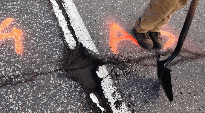
Seasonal and daily temperature variations, freeze-thaw cycles and other environmental factors lead to pavement distress on low-volume rural roads. Modifying asphalt mixtures could improve pavement resistance to these environmentally driven distresses. A comparison of the mechanical properties and performances of selected asphalt mixtures identified a mixture and method that hold considerable promise for improving performance and longevity on low-volume roads. 

Continue reading Adapting Asphalt Mixtures for Tougher Rural Roads

Prioritizing Pavement Markings on Low-Volume Roads

Researchers have developed a tool to help Minnesota local agencies make cost-effective pavement marking decisions in their counties. The spreadsheet-based tool was developed as part of a recently completed research study by the Minnesota Local Road Research Board.

What Was the Need?

Minnesota has many miles of low-volume roads, most marked with yellow centerline and white edge lines. Applying and maintaining these markings is a significant financial investment for local agencies, which typically work within very constrained budgets. These agencies needed more information about the value and the initial and ongoing costs of typical 4-inch and enhanced 6-inch pavement markings on low-volume roadways. They also needed clarification and guidance for prioritizing pavement marking installation and maintenance that could work within their limited budgets.

What Was Our Goal?

The goal of this research was to develop a prioritization approach and a decision-making tool for using pavement markings on low-volume roads based on the benefits and costs of these markings. Local agencies could then use these resources to make cost-effective decisions about installing and maintaining pavement markings.

Rural road with cyclist in bike lane
This segment of Minnesota Highway 38 has yellow centerlines and white edge lines that delineate a 4-foot bicycle lane

What Did We Do?

Researchers took a multistep approach to identifying critical pavement marking information and practices:

• Conducted a literature search of existing research on typical (4-inch) and enhanced (6-inch) pavement markings, focusing on the benefits (such as crash reduction and improved lane-keeping), costs and current maintenance practices.
• Surveyed Minnesota counties to learn about their current practices and management approaches for pavement markings.
• Reviewed existing County Road Safety Plan (CRSP) methodology to learn about research and data used to rank at-risk road segments and identify CRSP improvement strategies, specifically the range of pavement markings that CRSPs recommended.

Researchers were then able to develop a prioritization approach and a decision-making tool that incorporated both past research and local state of the practice. In addition to producing a final report describing task results, they developed a brochure explaining the approach, the tool and implementation steps.

“This innovative tool will help local agencies make pavement marking decisions under tight budget constraints, where the question is always how to best allot funds for competing needs. This tool clarifies the problems and helps prioritize the possible solutions,” said David Veneziano, LTAP Safety Circuit Rider, Iowa State University Institute for Transportation.

What Did We Learn?

The literature search revealed limited research addressing traditional pavement marking use and effectiveness on local roadways. Pavement markings produce safety benefits, including reduced crash rates, but showed no real effects on vehicle speed, indicating that pavement markings may not alter driver behavior. Only limited efforts were identified in the literature aimed at investigating the prioritization and management of pavement markings.

The survey of local Minnesota agencies revealed that most counties use centerline and/or edge lines, which may be the result of MnDOT State-Aid Operation Rules. Some counties mark all their roads; most use 4-inch latex paint or epoxy markings. Repainting schedules depend upon road age, marking condition and county budgets.

A review of Minnesota counties’ CRSPs showed they included pavement marking recommendations. The CRSPs recommended, on average, 109 miles of pavement markings in every county. Applying one linear foot of centerline costs about 5 cents; 100 miles of centerline cost $26,400. Because of the extent of these recommendations, researchers directly incorporated the methods and directives from the CRSPs into their prioritization approach and tool.

The spreadsheet tool produced through this project allows users to enter road site characteristics such as pavement condition, road width, the CRSP rating and traffic volume, as well as the age of extant markings, costs, durability and the potential for crash reduction. Pavement marking options include centerline and/or edge lines, high visibility markings and enhanced durability materials. The tool uses factor weights that assign a relative importance to each criterion for any potential marking approach compared to other alternatives. The result is a performance rating score for each marking alternative. Thus, the tool assists not only in identifying the physical aspects of a road segment, it also incorporates the agency’s preferences, priorities and budget through a priority-weighting feature that generates the cost or cost range for a marking project.

What’s Next?

Recommendations for further research include conducting a follow-up survey of users
of the new spreadsheet tool to facilitate future modifications, creating databases of roadway characteristics to simplify agencies’ use of the tool, and performing additional research on the safety and other effects of pavement markings. Researchers also encouraged agencies to keep in mind a proposed national retroreflectivity rule for the Manual on Uniform Traffic Control Devices that could affect pavement marking practices on low-volume roads. This rule has not yet been finalized or implemented.

This post pertains to LRRB-produced Report 2018-21, “Investigating the Necessity and Prioritizing Pavement Markings on Low-Volume Roads,” published June 2018. The Pavement Marking Prioritization Tool can also be found on the project webpage on the LRRB website.