Minnesota’s primary seat belt law continues to save lives and reduce serious injuries more than four years after being passed, according to a study by researchers at the U of M’s Humphrey School of Public Affairs.
The study examined Minnesota crash data collected from June 2009 (when the law was implemented) through June 2013 and compared it to expected data based on crash trends over time. Findings indicate that there were at least 132 fewer deaths, 434 fewer severe injuries, and 1,270 fewer moderate injuries than expected during this time.
According to the researchers, the safety benefits of the law translate into a savings of at least $67 million in avoided hospital charges, including nearly $16 million in taxpayer dollars that would have paid for Medicare and Medicaid charges.
The study was sponsored by the Minnesota Department of Public Safety and led by Humphrey School research fellow Frank Douma and Nebiyou Tilahun, a U of M graduate now on the faculty at the University of Illinois-Chicago.
The researchers also examined seat belt use data and survey results that measured support for the law. Findings show that support increased from 62 percent just before the law was passed to more than 70 percent in 2013, while the percentage of Minnesotans buckling up was at an all-time high of nearly 95 percent in 2013. This shows that some people are wearing their seat belts even though they don’t support the law.
When this increased seat belt use is combined with the reduction in fatalities and injuries, it further demonstrates that people are surviving—and even walking away from—crashes that may have had different results if the primary seat belt law had not been in effect.
Read the full article in the June issue of CTS Catalyst.
Traffic signs provide important information to drivers, and are a critical component of traffic safety. In order to be effective, their visibility and readability must be maintained under both day and night conditions.
Key to signs’ effectiveness is a quality known as retroreflectivity — the ability for signs to bounce light back toward a driver’s eyes, making them appear brighter and easier to read. Retroreflectivity deteriorates with time, so transportation agencies need to actively maintain their signs.
A research project funded by the Local Road Research Board is developing a guide to help cities and counties better manage their signs, and also to meet a new Federal Highway Administration retroreflectivity management requirement while getting the lowest life-cycle costs.
Cities and counties have until June to establish a sign assessment or management method that will maintain minimum levels of sign retroreflectivity.
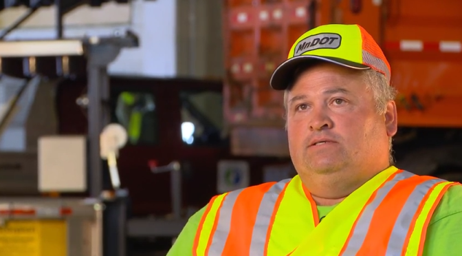
“Right now there’s a mixture of different management methods, with very little guidance as to what’s appropriate for your agency based on the signs you have and your labor force and equipment,” said Matt Lebens, a MnDOT research project engineer.
Since 1993, the Manual on Uniform Traffic Control Devices has included guidelines for minimum retroreflectivity of pavement markings and signs. The standards are meant to ensure that drivers, especially the growing population of elderly drivers, are able to detect, comprehend and react to traffic signs. The LRRB project is designed to help fill certain knowledge gaps in this area.
Measuring retroreflectivity
Possible methods for ensuring retroflectivity include night-time inspection; use of a reflectometer; spot-checking a sampling of signs that are the same age; or blanket replacement of signs once they reach a certain age.
Although the retroreflectivity of a sign is guaranteed by its manufacturer to last a certain number of years, it commonly lasts much longer.
“Currently, we don’t have expected sign life guidance for agencies to use. Through this project, we are establishing a control deck for sign sheeting used in the state, and an expert panel will make recommendations on expected sign life ranges,” Lebens said.
Researchers reviewed retro-reflectivity studies from other states and also measured the retro-reflectivity of signs out in the field across Minnesota using a retroreflectometer. As part of this project, MnDOT is providing training on the retroreflectometer and will also make it available for loan to local municipalities. (Watch a video demonstration.)
At MnDOT’s MnROAD site, control decks contain dozens of signs. In addition to measuring retroreflectivity, the MnDOT Materials lab is monitoring color fade, which has been a larger issue in Minnesota.
“By getting better data as to the real life in-field life span of the signs, agencies will have a more realistic and better informed value for sign life expectancy, as well as potentially reducing costs,” said MnDOT Senior Engineer Mark Vizecky.
Expected life
There’s been no definitive studies to date as to what the life of a sign is, said lead project investigator Howard Preston of CH2M Hill, but the research so far shows it is in well excess of manufacturer warranties.
Cities and counties will be advised to pick an expected sign life that goes beyond the warranty – and then stay tuned.
“The notion is to watch these signs until they fail,” Preston said. “The sheeting material is better than it used to be. The failure might be 20 or 30 years out.”
There are two basic types of reflective sheeting material: beaded and prismatic.
Although beaded is guaranteed to last 10 years, researchers anticipate a retroreflectivity life of between 12 and 20 years old.
For the prismatic material – which has a 12-year warranty – the life cycle is anticipated to be 20 to 30 years.
“Nobody knows for sure, because nobody has actually followed this material to failure in a controlled condition,” Preston said. “On the road, there are so many variables: vandalism, knock-downs, etc.”
Researchers look at the test deck at MnROAD. The study panel includes city and county engineers.
City and county engineers often struggle with how to respond to safety concerns about pedestrian crossings, with no scientific method for evaluating them.
In Long Lake, for example, the police department received numerous complaints about the safety of a particular pedestrian crossing. But when the crossing was videotaped, no one was observed using it.
This example — which was part of a research project funded by the Local Road Research Board — exemplifies the difficulties local governments face when they receive requests for a stop sign or signals at a crossing.
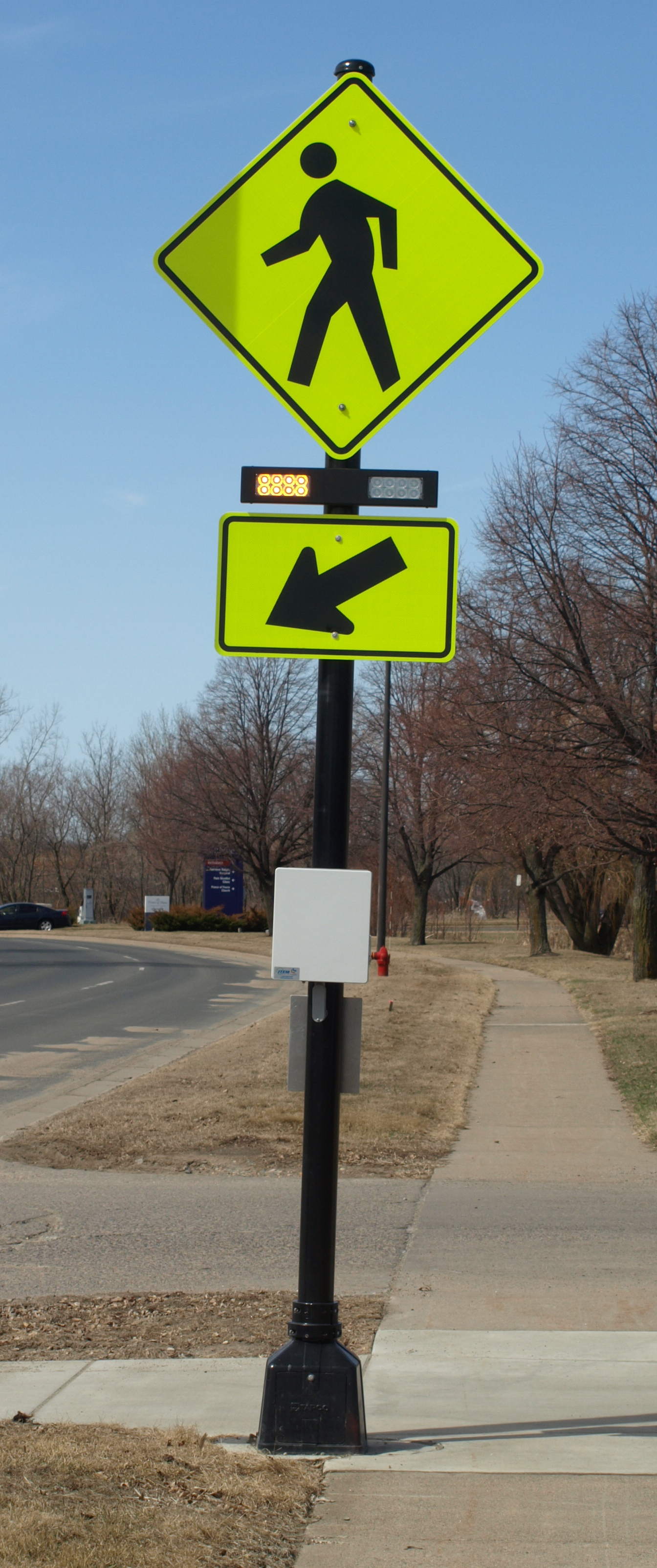
The soon-to-be released guidebook* recommends when to install marked crosswalks and other enhancements based on the average daily vehicle count, number of pedestrians, number of lanes and average vehicle speed. It guides users how to rate a crossing for pedestrian service, and includes a flow chart to assist in decision-making.
The training is unique because it is based on actual video footage of existing crosswalks and the pedestrians which use them.
No guidance
Although vehicles are legally required to stop for pedestrians crossing at intersections and within marked crosswalks, they don’t always yield the right-of-way. And areas with high traffic volumes may not have adequate gaps for pedestrians to cross safely, leading to risk-taking.
Alan Rindels, a MnDOT research engineer, had previously looked for a methodology to evaluate a crosswalk’s effectiveness, but could not find an appropriate engineering analysis.
“What I kept coming up with were results based on the experience of an engineer or planner for what they ‘felt’ was a better crosswalk, such as additional pavement markings, lights or maybe a signal system,” he said.
Rindels finally found guidance in a Transportation Research Board webinar two years ago. Based on that, he asked the LRRB to develop a training methodology for Minnesota practitioners.
Uncontrolled pedestrian crossings
Unless specifically marked otherwise, every intersection is a pedestrian crossing, regardless of the existence of crosswalk markings or sidewalks. At mid-block locations, crosswalk markings legally establish the pedestrian crossing. Uncontrolled pedestrian crossings (which the guidebook focuses on) are locations that are not controlled by a stop sign, yield sign or traffic signal.
Defining where to place pedestrian crossing enhancements — including markings, signs and or other devices — depends on many factors, including pedestrian volume, vehicular traffic volume, sight lines and speed.
The LRRB developed a worksheet that engineers can use to evaluate an uncontrolled pedestrian crossing location in a systematic way, in accordance with the 2010 Highway Capacity Manual. Users note the level of lighting, distance from the nearest all-way stop and whether another location might serve the same pedestrian crossing more effectively.
The guidebook’s 11-step evaluation can identify what level of treatment is appropriate, ranging from overhead flashing beacons and traffic calming devices, such as curb bump-outs, to more expensive options like building overpass or underpass.
Hennepin County Senior Transportation Engineer Pete Lemke, who went through pre-training, said the guidebook will help engineers measure the pedestrian experience by “quantifying the delay at non-signalized intersections.”
“It will inform how we respond to concerns — whether that response is ‘the crossing fits the needs of what’s there’ or ‘we need to make changes or enhancements,'” he said.
Further Resources
Putting Research Into Practice: A Guide for Pedestrian Crossing Treatments at Uncontrolled Intersections – Technical Summary (1 MB, 2 pages); Final Report.
* Consultant Bolton & Menks prepared the guidebook with guidance from a 21-member project team that included University of Minnesota researchers and engineers from the city of Eagan, Hennepin County, Carver County, Scott County, MnDOT, the Center for Transportation Studies and the Federal Highway Administration.
Rumble strips alert sleepy and inattentive motorists that they are about to veer off the highway or into the opposite lane of traffic. But the grating noise that prevents collisions can also be annoying to nearby residents.
Around Minnesota, more and more counties are facing push-back as they install shoulder rumble strips on roadways in populated areas. This is because county road shoulders are narrow — leading drivers to frequently hit the rumbles.
“There is a strong concern statewide that these noise complaints will raise enough concern that legislation may be passed reducing their use,” said technical liaison Ken Johnson of MnDOT’s Office of Traffic, Safety and Technology.
A European-developed style of rumble strip, called sinusoidal, could provide Minnesota a new means of warning drivers without as much stray highway noise.
Accident reduction
Rumble strips are patterns ground into asphalt that cause a vehicle to vibrate when its tires come close to the centerline or road edge. They help prevent lane departure crashes, which account for more than 50-percent of fatalities on the road system.
The sinusoidal rumble (below) has a sine wave pattern ground into the pavement, while the traditional rumble strip (top photo) doesn’t follow a wave pattern.
Creation of a Sinusoidal rumble strip. Photo courtesy of the Wirtgen Group
MnDOT’s Office of Traffic, Safety and Technology plans to test different designs of the Sinusoidal rumble strips to find the one with the highest level of interior vehicle noise and lowest level of exterior vehicle noise.
The navigability of sinusoidal rumbles by motorcycles and bicycles will also be evaluated. The project was recently funded with a research implementation grant from MnDOT’s Transportation Research Innovation Group.
If sinusoidal rumble strips are found to be effective, the chosen design will be used for centerlines and road shoulders in noise-sensitive areas throughout the state highway system. It is anticipated that counties will also adopt the design.
Unlike counties, most of MnDOT’s recent complaints have been for its centerline rumbles, which are required on all rural, high-speed undivided roads in Minnesota, Johnson said.
MnDOT has considered allowing more exceptions due to residential noise concern; however, doing so could result in more fatal and serious crashes. Sinusoidal rumbles are seen as a possible alternative for these noise-sensitive areas.
The Local Road Research Board is also studying different designs of sinusoidal rumble strips in Polk County.
The new Roadway Safety Institute, a $10.4 million regional University Transportation Center (UTC) established in late 2013, will conduct a range of research, education, and technology transfer initiatives related to transportation safety. Led by the University of Minnesota, the two-year consortium will develop and implement user-centered safety solutions across multiple modes.
The Institute will be a focal point for safety-related work in the region, which includes Minnesota, Illinois, Indiana, Michigan, Ohio, and Wisconsin. Other consortium members are the University of Akron, University of Illinois at Urbana-Champaign, Southern Illinois University Edwardsville, and Western Michigan University.
Max Donath, professor of mechanical engineering at the U of M, serves as the new Institute’s director. In this month’s issue of the CTS newsletter, Catalyst, Donath shared his vision for theInstitute.
According to Donath, the Institute will focus on addressing regional traffic safety priorities, educating the public, and attracting more professionals to the safety workforce by connecting with students.
Research topics will focus on two key areas, Donath said: high-risk road users and traffic safety system approaches. The goal of this work is to prevent the crashes that lead to fatalities and injuries on the region’s roads.
One unique Institute effort will involve working with American Indian communities in the region to explore and address the unusually high number of motor vehicle crash fatalities on tribal lands. “Our research will work to better understand why this is happening and to develop more effective solutions,” Donath said.
Each year, approximately 17 percent of road construction work zone fatalities nationwide are pedestrians.
At special risk are the visually impaired, who rely on walking and public transportation to get around.
A major challenge for them is crossing the street — which is even more difficult if an intersection is torn up.
MnDOT has invested significant effort to accommodate pedestrians, particularly those with disabilities, in temporary traffic control situations. This includes requiring temporary curb ramps and alternative routes when a sidewalk is closed.
Researchers, funded by MnDOT, have now developed a cell phone application to guide blind pedestrians around a work-zone.
Illustration of Bluetooth beacon placement at decision points around a work zone.
Building on previous work to provide geometric and signal timing information to visually impaired pedestrians at signalized intersections, the smartphone-based navigation system alerts users to upcoming work zones and describes how to navigate such intersections safely.
The smartphone application uses GPS and Bluetooth technologies to determine a user’s location. Once a work zone is detected, the smartphone vibrates and announces a corresponding audible message. The user can tap the smartphone to repeat the message, if needed.
The federal government strongly encourages states to provide either audible warnings or tactile maps at work zones where visually impaired pedestrians are expected to be impacted.
“The smartphone application is a step in that direction,” said MnDOT technical liaison Ken Johnson. “It’s a way to see if this type of way-finding device would work.”
Since smartphone use is still limited, the state is also interested in special equipment that could relay the audible warnings at affected work zones.
“However, smartphone use is increasing in the general population, as well as with persons with disabilities, and there will likely be a day when it will be rare to not have a smartphone and this tool could meet road agency needs,” Johnson said.
Before developing the smartphone application, researchers surveyed 10 visually impaired people about their experiences at work zones and what types of information would be helpful in bypass or routing instructions.
The University of Minnesota research team, led by Chen-Fu Liao, tested the smartphone application by attaching four Bluetooth beacons to light posts near a construction site in St. Paul.
Additional research is now needed to conduct experiments with visually impaired users and evaluate system reliability and usefulness.
With freight traffic increasing on U.S. roadways, commercial truck drivers often struggle to find safe and legal places to park. If parking spaces are not available at a nearby rest area or truck stop, drivers may be forced to pull over in unsafe locations or continue driving and become dangerously fatigued. Drivers may also risk violating federal hours-of-service rules, which require them to rest after 11 hours of driving.
In response to this issue, a team from MnDOT, the University of Minnesota, and the American Transportation Research Institute is developing a system that can identify available truck parking spaces and communicate the information to drivers—helping them determine when and where to stop. System benefits include improved safety, reduced driver fatigue, and better trip management.
The system uses a network of digital cameras suspended above a parking area to monitor space availability. Image processing software developed by researchers at the U of M’s computer science and engineering department analyzes the video frames and determines the number of available spaces.
As part of a demonstration project funded by MnDOT and the Federal Highway Administration, the project team is installing the system at three MnDOT rest areas and one private truck stop on I-94 west and northwest of the Twin Cities.
The U of M research team first installed the system in late 2012 at the the Elm Creek Rest Area, two miles north of Interstate 494 on I-94. As of early 2014, the system has been installed at an additional rest area, and a third site is in progress.
Next steps for the project include implementing several mechanisms that will communicate parking information to truck drivers. First, the team plans to install variable message signs along I-94 this spring. Also in the works are an in-cab messaging system and a website.
Overall results of the demonstration project will help the team determine whether this technology holds promise for use in other corridors throughout the nation.
Read the full article in the February issue of Catalyst.
Minnesotans have grown accustomed to roundabouts as they’ve proliferated throughout the state, but many motorists are still confused by the less common two-lane roundabout.
While roundabouts have been shown to reduce vehicle delay and severe crashes, the few Minnesota cities with this type of multi-lane roundabout have had a prevalence of driver mistakes.
In Woodbury, two such roundabouts were converted into smaller, one-circulating-lane designs due to driver confusion.
The City of Richfield had no such option at the high-volume Portland Avenue and 66th Street, a formerly signalized intersection that carries about 30,000 vehicles per day. (See video)
Crash-prone and congested prior to its reconstruction in 2008, a two-lane roundabout seemed to be the practical solution for this intersection. But although the roundabout reduced overall crashes, the intersection still had more fender benders than designers were comfortable with, according to City Engineer Kristin Asher.
“The crashes were primarily related to improper left-turns from the outside lane and failure to yield at the entry,” she said.
Not only were drivers unsure which lanes they should use to enter or exit the roundabout, they didn’t know how to respond to other cars inside the roundabout. (See news story)
“People don’t understand they have to yield to both lanes inside the roundabout,” explained University of Minnesota researcher John Hourdos.
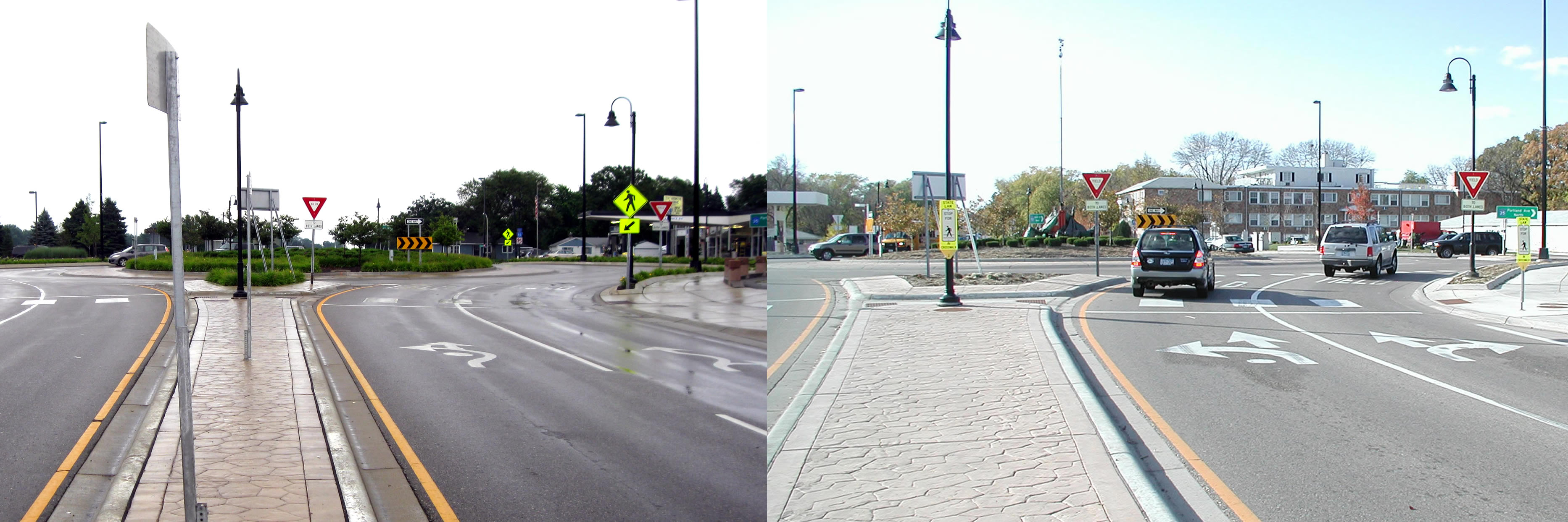
The city of Richfield extended the solid lines leading up to the intersection from 50 to 250 feet to encourage drivers to choose the correct lane before entering the roundabout. It also replaced fish-hook-style roundabout signs with traditional lane designation signs and did away with complex striping patterns.
Before and after photos show the original fish-hook style pavement markings, left, that were replaced with a more traditional design. (Courtesy City of Richfield)
Hourdos examined two years of traffic data to see how motorists responded to the improvements that were made in 2011.
He found 50 percent more drivers entered the correct lane from the get-go, which led to a reduction in improper turns within the roundabout. Lane violations were also reduced by 20 percent.
“One of the main problems was drivers didn’t know they have to choose one of the two lanes,” Hourdos explained. “Then once they were inside the roundabout, they were forced to either deviate from their course or commit a violation.”
The city also increased sign visibility to address yielding problems; however, these changes didn’t seem to make a difference.
With state and federal guidelines lacking much guidance for how to sign two-lane roundabouts, the LRRB is funding a new study for three other multi-lane roundabouts: in St. Cloud, at Highway 169/494 and one planned for the future realignment of County Roads 101 and 61 between Chanhassen and Shakopee.
The Minnesota Local Road Research Board is a major source of funding for transportation research in the state. Occasionally, it also produces educational videos designed to raise public awareness of important transportation topics.
Two new video offerings from the LRRB (embedded above and below) are focused on save driving in work zones. While not directly research-related, they might prove a useful resource to transportation professionals. More importantly, they serve to remind us all of the very real and dramatic consequences of work zone crashes, of which there are approximately 2,000 per year in Minnesota.
You might want to also check out some of their other recent YouTube offerings, including explanations of why we need stop signs and speed limits, as well as a fascinating look at how potholes are patched.
A research implementation project could provide MnDOT with a new set of tools to help combat a major source of bridge failure.
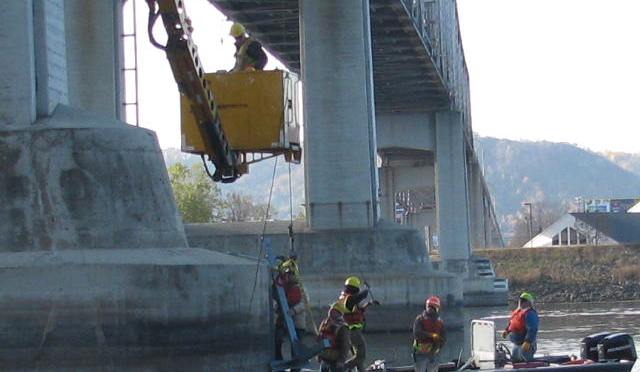
The MnDOT Bridge Office is testing several new methods of monitoring bridge scour — erosion that occurs around bridge piers and abutments during high water-flow events like floods. Acting Waterway Engineer Nicole Danielson-Bartelt said the project’s goal is to be able to monitor scour-critical bridges remotely rather than sending maintenance personnel out on the water during difficult or hazardous conditions.
“There are a number of bridges that are pretty difficult to monitor, especially during high water events,” she said. “Typically, you need to get out on a boat and do either sonar readings or drop weights. It’s dangerous work to be out on the water during those types of events unless you have the right training.”
The project will evaluate several different monitoring technologies, including continuous monitoring equipment like tilt meters and active sonar. The sonar systems, which allows continuous stream bed and water surface elevation data to be transmitted to a website for graphical display, could provide benefits that go beyond monitoring individual bridges.
“The ability to collect continuous, long-term data could help engineers understand short term scour-fill and long term aggradation-degradation cycles,” said Solomon Woldeamlak, a Bridge Office hydraulic engineer. He added that the data can be used to calibrate existing methods of estimating scour at bridges.
Other devices being tested include “float-out” devices, which are buried in the sand around the abutment and send out a signal only if washed to the surface by a scour. Danielson-Bartelt said these non-continuous monitoring devices might be appropriate for bridges where installing permanent sonar is not advisable due to the presence of debris that could damage the equipment.
Monitoring equipment has been installed at two locations: the Highway 43 Winona bridge over the Mississippi River and the Highway 14 Mankato bridge over the Minnesota River. A final report on the project is expected in late 2014/early 2015. You can learn more about some of the products that are being tested on the website of ETI Instrument Systems, Inc., which provided the equipment.