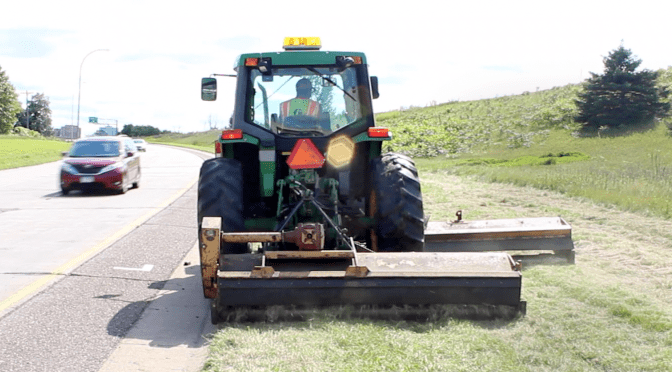
As temperatures fall and days get shorter, MnDOT Metro District maintenance workers are wrapping up a season of mowing grass along roadsides and in medians that they hope will prove a little more efficient than in the past.
Thanks to a research project that installed GPS devices in tractor cabs, operators have a better sense of exactly which areas they need to mow and which areas should be left alone. Five Metro District tractors were tested in 2015. This year, more than 40 tractors were fitted with the automated vehicle location (AVL) technology, which includes a GPS antenna, an on-board central processing unit (CPU) and an in-cab screen with a user interface.
Trisha Stefanski, Metro District asset management engineer, expects one of the biggest benefits of the project to be a reduction in herbicide use. Maintenance crews use herbicide to control the spread of noxious weeds that sometimes get spread during mowing operations. Mapping exactly where noxious weeds are, and providing that information to operators on a real-time, in-cab screen and user interface helps them mow around those areas.
“We’re really hoping it will reduce the amount of herbicide that we’re putting on our roadways by 50 percent,” Stefanski said. “We’re not certain that will be the number, but that’s what we’re hoping for. We think just not mowing those areas will not spread as many noxious weeds and so we don’t have to apply as much herbicide.”
Metro District operators, such as Jesse Lopez, give the AVL technology rave reviews.
“Basically you can see what you shouldn’t mow and what you should mow. So, it makes it easy for me. It’s just like playing a game,” Lopez said. “This actually helps me to optimize what my job is. I know exactly where I’m at and where I’m going. I think everyone should use it – absolutely everybody who is in a mowing situation or a plowing situation.”
In addition, the AVL technology helps maintenance supervisors keep tabs on exactly where their operators are in real time. It also helps supervisors complete reports by automatically providing the geographic areas where mowing has been completed.
Stefanski says the project has gone really well, and she hopes collecting more data over another mowing season will show real savings on herbicide use. In the meantime, she is thinking of other ways AVL technology could be applied to maintenance operations.
“What I really like about the project is that we are taking something used in a lot snow plows and a lot of other technologies – cars, other things, maybe UPS uses them – and we’re putting it into maintenance operations,” Stefanski said. “Having it for mowing, we can also use it for smooth pavements. We can also use it for other things in mowing operations.”
In the video, Jennifer Zink, MnDOT state bridge inspection engineer, explains the project, along with Tara Kalar, MnDOT associate legal counsel; Cassandra Isackson, director of MnDOT Aeronautics; and Bruce Holdhusen, MnDOT Research program engineer.
The initial drone project drew significant media coverage and a lot of attention from other state departments of transportation from all over the country.
A second phase of the project was approved year and is currently underway. A third phase is already in the planning stages.
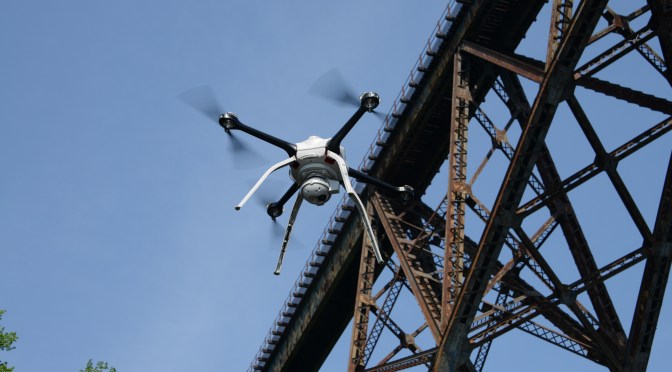
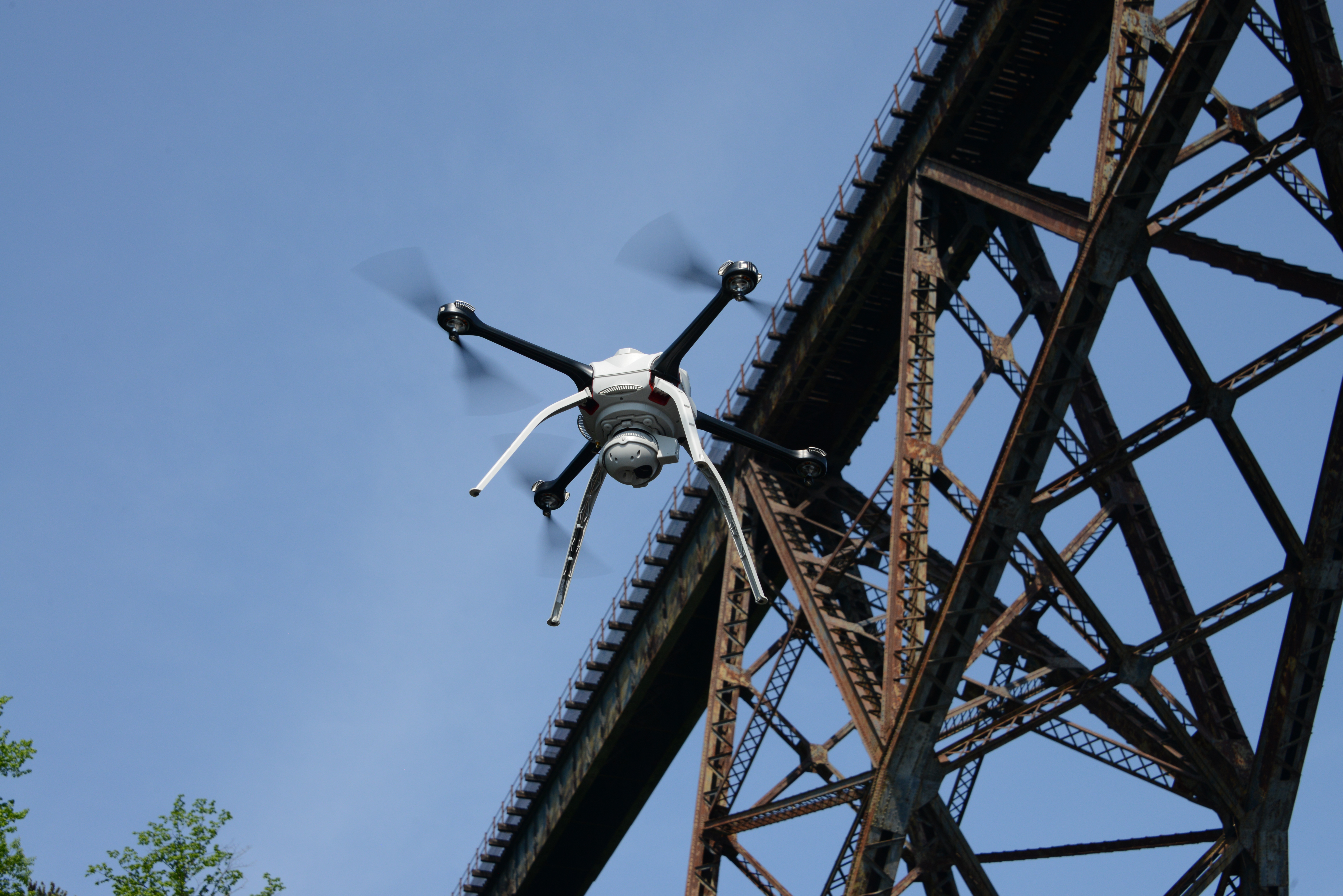
Developing the guidance needed to begin using drones for bridge inspections statewide is among the Minnesota Department of Transportation’s latest batch of research implementation projects.
Project champions take previously proven concepts and help MnDOT turn them into useful practices and procedures to make the state’s transportation system better. Funds can be used for equipment, consultant services or researcher assistance.
“The research implementation program fills the gap between research and deployment of new methods, materials and equipment,” Bruce Holdhusen, MnDOT Research Services senior engineer, said.
Here are the 12 newly funded research implementation projects by category:
Bridge and Structures
Improving Quality of Bridge Inspections Using Unmanned Aircraft Systems (UAS)
Prestressed Concrete Beam Shear Rating
OmniScan Phased Array Ultrasonic Corrosion Imaging System
Environmental
MnDOT Slope Vulnerability Assessments
Maintenance Operations
Ultra-thin Bonded Wearing Course (UTBWC) Snow and Ice and Wind Effects
Materials and Construction
Cold In-Place Recycling (CIR) for Bituminous Over Concrete (BOC)
Geogrid Specification for Aggregate Base Reinforcement
Balanced Design of Asphalt Mixtures
Cone Penetration Testing (CPT) Design Manual for State Geotechnical Engineers
Policy and Planning
One-year Pilot Test and Evaluation of ASTM DOT Package Compass Portal
Traffic and Safety
Improve Traffic Volume Estimates from Regional Transportation Management Center (RTMC)
Understanding Pedestrian Travel Behavior and Safety in Rural Settings
When it comes to creating the transportation system of the future, MnDOT is already doing its research and laying the groundwork for great things to come.
James Benham, JB Knowledge, speaks at the Transportation Conference. (Photo by Rich Kemp)
Among the topics Benham cited in his talk were the Internet of Transportation, unmanned aerial vehicles (drones) and 3-D printing, which MnDOT is already studying or even using.
Internet of Transportation
MnDOT recently produced series of white papers on technological trends that could impact transportation infrastructure in Minnesota.
Google is one of many companies developing autonomous vehicle technology that researchers believe will make driving nearly extinct by 2040. (Photo courtesy of Google)
The report details how the transportation system can accommodate such imminent innovations as autonomous vehicles, mobile web services, mobility as a service, information and communication advances, infrastructure sensors and energy and fuel alternatives.
For example, researchers predict that driving faces near-extinction by 2040, when non-autonomous vehicles will no longer be allowed on public roads at most times. As a result, total transportation-related fatalities may drop 90 percent, road geometry, sightlines and other design priorities may shift, and capacity and speed limits will likely increase on most major roadways.
Unmanned Aerial Vehicles (Drones)
MnDOT is researching how data and images collected by drones could aid bridge inspectors.
When it comes to drones, MnDOT is already conducting important research that the rest of the nation is closely following. Tara Kalar and Jennifer Zink from MnDOT, and Barritt Lovelace of Collins Engineers, spoke about their efforts at last month’s conference.
Last year, MnDOT Research Services published a report titled “Unmanned Aerial Vehicle (UAV) Bridge Inspection Demonstration Project” that detailed how MnDOT could use drones to perform bridge inspection functions. The initial research project tested one drone’s capability in a variety of bridge inspection scenarios last summer at four Minnesota bridges.
In November, researchers conducted a second research phase to test a more specialized drone at the Blatnik Bridge in Duluth that coincided with that bridge’s regularly scheduled inspection.
A few weeks ago, researchers secured funding to conduct a research implementation project that aims “to implement a statewide UAS (unmanned aircraft systems) bridge inspection contract, which will identify overall cost effectiveness, improvements in quality and safety, and future funding sources for both state and local bridges,” according to the project proposal.
3-D Printing
Benham’s talk also addressed 3-D printing, which Chad Hanson, a District 6 project manager, has already used successfully.
Hanson spoke at the conference about his experience using 3-D printing to create a model of the Red Wing Bridge project that brought the project idea to life. According to Hanson, the model enhanced public engagement and informed preliminary design efforts for the bridge.
Chad Hanson, District 6 engineer, used 3-D-printing to create a model of the Red Wing Bridge that was used during the project’s public engagement events. (Photo by Mike Dougherty)
Partners, stakeholders and members of the public could see, touch and hold the 3-D printed models, which accentuated the project’s engagement process.
To mark Earth Day 2016, MnDOT Research Services is taking a glance at five stellar examples of current research projects at MnDOT that involve pollution control, wetland mitigation, road salt reduction and new ways of recycling pavement.
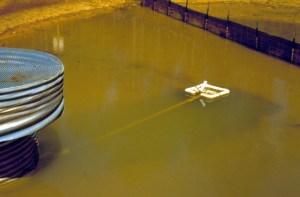
Temporary stormwater ponds with floating head skimmers can remove clean water from the surface of a settling pond.
Soil carried away in stormwater runoff from road construction sites can pollute lakes and rivers.
Stormwater settling ponds provide a place for this sediment to settle before the water is discharged into local bodies of water. However, since stormwater ponds have limited space, a mechanism is needed to remove clean water from the pond to prevent the overflow of sediment-laden water.
MnDOT-funded researchers designed temporary stormwater ponds with floating head skimmers that can remove clean water from the surface of the settling pond, using gravity to discharge water into a ditch or receiving body.
The study, which was completed in spring 2014, identified five methods for “skimming” stormwater ponds that can improve a pond’s effectiveness by 10 percent. MnDOT researchers also created designs for temporary stormwater ponds on construction sites with the capacity to remove approximately 80 percent of suspended solids.
These designs will help contractors meet federal requirements for stormwater pond dewatering. Researchers also determined how often a pond’s deadpool must be cleaned, based on watershed size and pool dimensions.
Stormwater infiltration rates at five swales were significantly better than expected based on published rates.
Stormwater can pick up chemicals and sediments that pollute rivers and streams. Roadside drainage ditches, also known as swales, lessen this effect by absorbing water. But until recently, MnDOT didn’t know how to quantify this effect and incorporate it into pollution control mitigation measures.
In a study completed in fall 2014, researchers evaluated five Minnesota swales, measuring how well water flows through soil at up to 20 locations within each swale.
A key finding: grassed swales are significantly better at absorbing water than expected, which may reduce the need for other, more expensive stormwater management practices, such as ponds or infiltration basins.
This could save MnDOT and counties significant right-of-way and construction costs currently expended on more expensive stormwater management techniques.
Even with little or no road salt, a permeable pavement like this porous asphalt in Robbinsdale, Minnesota, collects little slush and snow in the winter because it warms well and remains porous enough to infiltrate surface water effectively.
Road salt is used for de-icing roadways during winter months, but can have a negative impact on the environment.
This research, which was just approved for funding through the Minnesota Local Road Research Board in December 2015, will investigate the reduction in road salt application during winter months that can be attained with permeable pavements, while still providing for acceptable road safety.
Some initial investigations (see previous study) suggest that road salt application can be substantially reduced, even eliminated, with permeable pavement systems. The proposed research will investigate this hypothesis more thoroughly, and further document the reduction in road salt application that can be expected with permeable pavement.
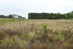
This photo from spring 2015 shows that wetlands have begun to take hold along Highway 53.
Road construction in northeast Minnesota often causes wetland impacts that require expensive mitigation. However, borrow areas excavated for road construction material can be developed into wetland mitigation sites if hydric vegetation, hydric soils and adequate hydrology are provided. Fourteen wetland mitigation sites were constructed north of Virginia, Minnesota along the U.S. Trunk Highway 53 reconstruction project corridor and evaluated for wetland. The sites were established with the goal of mitigating for project impacts to seasonally flooded basin, fresh meadow, shallow marsh, shrub swamp, wooded swamp, and bog wetlands. All but one of the sites consistently meet wetland hydrology criteria.
The sites contain a variety of plant communities dominated by wet meadow, sedge meadow, and shallow marsh. Floristic Quality Assessment (FQA) condition categories for the sites range from “Poor” to “Exceptional.”
According to the research report published in March 2016, these sites have shown the potential for creating mitigation wetlands in abandoned borrow pits in conjunction with highway construction. Adaptive management, particularly water level regulation, early invasive species control, tree planting, and continued long-term annual monitoring can make mitigation sites like these successful options for wetland mitigation credit.
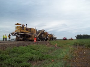
This photo shows a cold in-place recycling equipment train in action.
MnDOT already extends the lives of some old concrete highways by paving over them with asphalt instead of tearing them up. Now MnDOT hopes to add a third life for these old concrete roads by using a process called cold in-place recycling to re-use that existing asphalt pavement when it reaches the end of its life.
Cold in-place recycling (CIR) uses existing pavements, without heat, to create a new layer of pavement. It involves the same process of cold- central plant mix recycling (which is being employed by MnDOT for the first time on two shoulder repair projects this year), but it is done on the road itself by a train of equipment. It literally recycles an old road while making a new road.
CIR has been in use in Minnesota for 20 years, but only with hot-mix asphalt (HMA) over gravel roads. The purpose of a new study, which was approved for funding in April 2016, is to validate Iowa’s promising new practice using CIR on bituminous over concrete.
In this research project (see proposal), MnDOT will use cold-in-place recycling to replace the asphalt pavement on a concrete road and then evaluate it for several years, comparing it also with control sections.
Along with the potential of a better service life, the cost of CIR is much lower than new hot mix asphalt (HMA). Therefore, a 20-percent to 30-percent price reduction per project may be realized.
Darryl Oeltjenbruns, snowplow driver in District 7, operates the only driver assist system, or DAS, equipped snowplow in the state. The system helps snowplow operators see road alignments and features such as turn lanes, guardrails and road markings. (Photo by Chase Fester)
By Sue Roe, MnDOT Communications
Southwest Minnesota has the highest average wind speeds in the state—bad news for MnDOT snowplow operators who often drive in low visibility to clear roads.
“We have more days when the wind blows than when it doesn’t,” said Chase Fester, MnDOT District 7 transportation operations supervisor. “We struggle with the wind.”
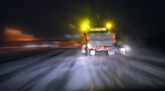
That’s why District 7 is piloting a snowplow driver-assist system (DAS) developed by University of Minnesota researchers to combat the blowing snow and fog that often cause zero visibility. The DAS helps snowplow operators see the road alignment and features, such as turn lanes, guardrails, and road markings. Even in less extreme winter weather, snowplow operators gain assurance of their lane location using the system.
The driver assist system displays a white box on the screen when an obstacle, or in this case a mailbox, is located. If the object appears in the lane, such as a car stuck in a snow drift, the box turns red and gets bigger as the snowplow gets closer to the object. (Photo courtesy of MnDOT District 7)
The DAS was developed and refined over the past 20 years under multiple research projects funded by MnDOT and the USDOT’s University Transportation Center program. Professor Max Donath, director of the University of Minnesota’s Roadway Safety Institute, led the work. In addition to plows, the DAS technology has also been applied in other specialty vehicles such as patrol cars and ambulances. Numerous vehicles using the system have been deployed in both Minnesota and Alaska.
The DAS uses GPS technology and a front-mounted radar to provide an image of the road and any obstacles in front of the operator. The image is displayed on a monitor inside the cab of the plow. The system also vibrates the operator’s seat as a warning if the plow veers too close to the roadway’s centerline or fog line.
“If the driver gets within one foot of the fog line on the right side, the right side of the seat vibrates. If the driver gets too close to the centerline on the left side, the left side vibrates,” said Fester.
The vibrations continue until the driver moves back into the center of the lane. The driver can also turn off the warning feature to clear snow from the shoulder.
The DAS is currently installed in one truck in District 7. The $75,000 cost makes it difficult to install in every truck in the district or the state, although having at least one system in every district may be possible, Fester said.
Fester said the system proved its worth one day in February when blizzard conditions caused zero visibility and forced many road closures in southwest Minnesota. He was called out at 2 a.m. Feb. 8 to assist a stranded state trooper and several motorists on a 12-mile stretch of Hwy 60 between Windom and Heron Lake. Fester drove a pickup behind the DAS-equipped snowplow, driven by Darryl Oeltjenbruns, to reach them.
As the DAS identified stranded vehicles on the way to Heron Lake, Fester and Oeltjenbruns checked to make sure they weren’t occupied with people. Once they made it to Heron Lake, they stopped at the community center, where the state trooper and the stranded motorists he brought in were located.
On the way back to Windom, Fester and the state patrolman continued to check on stranded vehicles as the DAS-equipped snowplow led the way. If the vehicles weren’t in the ditch, motorists drove behind the two MnDOT vehicles. If their vehicles were in the ditch, motorists rode in a Suburban that was also being escorted to Windom. After returning to Windom, the motorists were dropped off at motels or truck stops.
“When we first went out, there were about six stranded vehicles. Coming back from Heron Lake, there were about 15,” Fester said. “At one time, we had 12 vehicles in line as we drove back to Windom, driving about 10 to 15 miles per hour.”
Later that morning the DAS system was used again to locate other motorists.
“We continued to use it until about 10 a.m. or 11 a.m. that day,” Fester said. “The system worked great and kept everyone safe. It was an interesting morning.”
(Reprinted and adapted with permission from an article by Sue Roe in MnDOT’s Feb. 17, 2016 Newsline.)
The benefits of living snow fences and other snow control tools to keep roadways clear of blowing and drifting snow have been known for decades, and MnDOT has been using a variety of these techniques for years to catch snow before it gets to a road.
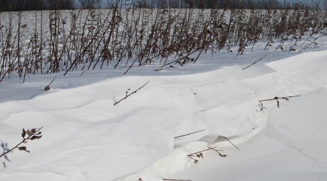
Living snow fences often consist of trees, grasses and even corn stalks left standing in a farmer’s field. Now willow shrubs are being added to the list as a fast-growing, inexpensive snow control measure.
What’s new
Fish Creek willow shrubs (left) grow alongside corn in September 2015.
Researchers recently completed a study that investigated whether willow shrubs could make good living snow fences. While typical snow-fence plants, such as dogwood or cranberry shrubs, can take five to 20 years to establish themselves, shrub willows were effective at trapping snow after just two growing seasons, according to the study.
In spring 2013, researchers installed three varieties of shrub willow side-by-side in two-row and four-row configurations along about a quarter of a mile of Highway 14 in Waseca, where snow drifts are an issue. In April 2014, they cut the shrubs down to the ground to encourage branching and bush density. Though the trimmed willows had little impact on drifting snow the first winter, each willow-shrub plot was collecting two to three metric tons of snow by the second winter, according to the research report. Researchers believe that after three or four growing seasons the willow shrubs could catch the entire mean annual snowfall on the site.
In the four-row configuration recommended by researchers, costs of raising, furnishing, planting and mulching came to about $3.60 per plant, which is dramatically less than the contract bid cost for traditional living snow fence species that cost more than $50 per plant. In addition, the willow shrubs could be harvested and sold as biomass every few years to provide an income source.
Past research
Willow trees is just the latest advancement in the state’s snow control program. A 2012 research project evaluated the costs and benefits of living snow fences and provided MnDOT with a payment calculator to determine how much to compensate landowners for installation and maintenance costs.
MnDOT has used these tools and other promotional efforts to nearly double the number of farmers with contracts for corn rows enrolled in the Living Snow Fences program.
What’s next
The willow species recommended by researchers will be evaluated further in 2017 when they install it as a living snow fence on a new construction site on Highway 60 between Windom and Mountain Lake. Researchers also recommend a future study to compare volume of road salt use before and after installation. They also want to look into identifying appropriate buffer distances to keep willow roots from interfering with cropland root systems.
The mix of fuels used to power the vehicles on our nation’s roadways is diversifying rapidly. While gasoline and diesel are still dominant, an increasing percentage of vehicle power is coming from alternatives such as biofuel, natural gas, and electricity. What could this shift mean for Minnesota’s transportation future? MnDOT and the Minnesota Local Road Research Board turned to U of M experts for analysis.
“The rise of alternative fuels is something we need to keep a close eye on, because it presents a number of issues that may significantly alter our state’s transportation system,” says Adam Boies, an assistant professor in the U of M’s Department of Civil, Environmental, and Geo- Engineering (CEGE).
Minnesota leads the nation in biofuel use, in part due to a series of legislative acts designed to encourage ethanol production and consumption. Boies predicts, however, that biofuel consumption in the state is near saturation and that future shifts will likely be between biofuels. “These shifts may alter the routes of heavy-goods vehicles in the state as refineries shift from corn and soy to fuels derived from agriculture wastes and forest byproducts,” he says.
If the price of natural gas remains significantly lower than diesel fuel, natural gas vehicles will likely make up an increasing share of the heavy-duty vehicle fleet in Minnesota. A larger natural gas refueling infrastructure will need to be developed, most likely by private organizations that manage fleets of vehicles. “As this happens,” Boies says, “efforts must ensure that natural gas vehicles and refueling infrastructure do not emit significant quantities of methane, which has a high global warming potential.”
Minnesota electric vehicle sales have lagged behind the nation—winter temperatures are one factor—but Boies expects the numbers to rise. He estimates 16 percent of new cars sold in Minnesota in 2035, and 56 percent in 2050, will be electrified. The growing numbers will require a more robust charging infrastructure, likely supplied or subsidized by government agencies, he says.
In the long term, on-road charging systems are being investigated. In these systems, under study in several countries, charging coils embedded within the roadway transfer power wirelessly to vehicles. “The systems could make electric vehicles drastically more efficient by reducing vehicle battery size,” he says.
Better vehicle efficiency is likely to continue the trend of falling fuel tax revenues. “Minnesota will need a method for producing revenues from electric vehicles to maintain long-term funding for the transportation road network,” he says. “Currently the higher price of electric vehicles results in increased revenues during vehicle registration, which tends to offset the difference in fuel tax revenues. However, as the price differential between electric vehicles and traditional vehicles shrinks, there will be decreased funding for Minnesota roadways unless additional revenue sources are found.”
Finally, emphasis on fuel efficiency in the light-duty and heavy-duty vehicle fleets will drive the weight of these vehicle segments in opposite directions. “Light-duty vehicles will get lighter and heavy-duty vehicle fleet operators will lobby for increased weight limits on Minnesota roadways to reduce the energy intensity of goods deliveries,” Boies says. “This growing disparity in weight between the two vehicle classes may require increased safety measures to reduce the severity of crashes between vehicle classes.”
“The question of how alternative fuels and electric vehicles will impact the transportation system, ownership models, and operating costs, as well as vehicle and driver safety, are extremely important topics to study,” says Ken Buckeye, MnDOT program manager. “The potential for these trends to impact our revenue streams is also very significant. When you couple those trends with the federal mandate for a CAFÉ standard of 56 mpg by 2025, we are likely to see some profound impacts that reach across modes, jurisdictions, and funding mechanisms.”
Boies’s research is part of a multi-pronged study funded by MnDOT and the LRRB that analyzed the technological shifts altering surface transportation and the implications for Minnesota. Other contributors included CEGE professor and principal investigator David Levinson and associate professors Jason Cao and Yingling Fan of the Humphrey School of Public Affairs. Their high-level white papers are compiled in a final report: The Transportation Futures Project: Planning for Technology Change.
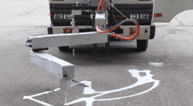
In the above video, University of Minnesota-Duluth Associate Professor Ryan Rosandich tests a prototype of a robotic arm he developed to paint messages and markings on roadways. He calls the machine “The MnDOT Robot.”
During a test run in October 2015, the MnDOT robot painted a right-turn arrow and the word “ahead” on pavement at MnDOT’s Pike Lake station in Duluth.
Rosandich hopes commercial companies will show an interest in further developing his proof-of-concept technology into something that road authorities can use regularly to make work easier, faster and safer for their employees.
Companies interested in commercializing this technology can contact Andrew Morrow at amorrow@umn.edu.
Editor’s Note: The paint used in the above demonstration was diluted due to the cold weather at the time of the demonstration and does not reflect the condition of the paint expected in a typical application.
A handful of county highway department employees in the Rochester area gathered recently at the Olmsted County Public Works Service Center for a presentation and live demonstration by University of Minnesota Research Fellow Brian Davis about his team’s work involving light detection and ranging – or LiDAR.
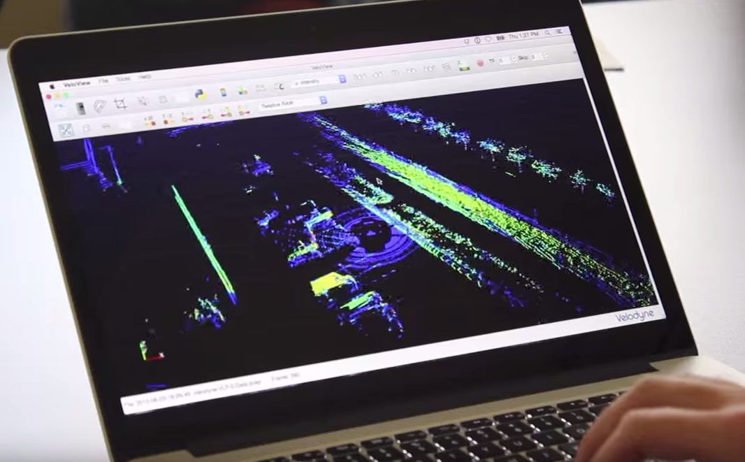
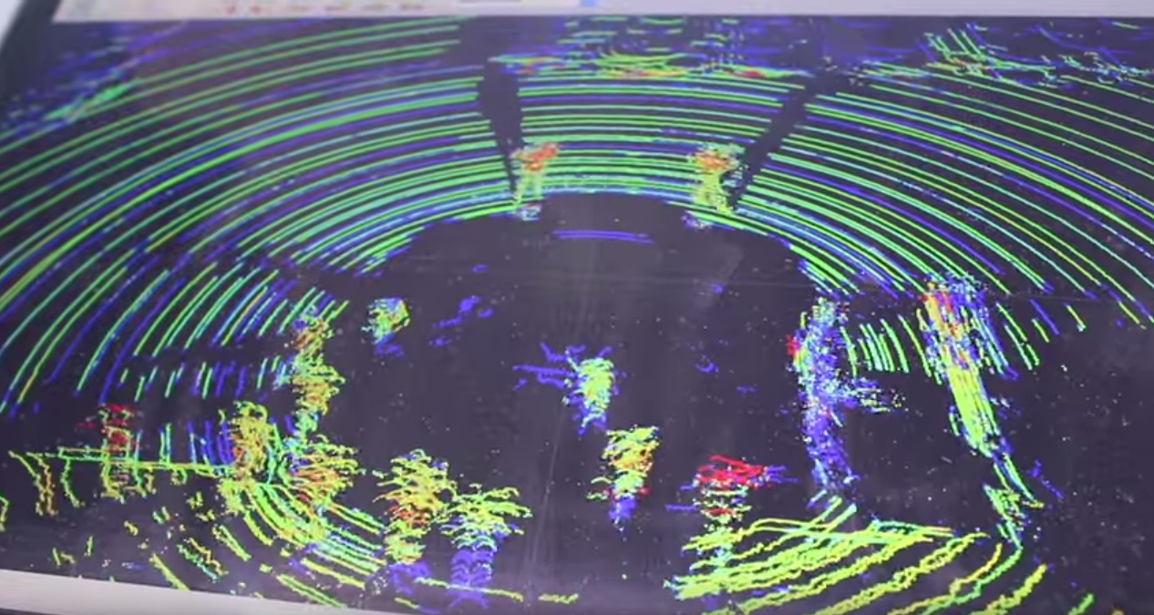
“LiDAR is like radar, but with light,” Davis said. “It gives you information about what’s around the sensor.”
Event attendees gather around a sedan outfitted with a spinning LiDAR sensor. (Photo by Micheal Foley, MnDOT)
Davis and his fellow researchers have outfitted a sedan with special LiDAR equipment and other technology that is capable of capturing a 360-degree, 3-D view of a scene in real time.
“We use the car as a test bed,” Davis said. “We have a lot of different types of sensors on the car that we use for the different projects that we’re working on. Right now we have a LiDAR sensor on top. Sometimes we have a high-accuracy GPS receiver in there. We have a cellular modem. We have a handful of inertial sensors. So it’s a lot of different stuff that we use to cater to the application.”
For his presentation, Davis showed the attendees some of the data his team had already collected.
Davis presents data that shows the LiDAR-equipped sedan moving along a roadway. (Photo by Micheal Foley, MnDOT)
“We showed a handful of pre-collected data at a handful of intersections around Rochester and Minneapolis,” Davis said. “What it shows is the point cloud collected by the sensor – just the raw point cloud with no post-processing done. In that information you can see people moving through it, cars moving through it, buses and light rail trains.”
Event attendees move around the sedan to see how the LiDAR sensor views them. (Photo by Micheal Foley, MnDOT)
After the presentation, Davis led the group to the parking lot for a close-up look at the technology and how it collects data and displays that data in real time. Le Sueur County GIS manager Justin Lutterman was among those who could envision possible applications for LiDAR.
“It’ll be interesting to see where this can go,” Lutterman said. “I’m sure the private industry will take off with this and emergency management, or the sheriffs and ambulances, would appreciate this kind of technology on their vehicles for a situation they might have to recreate. Roads and traffic designers would be able to monitor their resources, pavements, traffic counts and things like that.”
Over the coming months, researchers will gather more data to develop a workshop for county personnel interested in learning more about LiDAR and how it can be applied in their transportation systems.
“The next steps for this project are to collect some data with the car at intersections. Then we can use that information to fine tune our algorithms,” Davis said. “What the algorithms are going to do is take that raw data and give us useful information, like the number of cars, or the time a car passes through an intersection. That all feeds into the workshop we’re developing. The workshop is going to be for county GIS workers, traffic engineers and county engineers who are interested in learning about these technologies.”