Category Archives: Multi-modal

‘New logistics’ will change the way goods are delivered—and how the road network is used

Today, moving freight accounts for more than a third of the world’s transport energy—and that share is growing. The rise in global trade, online retailing, and business-to-business delivery is not only changing how goods are moved but also the type of goods moved and how far or frequently they are transported.

Currently, this massive movement of goods throughout the economy relies on an intricate—and largely decentralized—multimodal network of truck, rail, ship, and airplane delivery. However, change is on the horizon. In a study sponsored by MnDOT and the Minnesota Local Road Research Board, U of M experts outline the important impacts these changes will have on the road network and transportation infrastructure.

“There is hope that new methods of organization and proposed standardization will increase efficiency of freight movement and give rise to a new era of goods transport,” says Adam Boies, an assistant professor in the Department of Civil, Environmental, and Geo- Engineering (CEGE). “In the years to come, we expect that advances in logistics systems will be enabled by new technologies, approaches, and the desire for increased efficiency.”newlogistics2

Changes in the way logistics operations are organized will help drive advances. New information technology permits the sharing of data between and across businesses, which in turn drives efficiency and leads to fuller vehicles. “This may reduce the distance traveled by heavy goods vehicles per unit of GDP, which may in turn reduce costs and entice more demand for delivered goods,” says CEGE professor David Levinson, the study’s principal investigator. “Ultimately, this could mean fewer trips by individual consumers and more deliveries. We anticipate the result will be a net reduction in distance traveled.”

The study also examined some of the potential drivers for changes in the freight industry as a result of logistics reorganization. These include supply chain pooling, in which individual logistics operations are shared between collaborators, and the Physical Internet Initiative, which seeks to create standards for packaging to enable the homogenization of freight technology. “While both of these advancements have the potential to increase logistics efficiency by reducing the transportation of empty loads, they will also increase truck weights—which may increase pavement damage,” Boies says.

Other transportation and logistics changes will result from shifts in the ways businesses and consumers receive goods and services, including business-to-business systems and technologies that enable a sharing economy, same-day delivery services, 3-D printing, and “last mile” delivery services. In addition, a growing portion of purchases can be delivered directly over the Internet. “Delivery is easily automated for data-based goods like books, music, video, and software,” Levinson says. “Purchases that could once only be completed by moving things can now be done by moving data.”

The research is part of a multi-pronged study that analyzed the technological shifts altering surface transportation and the implications for Minnesota. Findings are available in a final report: The Transportation Futures Project: Planning for Technology Change.

Using drones to inspect bridges

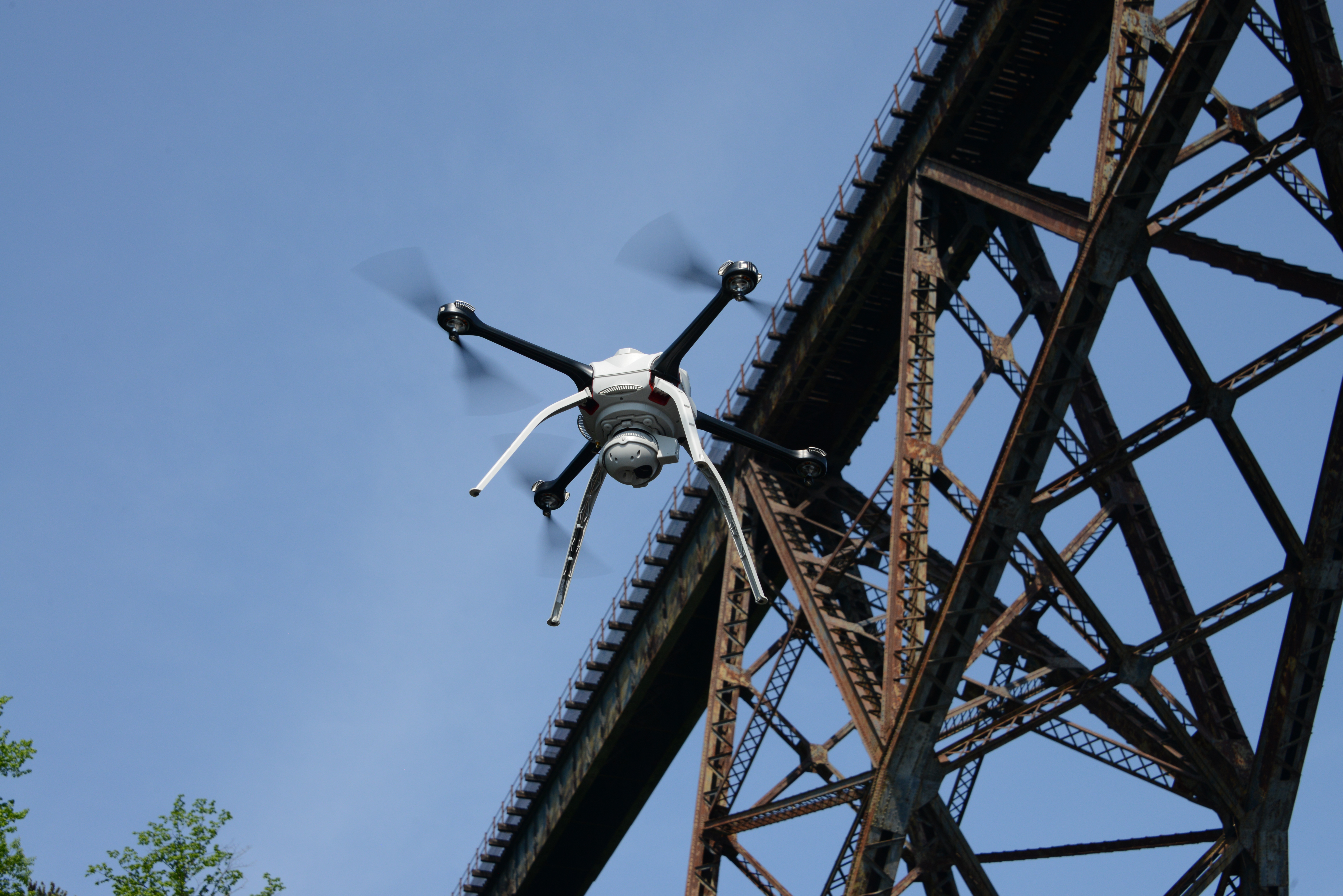
MnDOT is researching how data and images collected by drones, such as the Aeryon Skyranger shown here, could aid bridge inspectors.
MnDOT is researching how data and images collected by drones, such as the Aeryon Skyranger shown here, could aid bridge inspectors.

In recent years, drones made headlines for fighting wars overseas, detecting crop conditions, keeping an eye on power lines and even delivering retail goods.

As the flying electronic devices became easier to use and less expensive, all sorts of individuals, businesses, nonprofit groups and government organizations – including the Minnesota Department of Transportation (MnDOT) – are exploring ways to use them.

This past summer, MnDOT began researching how to employ these unmanned aerial vehicles, or UAVs, to someday help inspect the state’s many bridges.

“That day may still be far off, but our initial project was an encouraging first step,” said Jennifer Zink, MnDOT bridge inspection engineer. “Phase 2 of the project will better provide details as to methods, criteria and cost effectiveness for how to apply drone technology best to bridge inspection.”

Project goal

Using drones could also minimize risks associated with current bridge inspection methods, which include rope systems and special inspection vehicles. (Photo by D.R. Gonzalez, MnDOT)
Using drones could help minimize risks associated with current bridge inspection methods, which include rope systems and special inspection vehicles. (Photo by D.R. Gonzalez, MnDOT)

The research team tested drones this past summer while inspecting four Minnesota bridges (in Chisago County, Olmsted County, Morrison County and near Stillwater) specifically selected for the study after an extensive evaluation and FAA approval.

Zink and her colleagues wanted to investigate whether drones could help MnDOT decrease the rising costs of bridge inspections and collect more detailed information. Drones could also minimize the risks for bridge inspectors, who currently use rope systems and special inspection vehicles to access hard-to-reach areas. Using a drone to gather images could keep inspectors out of harm’s way and inspection vehicles out of active traffic lanes.

“The goal of the project was to study the effectiveness and possibilities of using UAVs to aid in bridge inspection work, typically in gathering images without the use of an under-bridge inspection vehicle and in areas where access is difficult or not safe for an inspector,” Zink said. “There is no substantive guidance in existence for this application of this evolving technology. This initial effort was to gain a better understanding of potential capabilities, processes and planning best practices.”

FAA approval

Before simply launching drones and collecting bridge data, the research team reviewed current FAA rules and applied for the necessary exemptions. Approval was granted, but only for the use of an Aeryon Skyranger drone. Even though exemptions for several models were submitted to the FAA, none were approved in time for the field study.

The team, which included personnel from Collins Engineers Inc. and Unmanned Experts, also worked closely with the MnDOT Office of Aeronautics to plan the project and gain the necessary approvals. The Aeronautics Office recently published an official MnDOT drone policy.

In the air

Once in the air, the drone suitably performed a variety of inspection functions that didn’t require a hands-on physical inspection. Researchers tested the drone’s ability to gather high-quality still images and video footage of bridges. They also collected data from infrared cameras. In addition, the drone provided the ability to capture data needed to construct maps of bridge areas and 3D models of bridge elements.

“The images, including infrared images to detect deck trouble spots, obtained from the drone correlate to the findings in the bridge inspection reports for specific bridge elements,” Zink said.

Missing from the research were images of the underside of bridges. The drone model used in the study wasn’t able to shoot images upward from beneath a bridge, and inspectors identified that as a key feature along with the ability to operate without a GPS signal.

“The drone we used in this project was not completely ideal for an entire gathering of imagery for all bridge inspection elements as it was limited to GPS signal capability,” Zink said. “However, it did give us an idea of what a drone could provide, what the limitations were, and what features we would like to see on newly available UAV models. Unfortunately, our hands were tied with obtaining FAA exemptions only for the particular model used in this project within the funding timeframe.”

Conclusions and recommendations

The project’s final report listed several conclusions, including that drones can be used safely during bridge inspections and that risk to both the inspectors and public is minimal.

“Due to the successful outcome of the initial project, we have a better understanding of the drone capabilities we would like to use during an actual scheduled bridge inspection,” Zink said. “The drone that will be used in Phase 2 is specifically designed for inspection of structures. Several goals exist for the Phase 2 research project, and if we can accomplish them, they will decrease MnDOT’s costs and increase bridge inspection abilities. It could improve inspection data collection for local agencies as well.”

The researchers recently were notified that they received funding for Phase 2 of their project, which is expected to start later this fall.

Related links

Bike, pedestrian counting efforts engage local agencies statewide

Across Minnesota, local agencies need better information about where and how many people are biking and walking to make decisions about infrastructure investments, understand safety risks, and even plan active living initiatives.

To help provide agencies with bicycle and pedestrian traffic data, U of M researchers have been working with MnDOT on the Minnesota Bicycle and Pedestrian Counting Initiative since 2010. The initiative is a collaborative, statewide effort to support bike and pedestrian traffic monitoring by local, regional, and state organizations.

Recently, the project team completed an implementation study—the second of three MnDOT-funded projects related to the initiative—specifically designed to engage local agencies. The goal was to demonstrate the feasibility of using both permanent and portable sensors to collect bicycle and pedestrian traffic data in several Minnesota cities, suburbs, and small towns.

“If we want to institutionalize counting and monitoring across the state, local agencies need to know it’s not something that’s only important for large cities like Minneapolis,” says principal investigator Greg Lindsey, professor at the Humphrey School of Public Affairs and current MnDOT scholar-in-residence. “We have to be on the ground in these places, illustrating that it’s relevant to the decisions they’re making.”

To that end, the team installed commercially available sensors—including inductive loops, passive infrared, pneumatic tubes, and radio beams—to collect traffic counts in several Minnesota cities. Overall findings indicate that all of the sensors produced reasonably accurate measurements—and that participating agencies found value in the collected data.

Findings and case studies from the study have already been incorporated into the draft Bicycle and Pedestrian Data Collection Manual, a new MnDOT guidance document being used in statewide training workshops. Also as a result of the study, MnDOT plans to include commitments to bike and pedestrian traffic monitoring in its forthcoming statewide bicycle and pedestrian plans. In addition, MnDOT is investing in a network of permanent traffic monitoring sites around the state as well as in portable equipment that will be available to local agencies.

Read the full article in the September issue of Catalyst.

Minnesota Bicycle and Pedestrian Counting Initiative highlighted in FHWA case study

Work on bike and pedestrian counting by University of Minnesota researchers and MnDOT has been highlighted as part of the FHWA’s Livable Communities Case Study Series.

The case study features the Minnesota Bicycle and Pedestrian Counting Initiative, led by the U of M’s Greg Lindsey and MnDOT’s Lisa Austin and Jasna Hadzic. Under the initiative, the team has developed general guidance and consistent methods for counting bikes and pedestrians. Team members have also worked with other state and local agencies to implement counting strategies across Minnesota.

The case study showcases the initiative as an example of how agencies can leverage partnerships to implement a successful counting program for nonmotorized traffic. These traffic counts can help agencies identify safety concerns, understand and communicate benefits of active transportation, prioritize investments, and analyze trends. According to the FHWA, the results can help inform decisions that make biking and walking viable transportation options in livable communities.

Read the case study on the FHWA Livability website.

Access Across America: University of Minnesota ranks accessibility to jobs by transit

New research from the Accessibility Observatory at the University of Minnesota ranks 46 of the 50 largest (by population) metropolitan areas in the United States for accessibility to jobs by transit.

The new rankings, part of the Access Across America study begun last year, focus on accessibility, a measure that examines both land use and transportation systems. Accessibility measures how many destinations, such as jobs, can be reached in a given time.

“This project provides the most detailed evaluation to date of access to jobs by transit,” says Andrew Owen, director of the Observatory. “We directly compare the transit accessibility performance of America’s largest metropolitan areas.”

The findings have a range of uses and implications. State departments of transportation, metropolitan planning organizations, and transit agencies can apply the evaluations to performance goals related to congestion, reliability, and sustainability. In addition, detailed accessibility evaluation can help in selecting between project alternatives and prioritizing investments.

“It can help reveal how the costs and benefits of transportation investments are distributed,” Owen says.

Top 10 metro areas: job accessibility by transit (January 2014)

  1. New York
  2. San Francisco
  3. Los Angeles
  4. Washington
  5. Chicago
  6. Boston
  7. Philadelphia
  8. Seattle
  9. Denver
  10. San Jose

The report—Access Across America: Transit 2014—presents detailed accessibility values for each of the 46 metropolitan areas, as well as detailed block-level color maps that illustrate the spatial patterns of accessibility within each area. In addition, time-lapse map videos for each area are forthcoming and new analysis of the data from the accessibility to jobs by transit rankings will be published periodically. Upcoming reports in the Access Across America series will explore more detailed aspects of transit accessibility to jobs, including accessibility to jobs of different wage levels and a comparison with accessibility by car.

In the study, rankings were determined by a weighted average of accessibility, giving a higher weight to closer jobs. Jobs reachable within 10 minutes were weighted most heavily; jobs were given decreasing weight as travel time increases up to 60 minutes. Travel times were calculated using full transit schedules for the 7:00 to 9:00 a.m. period. The calculations include all components of a transit journey, including “last mile” access and egress walking segments and transfers.

“Accessibility is the single most important measure in explaining the effectiveness of the urban transportation system,” says David Levinson, University of Minnesota civil engineering professor and principal investigator on the project.

According to Owen, accessibility can be measured for various transportation modes, to different types of destinations, and at different times of day. “There are a variety of ways to define accessibility,” Owen explains, “but the number of destinations reachable within a given travel time is the most directly comparable across cities.”

The research is sponsored by the Center for Transportation Studies at the University of Minnesota. Accessibility Observatory reports, including the analysis of job accessibility by auto published last year and interactive maps, are available on the Access Across America: Transit 2014 web page.

Why is all the colored concrete deteriorating so fast?

There’s nothing like colored concrete to make a crosswalk, sidewalk or breezeway look snazzy.

But the extra touch that many cities are putting into their downtown streetscapes may not be so pretty in just a few short years.

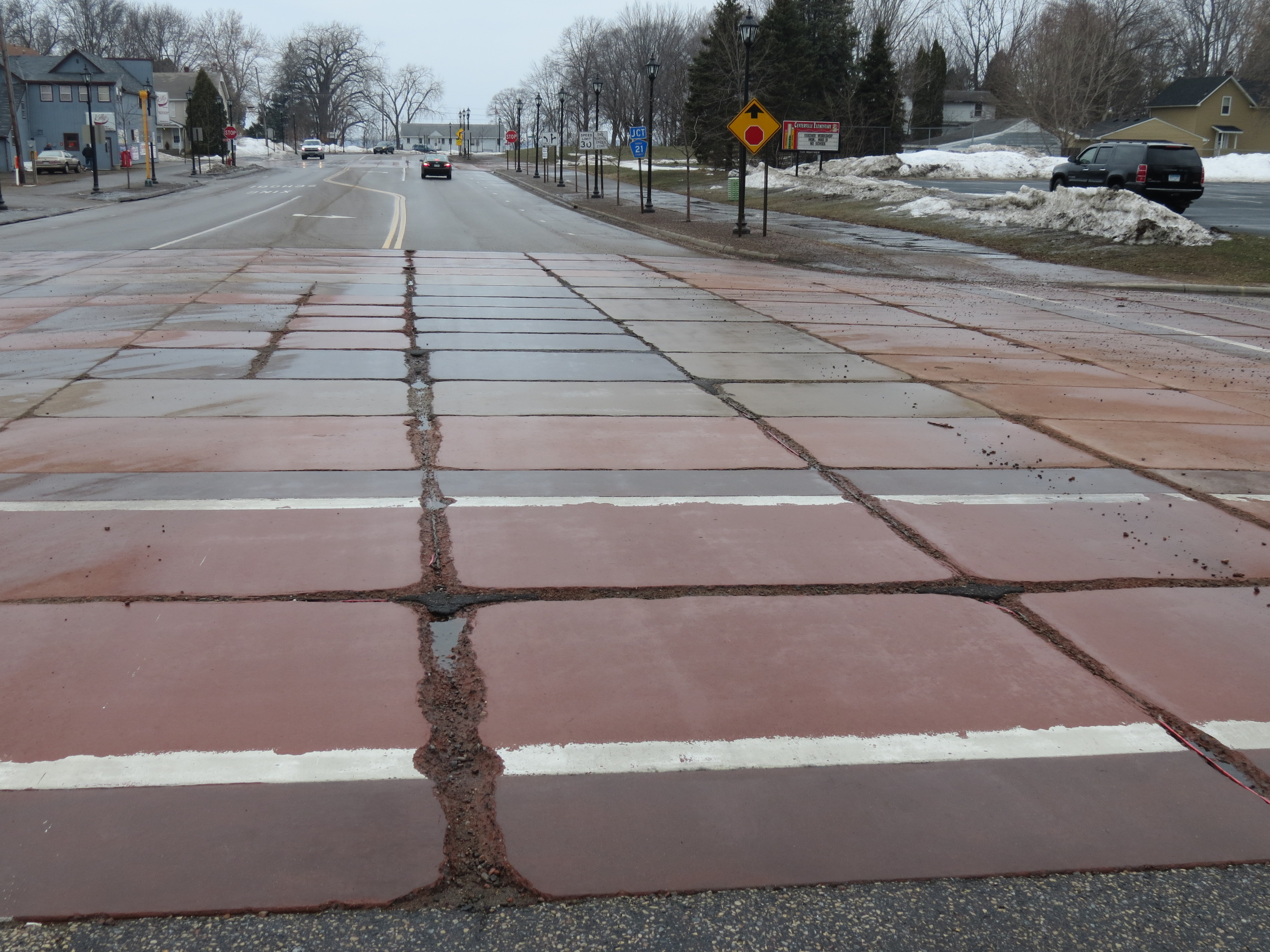
Early cracking has prompted the city of Vadnais Heights to tear up its colored concrete, and the city of Centerville — which installed colored concrete only six years ago — plans to follow suit, said MnDOT’s Senior Road Research Engineer Tom Burnham.

Both cities participated in a recent study, sponsored by the Local Road Research Board and conducted by MnDOT, to determine what is causing the early deterioration.

Across Minnesota, many of the estimated 45 colored concrete projects have experienced early deterioration, particularly microcracking near contraction joints. While this type of distress also occurs with regular concrete, it appears to be accelerated in the colored concrete projects, within five years in some instances.

Although the newly released study identifies likely causes for the failing colored concrete, further research is needed to evaluate proposed solutions.

Findings

Researchers determined that the colored concrete mixtures have likely been too porous for Minnesota winters, allowing deicing chemicals to leach in and wreak havoc. Although not quite as problematic for sidewalks and medians — which aren’t salted as heavily — it is especially bad for colored crosswalks.

A denser concrete mixture (one formed with less water) is recommended; however, constructing the concrete panels this way will require extra steps.

“There are chemicals that can be added to the mixture to artificially lower that water-to-concrete ratio,” Burnham said. “This will allow a  denser mixture to be more easily placed.”

The city of Centerville plans to tear up its colored concrete. This photo shows early joint deterioration.
Color in vogue

Although there was a spate of colored concrete construction in Ramsey County in the late 1990s, it has only come into fashion in the rest of the state within the last five to six years, according to Burnham.

“You go to almost any community and they’re installing it — on their sidewalk and medians and also crosswalks,” said Burnham, who coordinated the research study.

Because of the added expense, cities may be very disappointed in the results.

The city of Stillwater, which installed a colored concrete panel crosswalk on its main street just two years ago (see top photo), is already experiencing cracking and deterioration in several panels.

Possible remedies

Although reducing the porosity of the colored concrete mixture should help,  it won’t solve everything.

Another issue is the curing. The typical white curing product can’t be applied like it is with standard concrete, so curing the colored panels is more challenging, Burnham explained.

There are possible remedies, however, to assist with the curing, such as wet burlap or curing blankets.

Adding complexity to the issue are the new deicing chemicals on the market, which are also impacting regular road materials.

Several test samples showed evidence of chemical attack of the cement paste and fine aggregates, as well as an alkali-silica reaction, which can cause cracking or spalling and isn’t normally seen in regular concrete.

“Is there anything unique with the coloring that would accelerate the observed chemical reactions? We didn’t feel we had enough samples and knowledge at this point to conclusively say,” Burnham said.

Different construction techniques could go a long way toward increasing the livelihood of colored concrete; however, it could take several years of observation to determine if other methods work.

MnROAD is considering adding colored concrete panels to its facility for testing.

Until more questions are answered, MnDOT researchers are recommending repair techniques and alternative streetscaping ideas to cities, such concrete stains, pavers or colored high friction surface treatments.

In addition to sharing the findings with cities and counties, Burnham wants to educate contractors.

“We hope this research is a wake-up call for the colored concrete industry too because we don’t want the industry to die in Minnesota,” he said. “If it can work, we want cities and counties to be able to use it.”

*Editor’s Note: This story was updated 09/04/2014 to specify that this research project was funded entirely by the Local Road Research Board, and that MnDOT conducted the research.

Related Resources
  • Investigation and Assessment of Colored Concrete Pavement — Final Report (PDF, 20 MB, 368 pages); Technical Summary (forthcoming)

Parking availability system takes aim at truck driver fatigue

MnDOT, in partnership with the Federal Highway Administration, is test-deploying a high-tech system to help combat drowsy driving and keep truck drivers in compliance with federal hours-of-service regulations.

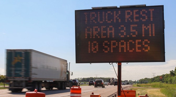
Developed by researchers at the University of Minnesota, the prototype system lets  drivers know when parking spaces are available at rest stops ahead. It has been deployed at several locations along the heavily traveled I-94 corridor between Minneapolis and St. Cloud.

From today’s MnDOT news release:

ST. PAUL, Minn. – New technology along the I-94 corridor west and northwest of the Twin Cities is helping truckers find safe places to park. Three Minnesota Department of Transportation rest areas are now equipped with automated truck stop management systems that tell truck drivers when parking spaces are available.

The technology will improve safety, lead to better trip and operations management by drivers and carriers and help MnDOT and private truck stop owners manage their facilities more effectively, according to John Tompkins, MnDOT project manager.

“So far, the results have been positive. We’ve had 95 percent accuracy in determining the availability of spaces,” he said.

Federal hours of service rules require truck drivers to stop and rest after 11 hours of driving. Tompkins said if drivers continue to drive beyond 11 hours, they could become fatigued and be forced to park in unsafe locations such as freeway ramps. They could also face legal penalties.

The problem of truck driver fatigue recently took the national spotlight when an allegedly drowsy driver slammed his semitrailer into a limousine carrying actor-comedian Tracy Morgan and six others. One passenger died in the crash.

The parking availability project is led by MnDOT Freight Project Manager John Tompkins and University of Minnesota professor Nikolaos Papanikolopoulos. MnDOT Research Services & Library produced the video above, which demonstrates the system in action. You can learn more about the project on the Center for Transportation Studies website.

Five Innovative Ways to Make Bicyclists and Pedestrians Safer

Last year, 41 people were killed while walking or biking on Minnesota roads and nearly 1,700 were injured.

Dozens of measures are available, however, for making roads safer for pedestrians and cyclists. Minnesota Department of Transportation Pedestrian and Bicycle Safety Engineer Melissa Barnes reviewed some of these design techniques in a recent presentation to city and state transportation engineers. (Watch the full webinar.)

We asked Barnes to highlight her favorite bike and pedestrian safety countermeasures used in Minnesota.

Rectangular Rapid Flashing Beacon RRFB

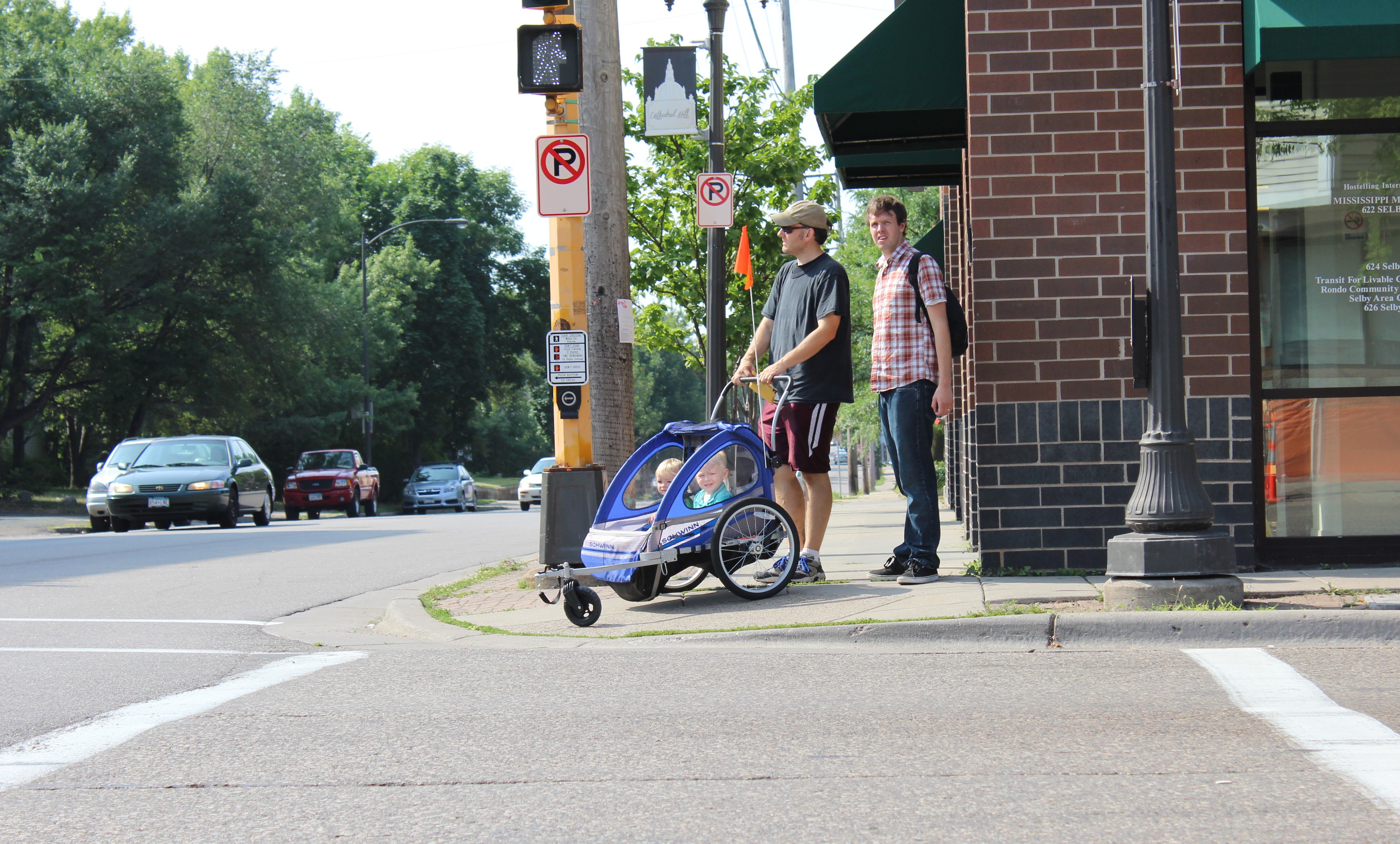
An unusually effective new pedestrian warning device, called the Rectangular Rapid Flashing Beacon, has become quite popular.

User-activated, the device alerts drivers to a pedestrian’s presence with a bright flashing beacon that “looks kind of like an ambulance or fire truck light,” Barnes said. (RRFBs can also be activated passively by a pedestrian’s presence.)

Studies have shown that the number of motorists stopping for pedestrians increases from 18 to 81 percent with the RRFB. Another plus: the device doesn’t appear to lose its effectiveness over time. After two years, compliance has been shown to still be more than 80 percent.

Advanced Stop Lines

It’s not uncommon for a motorist to stop for someone in a crosswalk, only for the vehicle following them to not see the pedestrian and veer around, driving through the crosswalk.

But an advanced stop line, placed 20 to 50 feet prior to a crosswalk, is effective at making both vehicles stop and see the person in the crosswalk.

“They are a really good option at an unsignalized, mid-block crossing,” said Barnes, although the stop line may not be a good option for a two-way stop.

Advanced stop lines have been shown to reduce pedestrian-vehicle conflict up to 90 percent; however, stop lines shouldn’t be placed too far in advance of the crossing, because motorists might then ignore them.

Leading Protected Interval

An innovative treatment called the Leading Protected Interval minimizes conflict by allowing pedestrians to enter a signalized intersection before vehicles do.

The walk signal begins three to seven seconds before the parallel street turns green by extending the time all lights are red.

A right turn on red can be prohibited with this device; however, even without the prohibition, the Leading Protected Interval has been shown to reduce crashes by 5 percent.

Protected Bike Lanes

Protected Bike Lanes

Bike lanes buffered from  traffic with some sort of physical barrier, even parked cars, will reduce all types of crashes. They also increase comfort levels for cyclists, helping keep bikes off the sidewalk.

“A lot of people are much more comfortable biking in these than a regular bike lane,” Barnes said. “It can be a very effective solution for places with lots of cyclists.”

Protected bike lanes, also called cycle tracks, also have a traffic-calming effect.

In New York City, the cycle track reduced all types of crashes an average of 40 percent and up to 80 percent on some roads.

“The challenge is how to design these at intersections,” Barns said. “It’s hard to get the turns right and get everybody visible. It’s pretty important to design these carefully at intersections.”

For those reasons, two-way cycle tracks work best on one-way streets, she said.

Flexible Bollards
Flexiblebollard
Photo courtesy of Reliance Foundry

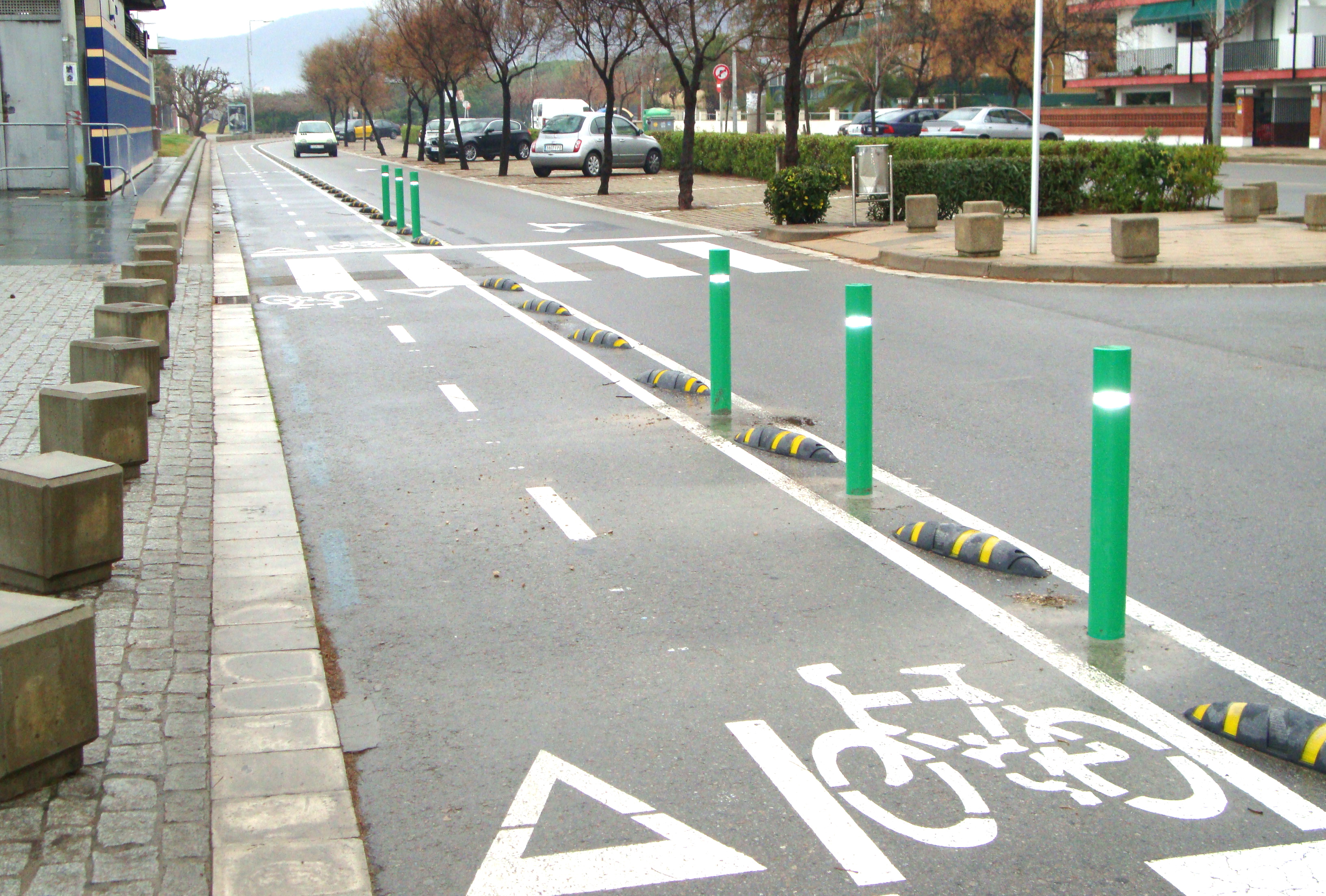
Flexible bollards create temporary curb lines that encourage vehicles to slow down. They can be installed easily and inexpensively.

Flexible bollards bend up to 90 degrees when struck by an errant vehicle. They do not physically stop a car, but encourage vehicles to stay within their lane. Although they can create additional maintenance, they are a good interim solution at locations that need an immediate fix, but have no funding to do so.

Unmanned aircraft systems create buzz of activity, but challenges remain

In late 2013, Amazon.com announced that it plans to someday use unmanned aircraft systems (UASs) to deliver packages. Amazon is not alone in considering these systems—the list of potential uses for this technology is rapidly expanding. Where is this technology headed, and what does it mean for the region, and for transportation?

State and national experts discussed these issues at an April 30 forum hosted by the Airport Technical Assistance Program (AirTAP), a part of CTS.

Often referred to as drones, modern UASs can be used for a broad range of activities, from aerial photography, surveying, precision agriculture, and communications to disaster response, wildlife research, and infrastructure protection.

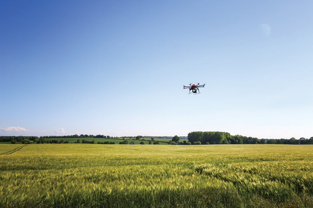
Potential uses of UASs include precision agriculture.

A hurdle to broader use is the lack of rules and regulations. Last November the Federal Aviation Administration (FAA) released its first annual roadmap outlining policies, regulations, technologies, and procedures needed to safely integrate UASs into U.S. airspace; it plans to issue regulations by 2015.

“The greatest challenge is integrating UASs into the National Airspace System,” said Brigadier General Alan Palmer, director of the Center for UAS Research, Education, and Training at the University of North Dakota. “We want to do this safely, we want to do no harm, and we want to be sure not to violate somebody’s personal space. We do not have any regulations for standards, training, certification, or anything like them. But we will get there.”

Other concerns include privacy issues and the existing aviation/navigation infrastructure, which did not account for a future including UASs when it was built 50 years ago.

To learn more about the forum, read the full article in the June issue of Catalyst. In addition, a proceedings from the event will be available on the AirTAP website this summer.