
Tag Archives: transportation


Software Tool Cuts Time to Analyze Twin Cities Congestion
Newly developed software has drastically reduced the amount of time and effort required by MnDOT’s Regional Transportation Management Center (RTMC) to analyze congestion in the Twin Cities metropolitan area.
Developing MnDOT’s annual Metropolitan Freeway System Congestion Report used to be a manual process that could be applied to only a portion of the large quantity of data generated by in-pavement sensors.
The new Highway Automated Reporting Tool now automatically imports and cleans data to produce a report about the percentage of network miles congested during peak periods as well as three new reports on other performance measures.
The tool will help MnDOT engineers and planners better develop congestion reduction strategies and determine the most cost-effective investments in the network.
From RTMC’s control room, engineers monitor and manage 400 miles of Twin Cities freeway traffic using data from thousands of in-pavement sensors.
“Before HART, it took months to analyze freeway performance using traffic data from only the month of October. Now engineers can quickly analyze data from any time period, significantly improving traffic planning,” said Jesse Larson, Assistant Freeway Operations Engineer for MnDOT’s Metro District Regional Transportation Management Center.
The tool was developed in a MnDOT-funded study led by University of Minnesota researcher John Hourdos.
Note: This article was adapted from the May–June 2014 issue of our Accelerator newsletter. Sign up for your free print or email subscription by clicking here.
Resources
- Technical Summary (PDF, 1 MB, 2 pages)
- Final Report (PDF, 14 MB, 106 pages)
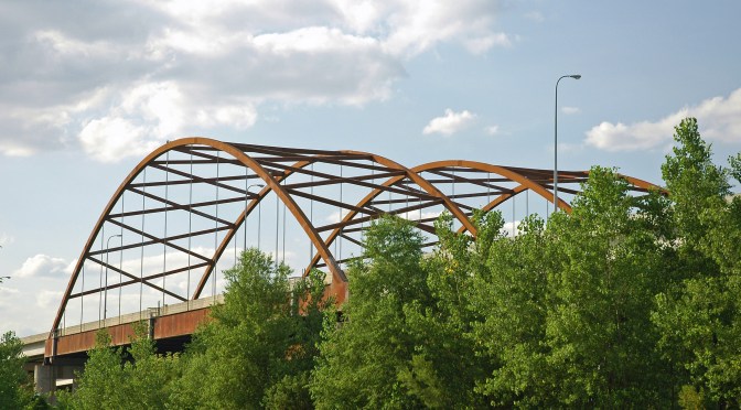
New monitoring system gives advance warning of bridge distress
While not inherently unsafe, MnDOT’s fracture-critical bridges — those having critical, nonredundant components — must be inspected on a regular basis. To help track the health of these bridges, MnDOT has developed a bridge health monitoring system that uses electronic instrumentation to provide advance warning of structural distress.
The system detects acoustic emissions — stress waves caused when cracks form and propagate in the steel components of a bridge. Researchers recently deployed and tested the system on the Cedar Avenue/Highway 77 Bridge in Burnsville, enabling them to develop procedures for automatically collecting and processing data.
“Ever since the collapse of the I-35W bridge in Minnesota, many states have been interested in developing a bridge health monitoring system that will help engineers address the many challenges of managing infrastructure and ensure the longevity and safety of our bridges,” said Moises Dimaculangan, MnDOT bridge rating engineer.
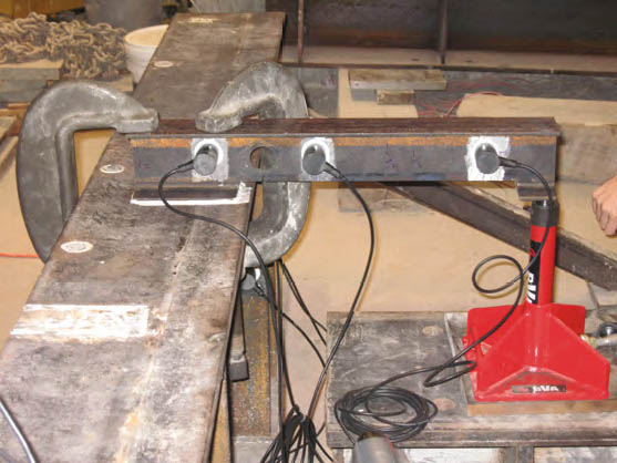
MnDOT will continue to use the system to monitor the Cedar Avenue Bridge, a steel tier-arched bridge over the Minnesota River. It was chosen because it is fracture-critical, but has no history of cracking. The test deployment also led to guidelines for monitoring other fracture-critical bridges.
University of Minnesota researchers recommend further investigation into acoustic emission data analysis methods, as well as using the system developed in this project to monitor another steel bridge, one with a history of cracking.
*Note: This article was adapted from the upcoming May–June 2014 issue of our Accelerator newsletter. Sign up today to receive your free print edition or to receive email notification when new issues become available online. Subscribe here.
Resources
Acoustic Emmission Monitoring of Fracture-Critical Steel Bridges – Technical Summary (PDF, 1 MB, 2 pages); Final Report (PDF, 5 MB, 236 pages)

Bicycle and pedestrian-counting project wins CTS partnership award
(Feature image courtesy Michael McCarthy, Center for Transportation Studies.)
Earlier this year, we wrote about the Minnesota Bicycle and Pedestrian Counting Initiative, a project that developed guidelines and protocols to help transportation planners accurately count non-motorized traffic. This groundbreaking research involved a diverse partnership of state and local officials, University of Minnesota faculty, and private and nonprofit organizations.
On Wednesday, April 23, the project team (photo above) was honored with an award from the Center for Transportation Studies. Team members accepted the CTS Research Partnership Award in a ceremony at the McNamara Alumni Center in Minneapolis. The award is given each year to projects that have resulted in “significant impacts on transportation” and that draw on “the strengths of their diverse partnerships” to achieve their results.
The video below, produced by CTS, explains the importance of the project. MnDOT is now in the process of implementing the research results by installing permanent counters and using portable counters in select locations around the state. MnDOT plans to use the information for a variety of purposes, including planning, safety analysis, investment planning and quality-of-life analysis.
Project team members will present their research findings at the North American Travel Monitoring Exposition and Conference in July. The conference’s focus is on “Improving Traffic Data Collection, Analysis, and Use.”
*Bonus: Read about last year’s Research Partnership Award-winner, a MnDOT-led, multi-state effort to reduce low-temperature cracking in asphalt pavements.
Learn more about the project:
- Technical Summary (PDF)
- Final Report (PDF)

Video: 3D Technology Enhances Underwater Bridge Inspection
A new technology that uses 3D-imaging sonar will enable MnDOT engineers to visualize the substructure of a bridge in a way they never have before.
Until now, MnDOT has relied on human divers and depth finders to identify problems beneath the water.
Divers are limited by what they can see and feel in murky waters, however, and depth finders can only look down, not around.
“With this new technology, we will be able to provide high resolution three-dimensional images of underwater areas, structures and objects to show what is occurring, regardless of water clarity,” said MnDOT Bridge Waterway Engineer Petra DeWall, who has received funding from MnDOT’s Transportation Research Innovation Group to purchase the equipment.
Video imagery from a sonar inspection of Minneapolis’ Third Avenue bridge is above.
Currently, MnDOT hires engineer divers to physically inspect about 500 bridges every five years. They look for cracked concrete, exposed reinforcement and other detrimental conditions.
Although divers can spot issues, they can’t always thoroughly assess the scope of a problem, such as the amount of sediment being washed out around a bridge pier, a problem called bridge scour.
It can also be difficult — or dangerous — for divers to venture down for an inspection.
This was the situation last winter with the Third Avenue Bridge in downtown Minneapolis, where the streambed has degraded around a bridge pier, causing erosion to the pier.
“The Third Avenue inspection was not totally detailed. We knew there was a void under the bridge, but it was very hard to visualize,” DeWall said.
Early ice build-up halted further inspection in November, so MnDOT asked 3D sonar scanner manufacturer Teledyne BlueView to scan the area as a demonstration of its equipment.
A video of the inspection is below:
Multiple holes were cut in the ice sheet to deploy the sonar, which provided an image of the bridge scour by emitting sound-waves that created a point cloud.
“It gives you a large data set of where the sound reaches and comes back to the equipment,” DeWall explained.
The 3D image provides a level of detail that will enable repair and construction contractors to make more accurate bids, saving MnDOT money on projects.
Although dive inspectors are also beginning to invest in this new technology, MnDOT wants its own equipment to perform quick assessments of troublesome spots without going through the lengthy contracting process.
The Federal Highway Administration is conducting a pooled fund study to see if the technology eliminates the need for dive inspectors all-together.
MnDOT also plans to use its 3D scanning sonar to inspect repair projects and assess bridge construction.
One of DeWall’s first goals is to take a scan of the Hastings bridge after construction is complete, which will provide a baseline scan that can be compared against future inspections. The old bridge has had problems with the loss of rocks at its piers. It is unclear if the rock just sinks or is washed away downstream. Monitoring will let MnDOT see what is happening over time.
“Inspection is just one part of it,” DeWall said of the sonar equipment. “The big interest in this project is coming from our construction folks.”
Post-Construction
Imagine building a new house and not being able to complete the final walk-through.
This is the situation that transportation departments face when they build a new bridge, due to the limitations of underwater inspections.
“With 3D technology, you can go back afterward and check to make sure things were done the way they were supposed to,” DeWall said.
DeWall wishes the state had the scanner many years ago when a bridge was built that required expensive correction.
A bridge construction crew left construction material behind under the water, which wasn’t discovered until the redirected water flow caused significant erosion to the bridge pier.
Divers picked up that something was going on during a routine inspection, but engineers still had to bring in depth finders to get a better look. Due to the water current, they were limited in how close they could get to the bridge pier, and turbulence crashed their boat against the pier, damaging the transducer.
Not only would this 3D technology have provided a more thorough assessment than the depth finder, it also could have captured the imagery from a safe distance away.

Minnesota Bike Lanes: Learning to Share the Road

Video: How to Navigate a Multi-Lane Roundabout

Culvert research aims to protect endangered small fish

(Photo courtesy of the Minnesota Department of Natural Resources)
In a new study funded by the Minnesota Department of Transportation, engineers are trying to ensure that new culverts do not degrade the habitat of an endangered fish in southern Minnesota.
The state has already researched how to better accommodate fish passage at river and stream crossings. Now it is looking at design guidelines for culverts that specifically impact the Topeka shiner, a small endangered fish found in five Midwestern states.
In Minnesota, the Topeka shiner is known to live in at least 57 streams, totaling 605 miles, within the Big Sioux and Rock River watersheds.
“The Topeka shiner is reported to have been erased from about 50 percent of its historic range in Iowa and much of its range in Minnesota, which is why Minnesota is so intent on doing what it can to help this fish thrive here,” said Alan Rindels, MnDOT’s project coordinator for the research.
The Topeka shiner is endangered due to the degradation of stream habitat, stream channelization, non-native predatory fishes and construction within waterways.
Culverts might impede the passage of this small minnow for a number of reasons, including that they might be too long, lack sufficient depth or carry water too fast.

In addition, long culverts block sunlight, which possibly discourages fish from swimming through. Typically, older culverts are replaced with longer culverts to improve road safety and minimize maintenance costs. To eliminate or minimize impacts to the Topeka shiner, the state is trying to determine if light mitigation strategies are necessary.
Researchers from the University of Minnesota’s St. Anthony Falls Research Laboratory will monitor a newly installed culvert (110 feet in length) and a few other culverts in critical Topeka shiner habitat streams during spawning and fall movement.
Additionally, a laboratory-based light manipulation experiment will examine the behavior of the warm-water fish when presented with a dark culvert.
Guidelines for culvert design in Topeka shiner habitat will be developed based on these results, as well as examples from neighboring states. The state is also collaborating with the U.S. Fish and Wildlife Service and affected Minnesota counties.
- Current research: Culvert Length and Interior Lighting Impacts to Topeka Shiner Passage (PDF, 271 KB, 1 page)
- Previous report: Accommodating Fish Passage at River Crossings (PDF, 781 KB, 2 page)
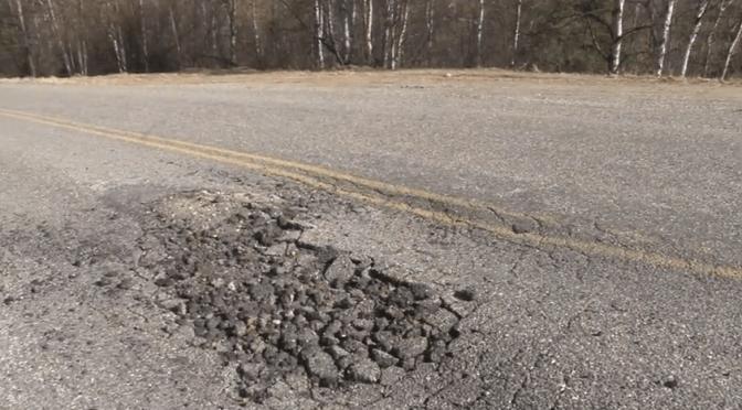
New videos show how frost heave ravages roads
Regardless of whether you’re familiar with the term “frost heave,” if you live in Minnesota and drive on the roads, you’re already familiar with its destructive capacity. Many of the dips, bumps, potholes and cracks that appear on our roads every spring are a direct result of frost heave, which occurs when water accumulates in the soil beneath the pavement and begins freezing and then thawing along with the changing seasons. The resulting expansion and contraction weakens the road base and leaves it susceptible to damage from traffic loading.
These new videos produced by the Local Road Research Board explain how frost heave works, and describe some of the strategies public works departments use to combat it. The top video is is the shortened, executive-summary version, while the bottom video is the full, 13-minute version meant for transportation professionals.
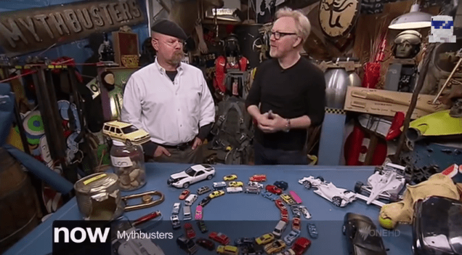
Friday fun: Mythbusters pits roundabouts against four-way stop intersections
Transportation research comes in many different forms and methodologies…
 Crossroads