A revised handbook offers Minnesota cities and counties the latest tips on how to meet new sign retroreflectivity requirements, as well as the 411 on sign maintenance and management – everything from knowing when it’s time to remove a sign to creating a budget for sign replacement.
The best practices guide – produced in conjunction with a new sign retroreflectivity study – also offers case studies from around the state.
“The life cycle of traffic signs, from installation to replacement, is a pretty complex issue and it can be a challenge to get your arms around,” said Tim Plath, Transportation Operations Engineer for the city of Eagan. “This handbook really boils it down into some basic concepts and also gives you the resources to dig deeper if necessary. It’s a good resource to have at your fingertips.”
This handbook updates a previous version issued in 2010, to include new FHWA retroreflectivity and maintenance and management requirements and deadlines.
“Maintenance/management of a large number of signs can potentially be an administrative and financial challenge for many local road authorities,” explained Sulmaan Khan, MnDOT Assistant Project Development Engineer.
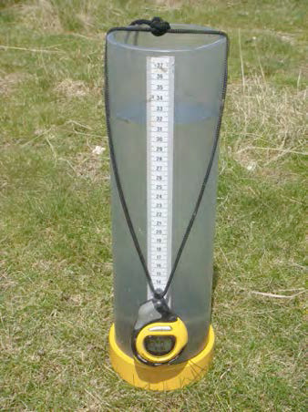
Here’s a video demonstration of a sign life reflectometer (the Gamma 922), another resource MnDOT has available for local government agencies. Cities, townships or counties may borrow the reflectomer by contacting the Office of Materials and Road Research, (651) 366-5508.
Stormwater can pick up chemicals and sediments that pollute rivers and streams. Roadside drainage ditches, also known as swales, lessen this effect by absorbing water. But until recently, MnDOT didn’t know how to quantify this effect and incorporate it into pollution control mitigation measures.
In a recently completed study, researchers evaluated five Minnesota swales, measuring how well water flows through soil at up to 20 locations within each swale.
“There’s a big push in Minnesota, and probably everywhere, to do more infiltration,” Barbara Loida, MS4 Coordinator Engineer, MnDOT Metro District, said. “We know that our ditches are doing some of that, but we wanted to look at how much infiltration these ditches are providing.”
A key finding: grassed swales are significantly better at absorbing water than expected, which may reduce the need for other, more expensive stormwater management practices, such as ponds or infiltration basins.
This could save MnDOT and counties significant right-of-way and construction costs currently expended on more expensive stormwater management techniques. While swales were recognized in the Minnesota Pollution Control Agency’s new Minimal Impact Design Standards, there was a need to quantify the amount of water a swale can absorb so it could receive the appropriate MIDS credits.
Researchers also tested the ability of carbon, iron chips, steel wool and other materials to remove pollutants as ditch check filters—material put into swales to enhance removal of pollutants.
Gradations on a Modified Philip Dunne infiltrometer allow the measurement of stormwater infiltration.
What’s Next?
A follow-up project, which the MPCA is participating in, will seek to clarify the impact of swale roughness on infiltration rates. The goal is a calculator for real-world infiltration rates that MnDOT and local agencies would be able to implement.
MPCA, MnDOT and the city of Roseville are also partnering on a project to install and test the effectiveness of ditch check filters in real-world locations.
Maintenance recommendations should help MnDOT and local agencies ensure that swales operate at maximum efficiency. These recommendations should continue to be revised as knowledge evolves.
There’s nothing like colored concrete to make a crosswalk, sidewalk or breezeway look snazzy.
But the extra touch that many cities are putting into their downtown streetscapes may not be so pretty in just a few short years.
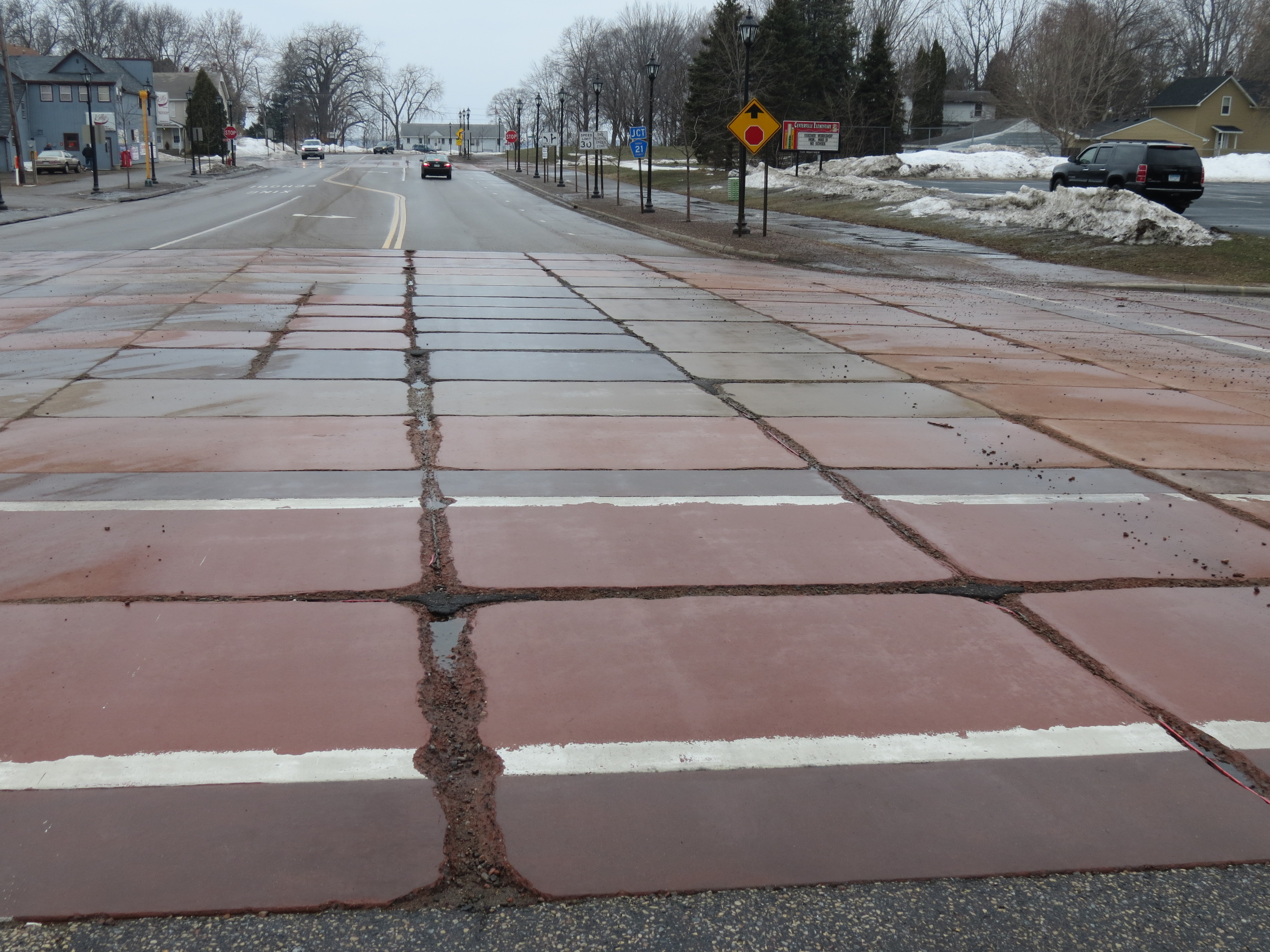
Early cracking has prompted the city of Vadnais Heights to tear up its colored concrete, and the city of Centerville — which installed colored concrete only six years ago — plans to follow suit, said MnDOT’s Senior Road Research Engineer Tom Burnham.
Both cities participated in a recent study, sponsored by the Local Road Research Board and conducted by MnDOT, to determine what is causing the early deterioration.
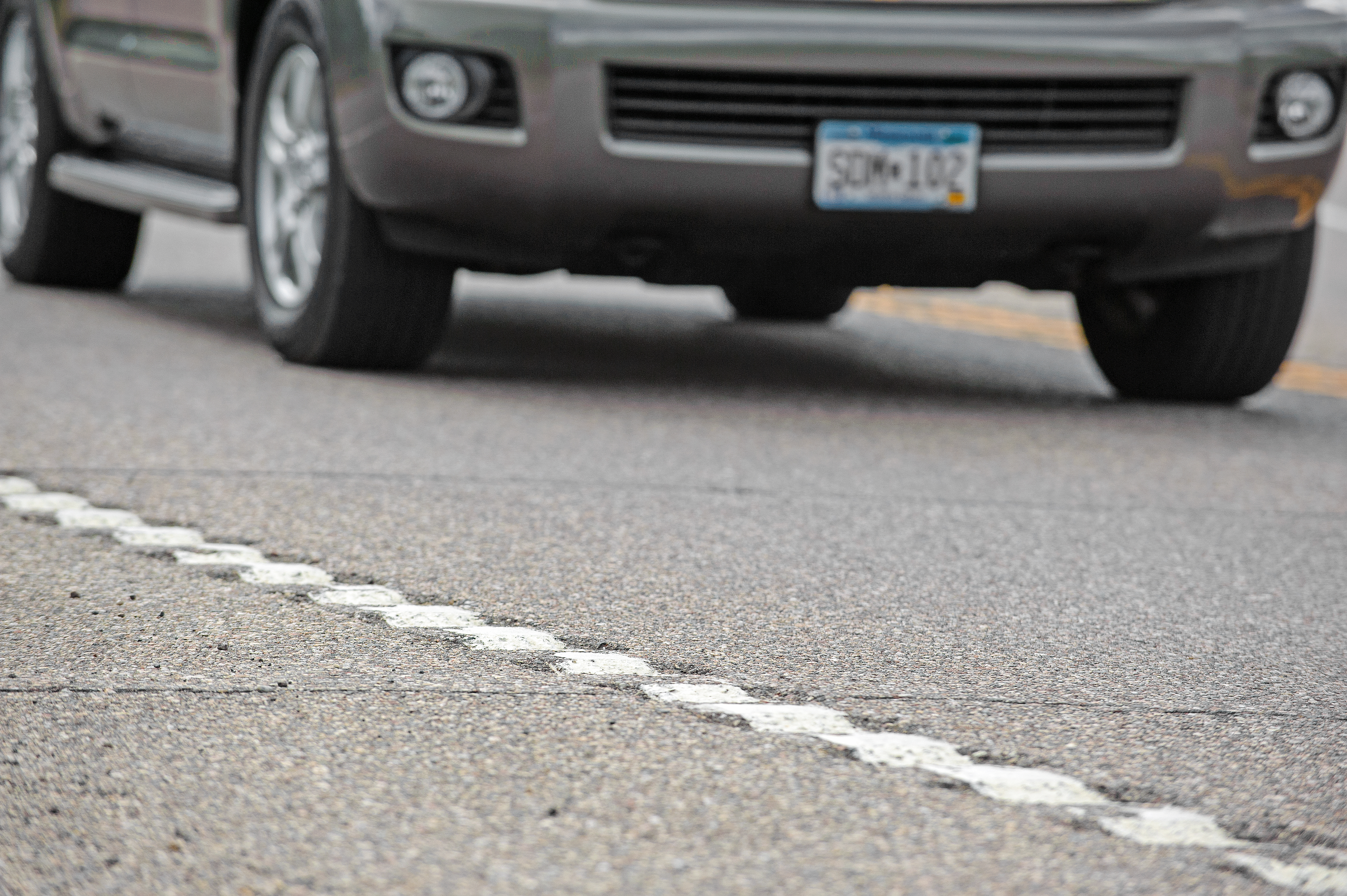
Across Minnesota, many of the estimated 45 colored concrete projects have experienced early deterioration, particularly microcracking near contraction joints. While this type of distress also occurs with regular concrete, it appears to be accelerated in the colored concrete projects, within five years in some instances.
Although the newly released study identifies likely causes for the failing colored concrete, further research is needed to evaluate proposed solutions.
Findings
Researchers determined that the colored concrete mixtures have likely been too porous for Minnesota winters, allowing deicing chemicals to leach in and wreak havoc. Although not quite as problematic for sidewalks and medians — which aren’t salted as heavily — it is especially bad for colored crosswalks.
A denser concrete mixture (one formed with less water) is recommended; however, constructing the concrete panels this way will require extra steps.
“There are chemicals that can be added to the mixture to artificially lower that water-to-concrete ratio,” Burnham said. “This will allow a denser mixture to be more easily placed.”
The city of Centerville plans to tear up its colored concrete. This photo shows early joint deterioration.
Color in vogue
Although there was a spate of colored concrete construction in Ramsey County in the late 1990s, it has only come into fashion in the rest of the state within the last five to six years, according to Burnham.
“You go to almost any community and they’re installing it — on their sidewalk and medians and also crosswalks,” said Burnham, who coordinated the research study.
Because of the added expense, cities may be very disappointed in the results.
The city of Stillwater, which installed a colored concrete panel crosswalk on its main street just two years ago (see top photo), is already experiencing cracking and deterioration in several panels.
Possible remedies
Although reducing the porosity of the colored concrete mixture should help, it won’t solve everything.
Another issue is the curing. The typical white curing product can’t be applied like it is with standard concrete, so curing the colored panels is more challenging, Burnham explained.
There are possible remedies, however, to assist with the curing, such as wet burlap or curing blankets.
Adding complexity to the issue are the new deicing chemicals on the market, which are also impacting regular road materials.
Several test samples showed evidence of chemical attack of the cement paste and fine aggregates, as well as an alkali-silica reaction, which can cause cracking or spalling and isn’t normally seen in regular concrete.
“Is there anything unique with the coloring that would accelerate the observed chemical reactions? We didn’t feel we had enough samples and knowledge at this point to conclusively say,” Burnham said.
Different construction techniques could go a long way toward increasing the livelihood of colored concrete; however, it could take several years of observation to determine if other methods work.
MnROAD is considering adding colored concrete panels to its facility for testing.
Until more questions are answered, MnDOT researchers are recommending repair techniques and alternative streetscaping ideas to cities, such concrete stains, pavers or colored high friction surface treatments.
In addition to sharing the findings with cities and counties, Burnham wants to educate contractors.
“We hope this research is a wake-up call for the colored concrete industry too because we don’t want the industry to die in Minnesota,” he said. “If it can work, we want cities and counties to be able to use it.”
*Editor’s Note: This story was updated 09/04/2014 to specify that this research project was funded entirely by the Local Road Research Board, and that MnDOT conducted the research.
Related Resources
Investigation and Assessment of Colored Concrete Pavement — Final Report (PDF, 20 MB, 368 pages); Technical Summary (forthcoming)
Have you ever dreamed that all of your tinkering, fussing, and fiddling in the shop and on the road could help improve every road in Minnesota? Do you need funding to improve your sign maintenance and installation process? Or maybe you’ve come up with an idea for a new tool for controlling roadside vegetation or a design for a more effective work-zone safety product. Whatever it is, the Local Operational Research Assistance (OPERA) Program wants to hear about it.
Funding for 2015 OPERA projects is now available, and it’s easy to submit a proposal. Simply fill out the brief proposal application (50 KB DOC) and submit it via e-mail to Mindy Carlson at Minnesota LTAP. There isn’t a deadline to submit your proposal, but FY15 funds are limited and they often go quickly.
The maximum funding per project is $10,000, and local agencies are welcome to submit more than one proposal.
Project Guidelines
Your proposed research project should focus on the timely development of relevant ideas or methods that improve transportation or maintenance operations. Our goal is to collect and disseminate homegrown, innovative solutions to the everyday challenges our transportation workforce faces on the job. Counties, cities, and townships, this is your opportunity to encourage your maintenance staff to become actively involved in researching and testing their ideas.
To see what other local agencies have done with OPERA funding, check out our fact sheets and annual reports, or watch these videos highlighting previous OPERA projects:
For the past 10 years, Minnesota and 37 other states have pooled their resources to test the effectiveness of roadway safety improvement strategies. The project, appropriately titled “Evaluation of Low-Cost Safety Improvements,” evaluates key strategies laid out in a national guidebook aimed at reducing the number of annual highway deaths.
Participating states say the project, which has now been extended a total of eight times beyond its original scope, has been a resounding success. MnDOT Safety Engineer Brad Estochen said the pooled-fund study has provided state DOTs much-needed evidence to gain support for implementing new safety improvements.
“Some states want to do a certain strategy, but don’t have the institutional support,” Estochen said. “Through the collaboration of the Peer Exchange, they have national results they can point to.”
We asked Estochen, MnDOT’s technical liaison for the pooled fund, to name his top strategies to come out of the study.
Traffic calming measures
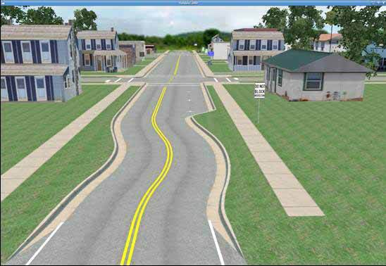
One phase of the study used simulated driving scenes to examine methods of traffic calming (i.e., getting drivers to slow down) in rural towns. The research found that drivers were most impacted by chicanes — extra curves in the road — and the presence of parked cars on the street. An alternative strategy, curb extensions (also called “bulb-outs”), was found to offer only a small potential safety benefit or no benefit at all.
Researchers also looked at ways of improving nighttime driver visibility on rural roads. Edge lines and post-mounted delineators were selected as the best alternatives for improving curve visibility at night, with curve detection improving 12 percent to 70 percent due to enhanced edge lines. The results are significant, since horizontal curve sections of two-lane rural roads are a major source of roadway fatalities.
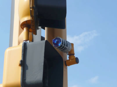
One way to make drivers aware that they’re approaching a stop sign is to add a flashing beacon to the intersection. Researchers installed various configurations of flashing beacons at more than 100 sites in North and South Carolina and examined the crash data before and after installation.
Courtesy of K-Kystems
Results indicate that standard flashing beacons, as well as some “actuated” beacons (i.e. those that only turn on when traffic is approaching the intersection), are not only effective at reducing crashes, but also economically justifiable based on cost-benefit calculations.This research helped pave the way for more widespread adoption of Minnesota’s Rural Intersection Conflict Warning Systems (RICWS).
Edgeline rumble strips on curves were shown to significantly improve safety in the third phase of the study, which tested a variety of techniques.
Whereas rumble strips are traditionally ground into centerline or on the shoulder, Kentucky and Florida experimented with placing rumble strips right along the white edgeline of curved sections of road. This method was shown to reduce overall crashes by 29 percent.
(Watch the FHWA website for updates on this phase of the study.)
Red light enforcement devices
In Florida, crashes due to people running the red light fell by 33 percent thanks to a small light that turns on when the signal turns red. This little light bulb, which is placed on top of a signal, allows for a police officer to sit at the other end of the intersection rather than pursue a car right through the intersection. Not only is it safer, but motorists are also more likely to obey the signal if they know police might be watching on the other side.
Researchers are also still collecting data on the other techniques studied in phase three, including surface friction treatments on curves and ramps and larger curve warning signs (called chevrons). Watch the FHWA website for updates.
Wider roads in rural areas
Could simply shifting the edge lines of a rural road reduce the number of accidental drive-offs?
Yes, according to this study, which evaluated the effectiveness of various lane-shoulder width configurations on rural, two-lane undivided roads using data from Pennsylvania and Washington.
In general, results were consistent with previous research, showing crash reductions for wider paved widths, lanes and shoulders. For specific lane-shoulder combinations, the study found a general safety benefit associated with wider lanes and narrower shoulders for a fixed pavement width; however, there are exceptions. The report has a chart that shows the optimal lane-shoulder combinations for different sizes of roads.
In theory, there should be no additional cost for these strategies, as an edgeline can be re-striped as part of an existing resurfacing project.
Soil carried away in stormwater runoff from road construction sites can pollute lakes and rivers.
Stormwater settling ponds provide a place for this sediment to settle before the water is discharged into local bodies of water. However, since stormwater ponds have limited space, a mechanism is needed to remove clean water from the pond to prevent the overflow of sediment-laden water.
MnDOT-funded researchers have designed temporary stormwater ponds with floating head skimmers that can remove clean water from the surface of the settling pond, using gravity to discharge water into a ditch or receiving body.
The Marlee Float from the SW Fee Saver is one of five available floating-head skimmers that researchers identified.
This is a new approach for MnDOT and Minnesota cities and counties, so research was needed to provide practical guidance for how to use these devices on construction sites.
“This was a small-scope implementation project for professionals to use as they design temporary stormwater ponds that meet state parameters,” said Dwayne Stenlund, MnDOT Erosion Control Engineering Specialist.
A new MnDOT study identifies five methods for “skimming” stormwater ponds that can improve a pond’s effectiveness by 10 percent. MnDOT researchers also created designs for temporary stormwater ponds on construction sites with the capacity to remove approximately 80 percent of suspended solids.
These designs will help contractors meet federal requirements for stormwater pond dewatering. Researchers also determined how often a pond’s deadpool must be cleaned, based on watershed size and pool dimensions.
“When sediment settles, it’s hard to determine when to clean out a pond. Based on the density of the sediments in the Minnesota River and the loading rates we computed, we were able to calculate how often we need to clean out a pond so sediment doesn’t reach the height of the skimmer,” said Joel Toso, principal of Wenck Associates and a consultant for the project.
Resources
Reducing Construction Pollution by Skimming Stormwater Ponds – Technical Summary (PDF, 2 MB, 2 pages); Final Report (PDF, 3 MB, 43 pages)
The only way to test pavements is to destroy them — slowly and painstakingly, one moving vehicle at a time. At MnROAD, the state’s world-renowned pavement research facility, the bulk of this monotonous-but-necessary work is performed by live traffic passing through Albertville on I-94. But on the facility’s 2.5-mile low volume road test track, which simulates rural road conditions, more controlled methods are preferred.
Doug Lindenfelser is one of several MnROAD employees who take turns driving an 80,000-pound semi tractor trailer in laps around the closed-loop low-volume track. The truck is loaded to the maximum allowable weight limit on Minnesota roadways. As it passes over the facility’s 23 distinct low-volume test cells, an array of sensors capture data on the pavement’s performance, which researchers then use to design stronger, longer-lasting roads. The truck only drives on the inside lane; that way, the outside lane can be used as an “environmental lane” to compare damage caused by loading vs. damage caused by environmental factors.
He has other duties as well, but on a given day, Doug might drive the truck 60 or 70 times around the low-volume road test track. It might not sound very exciting, but as Doug explains, some days his job can be quite interesting. We interviewed him on camera during a recent visit to MnROAD. The resulting video is available above and on our YouTube channel.
For those who might be wondering, all this diligent destruction of pavement has paid off. It is estimated that MnROAD’s first phase of research (from 1994-2006) has resulted in cost savings of $33 million each year in Minnesota and $749 million nationally. Cost savings from its second phase (2007-2015) are being calculated, and the facility is scheduled to enter its third phase in 2016.
As public works employees come and go, past research efforts — and the valuable knowledge gained — often goes with them.
But a recently launched web application allows users to track innovative pavement projects for a lifetime.
“It’s something everyone has always said we need to have,” said MnDOT Research Operations Engineer Jerry Geib, who worked on the project for the Minnesota Local Road Research Board.
Using an online map, city and county engineers can enter road test sections that they want to observe for many years due to a particular construction method or material that was used. Too often, the knowledge about such projects is lost when a particular staff person leaves an agency.
Not only will the lessons learned be remembered within the organization, but the results can also be shared with others.
More than 1,400 projects (including some on state roads) previously identified by MnDOT have been entered into the system. Search fields allow users to look for a particular type of project anywhere in the state or they can zero the map in on a particular area of the state.
The website is still in beta form, but functional.
“It’s complete, we just want people to use it so we can improve it,” said MnDOT Research Project Engineer Melissa Cole, who began planning the site two years ago.
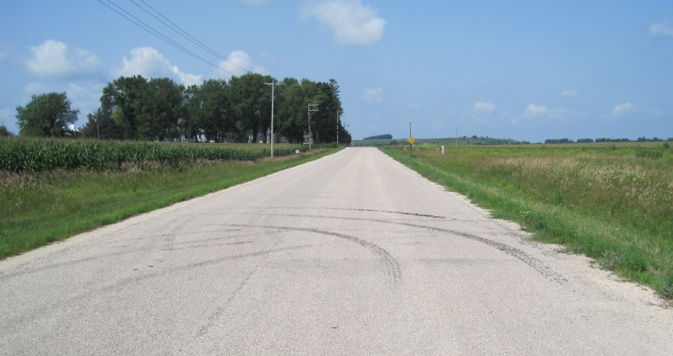
One featured project is a 1.8-mile section of dirt road in Wabasha County that had an Otta seal applied in 2007 (photo below). It is one of only a handful of lightly surfaced roads in the state (an improvement over a gravel road, but less expensive than asphalt ) so there is great interest in watching how it performs.
One of the projects being tracked is Wabasha County Road 73, one of only a handful of lightly surfaced (Otta seal) roads in the state.
More to come
The LRRB initiated the project in 2009, but it was put on the back burner for a while due to funding constraints. MnDOT ‘s technology staff began development of the current site about 11 months ago.
Anyone can look at the website, but cities and counties require permission to post projects (contact ResearchTracking.DOT@state.mn.us for credentials). They can upload photos, plans and weblinks relating to a particular project.
“We want to track anything that is worthy of looking at a few years from now,” Geib said.
Because the website uses Google maps, users can also view archived satellite and ground-level 360-degree imagery of the roads and bridges.
The website is viewable on a tablet, but it still must be tested on smart phones. Developers hope that crews will be able to submit information right from the field.
“We’re pretty happy with it,” said MnDOT software developer John Jones. “We think we’re headed in the right direction.”
The website might eventually be expanded for other areas, such as geotechnical (foundation work), whose practitioners have already expressed an interest.
A rumble strip applied to a center line on Highway 14 near New Ulm in 2004 is one of the projects being tracked.
Aging roads and bridges, increased traffic and persistently constrained revenues put local road systems in peril, but the public is largely unaware of the pressures facing their communities, a Minnesota Local Road Research Board study has found.
The LRRB undertook the study to identify critical gaps in public knowledge about local road system challenges and to develop communication methods and tools to address these shortfalls.
Researchers found that even elected officials are unaware of the gap in funding needed to keep the road system going — in part because county engineers have been creative in a period of dwindling resources, and the cost of deferred maintenance has not been immediately visible.
In fact, only one Minnesota news outlet specifically covered the issue of local road system sustainability in a five-year period analyzed by researchers, with media coverage focused mainly on big events, like the collapse of the 35W bridge and the federal transportation funding bill.
There are multiple challenges to road system sustainability, including rising construction costs, declining tax revenues, heavier agricultural and industrial equipment and rising public expectations.
In Beltrami County, researchers facilitated focus groups and round-table discussions regarding competing alternatives for revitalizing the county’s road system. (Photo by Guillermo Narvaez)
Education needed
To help county engineers better educate the public, researchers looked at outreach strategies (such as open houses and focus groups) currently used in three Minnesota counties: Beltrami, Dakota and Jackson. The research team talked with county road managers to identify key issues and concerns and surveyed 91 residents who had participated in public engagement efforts.
The project revealed widespread confusion about local road system issues. For example, many participants erroneously believed that the gas tax covers (or was enacted to cover) the cost of maintaining local roads.
Researchers have produced a set of recommendations and tools for county engineers to use in designing effective public engagement processes that overcome confusion and a lack of information. A newly approved follow-up project will test the tools in three or four other Minnesota counties and cities.
Note: This article was adapted from the July-August 2014 issue of our Accelerator newsletter. Sign up for your free print or email subscription by clicking here.
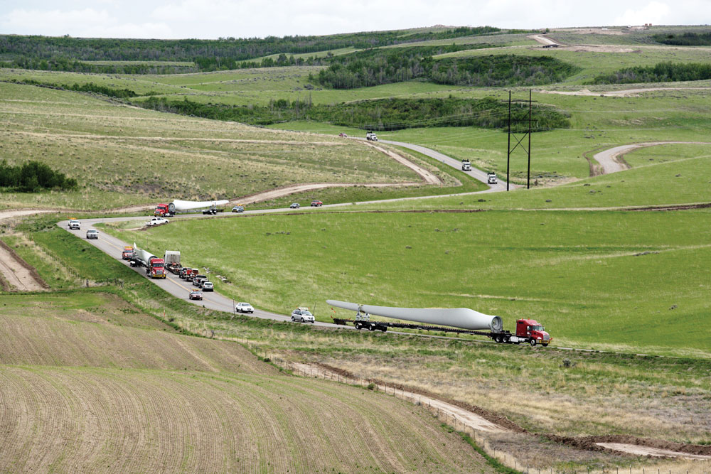
Minnesota farm equipment is getting larger and heavier, causing strain on rural bridges. However, there are no nationally recognized specifications for what size and weight of tractors can safely travel over them.
Currently, bridge load limits are based off semi-trucks, not farm machinery, which have much different axle configurations and wheel dimensions.
“Their geometry is atypical; their length, widths are different; they have different suspension characteristics,” explains Brent Phares, director of the Bridge Engineering Center at Iowa State University.
A new pooled fund study led by the state of Iowa is attempting to determine how much stress heavy farm vehicles put on bridges. This data will be used by local agencies to develop weight restrictions specifically for farm equipment.
“It will help limit the confusion of current load posting signs for farmers,” said MnDOT bridge load rating engineer Moises Dimaculangan.
Wisconsin, Minnesota, Nebraska, Oklahoma, Illinois, Kansas and the United States Department of Agriculture are also participating in the study, which is examining three types of local bridge superstructures: those with steel girders and concrete decks; bridges with steel girders and timber decks; and timber bridges with timber decks.
Through physical testing and modeling, the study will determine how different types of farm machinery distribute their loads on the bridge superstructure.
About a half-dozen farm vehicles were tested on 20 different bridges which were representative of those tending to be the most problematic for farm equipment traffic on secondary road systems, Phares said.
Instrumentation measured the response of the structures to the vehicles. This data was then used as a baseline to calibrate analytical models, which could be applied to 250 different bridges and 121 different farm vehicles.
Researchers will develop a generic tractor profile, which represents the worst-case scenario, for use in determining load limits. With the information developed, signs might be able to be added to the bridges, which show a tractor and the weight limit.
“I get a number of pictures emailed to me of bridges that have failed with a tractor implement of husbandry on top,” Phares said. “That’s the problem that people are looking to avoid; the goal isn’t to restrict the size of farm vehicles, but to develop better tools for engineers to make sound and solid analyses for the bridges, so they can provide that information to the people who need to have it.”
Phares said a couple previous studies have also looked at farm machinery weight restrictions. One study, from around 2004, took a high level look at the impact of farm vehicles on bridges. A more recent pooled fund study analyzed the impact of machinery on pavements.