Tag Archives: traffic & safety

New Project: Does lowering speed limits reduce driver speeds on urban streets?

In 2019, the Minnesota Legislature passed a law reducing barriers for cities to systematically lower speed limits. The City of St. Louis Park followed this guidance by reducing speed limits in 2021, but initial speed data collected before and 6–8 months after the changes showed little to no short‑term impact. Because driver behavior is habitual and may change slowly, advocates suggest that greater reductions in operating speeds may emerge over time, highlighting the need for repeat monitoring between 2025 and 2027.

This study aims to evaluate whether longer‑term changes have occurred 2–4 years after the initial reductions, while also examining other Minnesota agencies that have implemented or are considering reduced speed limits. The research will gather both measured and anecdotal data, assess “after” speed conditions where needed, and analyze how effectiveness varies based on roadway characteristics and any accompanying speed reduction countermeasures. These efforts address lingering questions about how speed limit changes influence driver behavior and roadway safety over time.

Understanding speed is critical because it directly affects the safety of all road users. According to Minnesota Motor Vehicle Crash Facts 2022, speeding was the leading cause of traffic fatalities, contributing to 130 of the state’s 444 deaths. By identifying agencies that have reduced speed limits, evaluating short‑ and long‑term impacts, and analyzing site‑specific factors, this research will produce guidance to help Minnesota road agencies assess and implement effective speed limit reductions.

“There is renewed interest in lower speed limits on municipal-type streets,” said Victor Lund, traffic engineer with St. Louis County’s Public Works Department. “The objective of this research is to better understand the intersection of speed limit policy, driver behavior and safety, which will result in guidance to better inform policies, practices and speed limits that support safer streets.”

The Objectives:

  1. Identify local agencies in Minnesota that have implemented reduced speed limits or may consider implementation along with any speed reduction countermeasures that have been implemented with the reduced speed limits.
  2. Evaluate the short-term and long-term effects of speed limit reductions implemented in Minnesota through the collection and analysis of speed data.
  3. Assess how these effects vary based on site characteristics or speed reduction countermeasures that were implemented in coordination with the reduced speed limit.
  4. Based on the findings, develop a summary document to aid Minnesota road agencies in assessing potential speed limit reductions.

Project Details:

  • Estimated Start Date: 06/25/2025
  • Estimated Completion Date: 06/30/2027
  • Funding: MnDOT and Local Road Research Board
  • Principal Investigator: Peter Savolainen
  • Co-Principal Investigators: Tim Gates
  • Technical Liaison: Victor Lund

Details of the research study work plan and timeline are subject to change.

To receive email updates about this project, visit MnDOT’s Office of Research & Innovation to subscribe.
New Project: User Understanding of Pedestrian Hybrid Beacon Operation

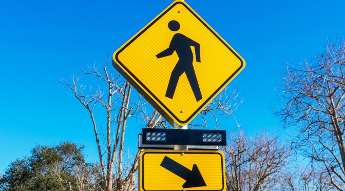
Pedestrian hybrid beacons (PHBs) are one tool to help pedestrians safely cross roads. PHBs provide red-signal control for vehicular traffic when needed at lower installation costs and reduced traffic delays than full traffic signals.

Continue reading New Project: User Understanding of Pedestrian Hybrid Beacon Operation

Evaluating the Traffic Safety Benefits of J-Turns in Minnesota

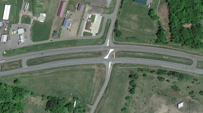
MnDOT traffic engineers are increasingly installing J-turn intersections on high-speed, multilane expressways to limit potential crash points. An analysis of crash data from intersections before and after the installation of J-turns demonstrated significant safety benefits from this alternative design. MnDOT researchers also explored crash history differences among J-turn intersections with varying characteristics. Consistent with the results from a previous study, this analysis found a clear decrease in fatal and other serious crashes after a J-turn was installed.

Continue reading Evaluating the Traffic Safety Benefits of J-Turns in Minnesota

A Mobile App to Report Driver Intrusions Into Work Zones

Transportation workers face critical safety risks when drivers fail to comply with traffic control instructions in work zones. These intrusions threaten not only the flaggers who are directing traffic, but all workers on the job site and the drivers themselves. Knowing the nature and frequency of intrusions is necessary to develop effective prevention strategies. A new mobile phone app enables workers to quickly and easily report incidents, allowing MnDOT to analyze risks and improve worker safety.

Continue reading A Mobile App to Report Driver Intrusions Into Work Zones

Guidance for Cities Considering Speed Limit Changes

The issue of reducing speed limits to increase public safety is an emotional, political, and controversial topic that has been debated by safety advocates, engineers, politicians, transportation officials, and the public for many years. A statutory change in 2019 put a spotlight on the topic, requiring a deeper look into how speed limits are established and the effectiveness that lowering speed limits has on reducing vehicle traveling speeds, as well as the impacts on pedestrian and bicycle traffic.

Continue reading Guidance for Cities Considering Speed Limit Changes

Impacts of Autonomous Vehicles on Operation and Maintenance of Minnesota Roads

As autonomous vehicle technology evolves, transportation agencies want to understand how road maintenance and traffic operations may also need to evolve. New research begins to identify potential needs and further questions for winter road maintenance, work zones and traffic flow.

Continue reading Impacts of Autonomous Vehicles on Operation and Maintenance of Minnesota Roads

Using Rumble Strips to Encourage Stops at Rural Intersections

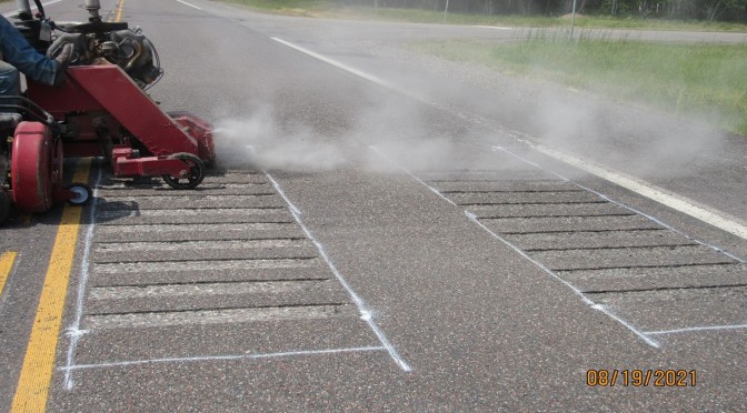
Vehicle crashes in rural areas often happen at intersections. Transverse rumble strips placed before a stop sign can be an effective safety measure that warns drivers approaching an intersection. Recent research has provided an increased understanding of the most effective rumble strip designs and noise characteristics to help county traffic engineers decide when and where to deploy the strips.

Continue reading Using Rumble Strips to Encourage Stops at Rural Intersections

New Project: Using Apps to Notify the Public of Local Road and Bridge Closures

The traveling public increasingly relies on navigation systems to get to their destinations. Currently, there is not a system, tool, or process being used by cities and counties in Minnesota to report road or bridge closures for use by transportation agencies to display to the traveling public or for use by third-party mapping/navigation companies (e.g., Waze, TomTom, HERE Technologies, Google Maps) to provide to the public.

This project will document up to three best practices for manual local road closure reporting, describe an approach that the Local Road Research Board could use to develop or implement an existing user-friendly road closure reporting system, and provide guidance on how to report closures to third-party mapping/navigation companies.

Objectives

MnDOT already operates and maintains a statewide traveler information reporting system known as CARS. This project will review and summarize the options and approach for adapting it for local road entry. As part of the study, researchers will:

  • Develop best practices for reporting systems by documenting four examples used in other states for establishing and operating tools to report local road closures.
  • Define three options for how to make a user-friendly system for local Minnesota agencies using the outcomes of the best practices summary.
  • Prepare users guide for entering information into existing mapping tools that will assist in understanding the process to submit road closures and mapping updates to established mapping/navigation providers.

Project Details

  • Estimated Start Date: 12/19/2022
  • Estimated Completion Date: 03/31/2024
  • Funding: Local Road Research Board
  • Principal Investigator: Dean Deeter
  • Technical Liaison:  Perry Clark

Details of the research study work plan and timeline are subject to change.

To receive email updates about this project, visit the Local Road Research Board to subscribe.