Tag Archives: Department of Transportation

Partnership planned for nation’s top pavement testing facilities

The nation’s two largest pavement testing centers are planning to partner in order to better leverage research performed at their cold and hot-weather facilities.

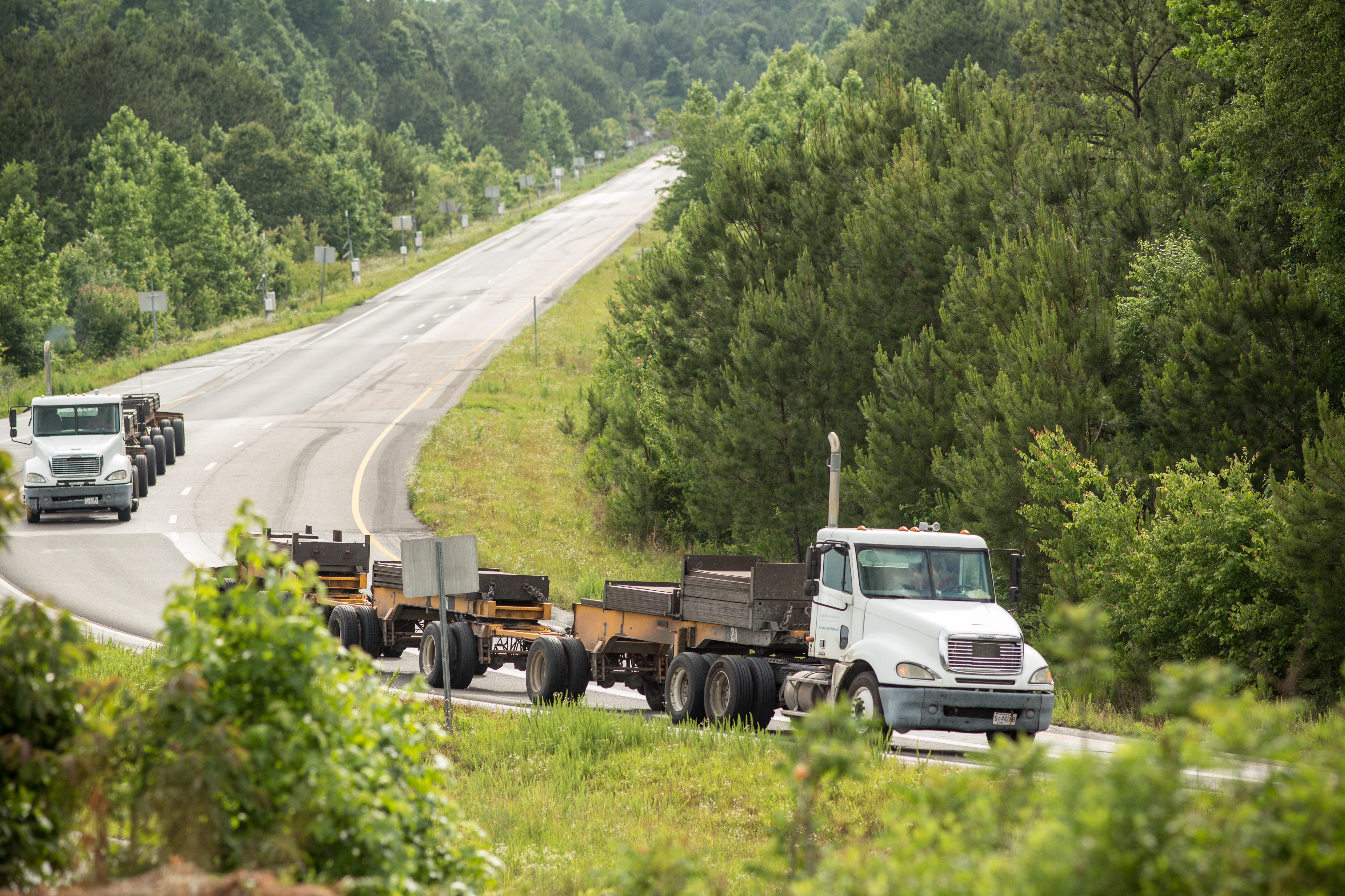
MnROAD, located in Albertville, Minnesota, and its southern U.S. equivalent, the National Center for Asphalt Technology in Auburn, Alabama, are full-scale test tracks that evaluate different types of pavement material under real-life conditions using semi-trailer truck and live interstate traffic.

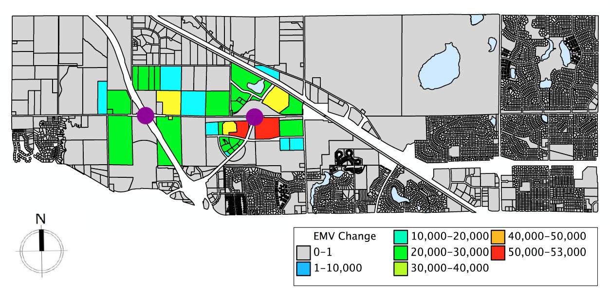
Each facility has a history of evaluating the performance of pavement preservation treatments, including chip sealing, micro-surfacing, crack sealing and thin overlays. To address needs in both northern and southern climates, similar test sections would be developed at each facility to address national issues.

“By working together we can maximize the potential for each track,” said MnROAD Operations Engineer Ben Worel. “A closer relationship between NCAT and MnROAD is a logical progression in developing and evaluating new sustainable technologies, pavement systems and construction methods that lead to safer, quieter, lower-cost and longer-lasting roads.”

A test track at the National Center for Asphalt Technology in Alabama, MnROAD's hot-weather equivalent.
A test track at the National Center for Asphalt Technology in Alabama, MnROAD’s hot-weather equivalent.

The partnership idea was introduced to federal officials earlier this month at a national pavement performance conference in Minneapolis. Final details must still be worked out.

One of the workshops at the event discussed the proposed partnership between MnROAD and NCAT. Further talks are expected at the end of October.

“NCAT is thrilled about the opportunity for a partnership with MnROAD to address pavement research needs at a national level,” said NCAT Director Randy West. “Bringing NCAT and MnROAD results together will expand the climate base, loading distribution and other important pavement factors.”

Pavement conference

Pavement engineers from around the nation gathered Sept. 2 to 5 for the Midwestern Pavement Preservation Partnership forum and the SHRP2 R26 Workshop for the Preservation of High-Traffic-Volume Roadways, which featured tours of MnROAD, Minnesota’s cold weather pavement testing facility.

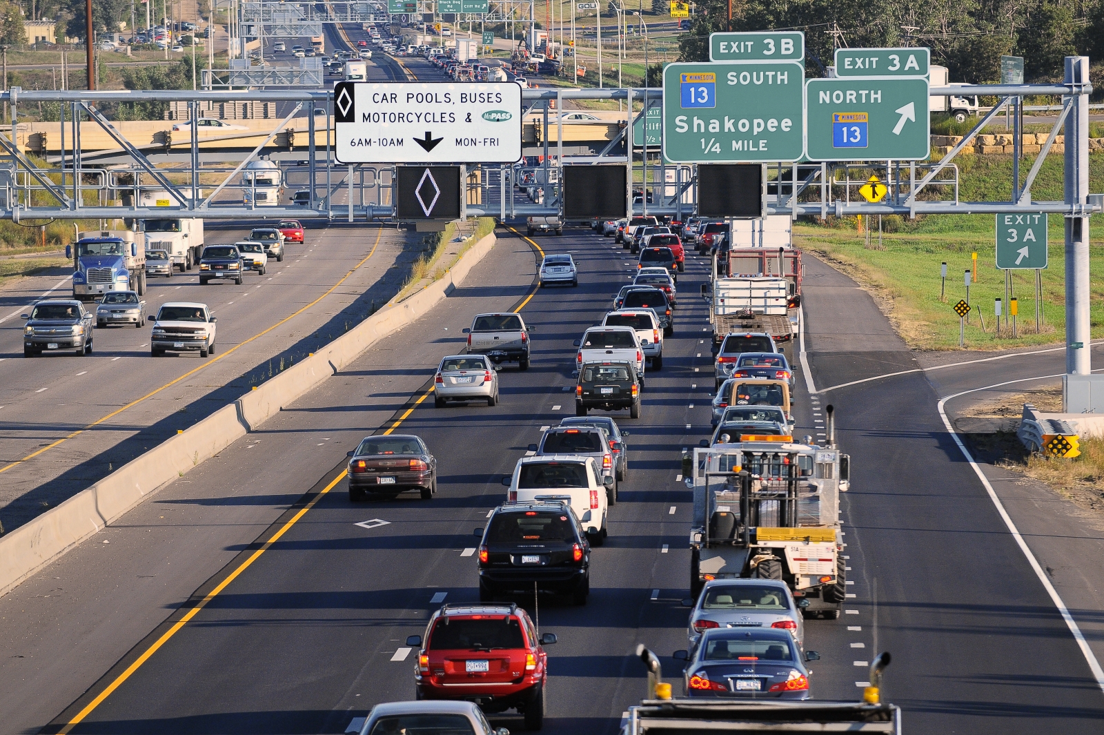
Conference participants also reviewed the latest preservation techniques being developed for high volume roads. MnROAD’s chip sealing study, which demonstrated that highways with an average daily traffic (ADT) of 58,000 can be successfully chip sealed, was especially attention-grabbing for agencies who don’t chip seal on roads with more than 2,000 ADT.

A national panel of speakers included Michael Trentacoste, director of the federal Turner-Fairbank Highway Research Center (pictured in top photo), who discussed Federal Highway Administration’s support of pavement preservation research and implementation.

With about 160 people in attendance over four days, MnDOT Materials Engineer Jerry Geib said the conference was successful in sharing the benefits of pavement preservation techniques with other state DOTs and federal highway officials who want adopt new practices to help alleviate budget constraints.

Parking availability system takes aim at truck driver fatigue

MnDOT, in partnership with the Federal Highway Administration, is test-deploying a high-tech system to help combat drowsy driving and keep truck drivers in compliance with federal hours-of-service regulations.

Developed by researchers at the University of Minnesota, the prototype system lets  drivers know when parking spaces are available at rest stops ahead. It has been deployed at several locations along the heavily traveled I-94 corridor between Minneapolis and St. Cloud.

From today’s MnDOT news release:

ST. PAUL, Minn. – New technology along the I-94 corridor west and northwest of the Twin Cities is helping truckers find safe places to park. Three Minnesota Department of Transportation rest areas are now equipped with automated truck stop management systems that tell truck drivers when parking spaces are available.

The technology will improve safety, lead to better trip and operations management by drivers and carriers and help MnDOT and private truck stop owners manage their facilities more effectively, according to John Tompkins, MnDOT project manager.

“So far, the results have been positive. We’ve had 95 percent accuracy in determining the availability of spaces,” he said.

Federal hours of service rules require truck drivers to stop and rest after 11 hours of driving. Tompkins said if drivers continue to drive beyond 11 hours, they could become fatigued and be forced to park in unsafe locations such as freeway ramps. They could also face legal penalties.

The problem of truck driver fatigue recently took the national spotlight when an allegedly drowsy driver slammed his semitrailer into a limousine carrying actor-comedian Tracy Morgan and six others. One passenger died in the crash.

The parking availability project is led by MnDOT Freight Project Manager John Tompkins and University of Minnesota professor Nikolaos Papanikolopoulos. MnDOT Research Services & Library produced the video above, which demonstrates the system in action. You can learn more about the project on the Center for Transportation Studies website.

Six effective low-cost safety improvements for roads

For the past 10 years, Minnesota and 37 other states have pooled their resources to test the effectiveness of roadway safety improvement strategies. The project, appropriately titled “Evaluation of Low-Cost Safety Improvements,” evaluates key strategies laid out in a national guidebook aimed at reducing the number of annual highway deaths.

Participating states say the project, which has now been extended a total of eight times beyond its original scope, has been a resounding success. MnDOT Safety Engineer Brad Estochen said the pooled-fund study has provided state DOTs much-needed evidence to gain support for implementing new safety improvements.

“Some states want to do a certain strategy, but don’t have the institutional support,” Estochen said. “Through the collaboration of the Peer Exchange, they have national results they can point to.”

We asked Estochen, MnDOT’s technical liaison for the pooled fund, to name his top strategies to come out of the study.

Traffic calming measures

Roadway

One phase of the study used simulated driving scenes to examine methods of traffic calming (i.e., getting drivers to slow down) in  rural towns. The research found that drivers were most impacted by chicanes — extra curves in the road — and the presence of parked cars on the street. An alternative strategy, curb extensions (also called “bulb-outs”), was found to offer only a small potential safety benefit or no benefit at all.

(Read more about this phase of the study.)

Nighttime visibility improvements

DSC_6498

Researchers also looked at ways of improving nighttime driver visibility on rural roads. Edge lines and post-mounted delineators were selected as the best alternatives for improving curve visibility at night, with curve detection improving 12 percent to 70 percent due to enhanced edge lines. The results are significant, since horizontal curve sections of two-lane rural roads are a major source of roadway fatalities.

(Read more about this phase of the study.)

Flashing beacons at stop-controlled intersections

One way to make drivers aware that they’re approaching a stop sign is to add a flashing beacon to the intersection. Researchers installed various configurations of flashing beacons at more than 100 sites in North and South Carolina and examined the crash data before and after installation.

Courtesy of K-Kystems

Results indicate that standard flashing beacons, as well as some “actuated” beacons (i.e. those that only turn on when traffic is approaching the intersection), are not only effective at reducing crashes, but also economically justifiable based on cost-benefit calculations.This research helped pave the way for more widespread adoption of Minnesota’s Rural Intersection Conflict Warning Systems (RICWS).

(Read more about this phase of the study.)

Edgeline rumble strips

DSC_4106pse

Edgeline rumble strips on curves were shown to significantly improve safety in the third phase of the study, which tested a variety of techniques.

Whereas rumble strips are traditionally ground into centerline or on the shoulder, Kentucky and Florida experimented with placing rumble strips right along the white edgeline of curved sections of road. This method was shown to reduce overall crashes by 29 percent.

(Watch the FHWA website for updates on this phase of the study.)

Red light enforcement devices

Red light indicator
In Florida, crashes due to people running the red light fell by 33 percent thanks to a small light that turns on when the signal turns red. This little light bulb, which is placed on top of a signal, allows for a police officer to sit at the other end of the intersection rather than pursue a car right through the intersection. Not only is it safer, but motorists are also more likely to obey the signal if they know police might be watching on  the other side.

Researchers are also still collecting data on the other techniques studied in phase three, including surface friction treatments on curves and ramps and larger curve warning signs (called chevrons). Watch the FHWA website for updates.

Wider roads in rural areas

manufacturing

Could simply shifting the edge lines of a rural road reduce the number of accidental drive-offs?

Yes, according to this study, which evaluated the effectiveness of various lane-shoulder width configurations on rural, two-lane undivided roads using data from Pennsylvania and Washington.

In general, results were consistent with previous research, showing crash reductions for wider paved widths, lanes and shoulders. For specific lane-shoulder combinations, the study found a general safety benefit associated with wider lanes and narrower shoulders for a fixed pavement width; however, there are exceptions. The report has a chart that shows the optimal lane-shoulder combinations for different sizes of roads.

In theory, there should be no additional cost for these strategies, as an edgeline can be re-striped as part of an existing resurfacing project.

Behind the bridge slide: dish soap and a lot of planning

Using Dawn dish soap to grease the rails, MnDOT crews inched the new Larpenteur Avenue Bridge into place two weeks ago using an innovative construction method.

As the bridge reopens to traffic tonight over I-35E, MnDOT celebrates the success of its first slide-in place bridge construction.

“The slide-in worked very well,” said David Herzog, MnDOT’s project manager for the I-35E Corridor – MnPass Project. “I think the process has given us the confidence to possibly use it again in the future.”

Slide-in technology

The slide-in method has been used in the past for railroad bridges and large bridges with high traffic and limited construction options. Now, state agencies and the Federal Highway Administration are applying the method to smaller, more routine bridges to minimize impacts to the traveling public.

Whereas the typical phased construction of a bridge builds one-half of the structure at a time, slide-in bridge technology allows the entire superstructure to be built at once, requiring just a brief, temporary closure of the highway.

Crews constructed the 3.5-million-pound Larpenteur Bridge right next to the existing bridge and then slowly slid it into place during the course of two nights. This effectively sped up construction from 110 days to 47 and reduced traffic impacts to drivers. (Watch video of the slide.)

The quality of the bridge also improves with this method, since it eliminates the deck construction joints and girder camber problems associated with phased construction, according to the FHWA. The pressure to use faster concrete cure times is also reduced.

History

With a quarter of the nation’s bridges in need of repair or replacement, the FHWA is pushing the slide-in method as a cost-effective technique that can cut construction time in half. It has previously been used in Oregon, Utah, Missouri, Michigan, Colorado and Massachusetts.

The concept has been around for more than a century, but slide-in technology is relatively new for small or medium-sized bridges, and it’s the first time MnDOT has attempted it on a state bridge.

Although MnDOT staff had flown out to Utah to view a slide-in, it was Burnsville-based Ames Construction that proposed reconstructing the Larpenteur Avenue bridge that way when it made its successful bid for the corridor project.

The slide-in method is about 15 percent more expensive, Herzog said, but it allowed the bridge to re-open in 47 days, versus 110 days.

Earlier this summer, Ames replaced the Wheelock Parkway and Arlington Avenue bridges in conventional fashion, although they were only closed for 65 days because they were constructed on a very accelerated timetable.

“Larpenteur is more of a major thoroughfare and we thought shortening the duration of its closure would be more valuable to  MnDOT,” said Steve McPherson of Ames Construction, who was brought in from Utah to oversee the corridor project.

The fast reconstructions will allow the company to complete the bridge replacements and highway reconstruction in just 120 days. Next year it’ll finish the other half of the corridor.

All three bridges are being replaced to make room for the new MnPASS lane on I-35E.

One of the drawbacks to slide-in technology is that it requires ample room to build the bridge on-site. An alternative is to construct off-site.

The new Maryland Avenue/I-35E bridge was built off-site, as was the Hastings Hwy. 61 bridge. It was then loaded onto a barge, floated down the Mississippi River and lifted into place.

Related Resources

MnPASS: Two systems, both work

I-35W’s MnPASS lane, where vehicles can frequently enter and exit the high-occupancy toll lane, is just as safe as the MnPASS lane on I-394, where motorists only have a few shots to enter the system, a new study finds.

Researchers at the Minnesota Traffic Observatory undertook the MnDOT-funded study because of objections to open systems like the one on 35W.

“The federal government has very strong arguments against the open system. They’re saying it’s going to be dangerous – cause more disruption and more congestion,” said John Hourdos, director of the Minnesota Traffic Observatory. “We found that both roadways are working very well today because they were designed appropriately for their location.”

The definition of an open system is one that has more opportunity for access than restriction. On 35W, a dotted white lane means vehicles can enter the toll lane at will, and a solid line bars access.

Vehicles must have two occupants on-board or an electronic pay card to use the express lanes during rush hour.

MnPASS on Highway 35W.

The reason I-35W allows vehicles to enter MnPASS more frequently than I-394 is because there are more ramps where new vehicles are entering the freeway and might want to get on MnPASS.

Researchers studied whether accidents are more likely to occur by studying the number of accident-inducing vehicle movements along the 35W corridor. They found that areas where accidents are mostly likely to occur are also where the lane would have to allow access anyway under a closed system like 394.

The study also looked at mobility, determining that MnPASS users have just as good free-flowing traffic under the open system.

Helpful tools

Researchers also created design tools that engineers can use to determine where access points should be on MnPASS lanes.

Until now, engineers have relied on rule of thumb. For example, the general guidance for allowing access on a closed system was 500 feet for every lane between the entrance ramp and the HOT.

The tools can be used to automatically determine how fluctuations in the MnPASS fee will affect congestion within the lane.

The fee to use MnPASS depends on the time of day.

As the express lane become more congested, the fee to use it increases. This slows the number of cars entering the lane, increasing the speed of the vehicles already in the lane.

“We ran the tool on three locations on 35W and found that, for example, on Cliff Road, you can increase the traffic by 75 percent and still be okay,” Hourdos said. “You have more leeway there than north of the crossroads of Highway 62 and 35W, for instance.”

 Related Resources

Rumble Strips vs. Mumble Strips: Noise Comparison (Video)

We recently blogged about a research project to evaluate a new type of rumble strip that produces significantly less external noise than traditional designs. The above video, shot near Thief River Falls, Minnesota, shows a comparison between traditional rumble strip designs and the newer, “sinusoidal” rumble strips (a.k.a. “mumble strips”).

The life-saving benefits of rumble strips are well-established, but traditional designs produce external noise that residents consider to be a nuisance. The issue has pit safety concerns against quality-of-life concerns in some parts of the state. Researchers are investigating whether sinusoidal rumble strip designs, which are much quieter, are effective enough to combat drowsy or inattentive driving.

The video is not exactly a scientific comparison, but it does give the viewer a good sense of the difference in noise levels produced by the two styles of rumble strips. The results of the actual research project are expected to be available later this year.

New Video: “Why Aren’t They Working on My Road?”

A new video produced by the Local Road Research Board helps the public understand why some bad roads aren’t always fixed first.

The seven-minute video explains what causes road pavements to deteriorate and why, like the saying, “throwing good money after bad,”  it may be more cost-effective to put maintenance dollars into roads that still have life left in them versus roads that are in the worst condition.

In it, city and county engineers discuss how they use a pavement management program to decide which roads to fix when, in order to stretch limited resources in the most effective way possible.

“We’ve learned that if we wait for things to break and fall apart, they’re much more costly to replace than if we put a little bit into it during its life cycle,” says Mark Maloney, City of Shoreview public works director.

Value capture alternative finance model tested on Highway 610

Those who use the roads in Minnesota are generally those who pay for them — through gasoline and vehicle taxes.

But motorists aren’t the only ones who benefit when a new interchange is built or a highway is improved. Home and business values along the corridor go up and the price of undeveloped land can skyrocket.

With highway funds strapped, a new method of funding road expansion, called “real estate value capture,” is garnering attention.

This emerging technique strives to identify beneficiaries of transportation improvements beyond just the highway user, so they provide their fair share of the costs — a concept not dissimilar from residential street assessment.

For instance, a local government might dedicate the additional property tax revenue generated due to a new highway to offset some construction costs, or collect fees on land that is developed near an interchange.

However, value capture is a relatively new technique that has been used primarily for transit projects. To be considered for roads or bridges, questions need to be addressed about potential revenue, impacts and public acceptability.

In a new case study, researchers use a long-delayed planned extension of Highway 610 in Maple Grove to model the impact of a completed highway on nearby property values, and, for the first time, quantify the potential revenues from several value capture strategies.

With properties near new highway exits worth an additional $65,450 more per acre, researchers calculated that $37.1 million in revenue could be generated through assessments on existing development and impact fees for future development.

Other strategies explored include tax-increment financing and private-public development of undeveloped parcels, in which revenue generated by that development is split.

“This research demonstrates a way to estimate the value of transportation improvement and to communicate that to the public,” said principal investigator Jerry Zhao, an associate professor of public administration at the University of Minnesota’s Humphrey School of Public Affairs.

This map projects the anticipated increase in estimated market value (EMV Change) of parcels near Highway 610 that will result from completion of the highway and construction of exits at the two locations marked in purple. The impacted parcels are currently vacant, farmland or residential.
Study links:
    • Real Estate Value Capture: An Emerging Strategy to Pay for New Transportation Infrastructure – Technical Summary (PDF, 1 MB, 2 pages);  Final Report (PDF, 5 MB, 36 pages).

New study to shed light on environmental impacts of deicers

Even naturally derived products like corn syrup and beet juice can impact the environment when applied to salt mixtures for winter roadways.

A wide range of products, including the ones mentioned above, are added to deicing mixes to limit the amount of salt needed for Minnesota roads each winter. However, although information is available about the corrosive properties of various deicing chemicals, less is known about the toxicity of these compounds, especially to the aquatic environment.

Thanks to a recently completed project sponsored by the Clear Roads Pooled Fund, MnDOT winter maintenance personnel will better understand the relative toxicity of eight common deicing agents, which also include non-organics like Magnesium Chloride, Calcium Chloride and Potassium Acetate.

“Because the state has been trying a lot of different alternative chemicals, we wanted to get a better handle on the environmental impacts,” said MnDOT engineer Tom Peters, the technical liaison for the 26-member, Minnesota-led pooled fund for winter maintenance research.

In January, researchers plan to release a concise summary of the toxicity rankings to help winter highway maintenance managers consider both expected levels of service and potential harm to the environment when selecting a deicer.

A Dec. 3 webinar available on the Clear Roads website discusses their findings.

About Clear Roads

Minnesota is the lead state for the Clear Roads Pooled Fund, which conducts rigorous testing of winter maintenance materials, equipment and techniques. Other recent and upcoming research (see our Technical Summary on the program) includes a winter maintenance cost-benefit analysis toolkit, snow removal techniques at extreme temperatures and environmental factors that can cause fatigue in snowplow operators.

You can learn more about Clear Roads via the project’s e-newsletter.