All posts by mndotresearch

Refined ROI Methodology Shows Added Benefits of MnPASS Lanes

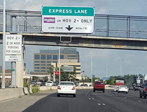
Researchers have developed a more comprehensive, standardized method for evaluating and selecting MnPASS managed lane projects. The new methodology uses a return on investment (ROI) and benefit–cost analysis framework that includes a more extensive set of factors, variables and perspectives than earlier methods. After applying the broader range of impact categories from the new methodology to an earlier study of a MnPASS corridor, researchers found that the MnPASS projects provide more benefits than previously reported.

In the past, MNDOT used a series of evaluation methods—cost estimation, performance measures and travel demand forecasting—to select new MnPASS corridors. While the recommendations and results from these assessments were adequate, each evaluation used a different set of objectives and assumptions. The range of benefit–cost factors in earlier evaluations was also limited to travel time savings, operating costs and crashes.

2017-37-p2-image
An overhead sign above a MnPASS express lane explains that drivers must have MnPASS or two or more occupants in a vehicle to use the lane during peak travel time of 6 a.m. to 10 a.m., Monday through Friday.

“Our previous corridor studies each had different benefit–cost elements, making direct comparisons difficult. This project makes it possible to quantify the transit, environment and travel time reliability benefits that we knew were there all along,” John Wilson, Economic Policy Analyst, MnDOT Office of Transportation System Management

MnDOT needed a more thorough and consistent benefit–cost analysis methodology to help decision-makers better assess MnPASS project alternatives; compare potential MnPASS corridors; and communicate why MnPASS is a financially effective, long-term strategy for addressing mobility and congestion issues.

What Was Our Goal?

The goal of this project was to develop a refined, standardized methodology to more accurately assess the ROI of MnPASS programs and projects. A refined assessment framework would include a broader range of financial and performance measures, allowing MnDOT to more thoroughly evaluate MnPASS investments.

What Did We Do?

Using ROI as the central framework, the research team set out to generate a more comprehensive method for estimating benefits and costs. To begin, team members identified limitations in the existing benefit–cost analysis methodology and developed a list of factors to include in the refinement process. Then they interviewed stakeholders from various agencies to better understand MnPASS planning and operations needs, as well as the data required to support the research and system benefits and costs.

Next, they began to develop the enhanced framework by defining economic, environmental and social ROI categories for MnPASS investments, and mapping the relationship between these categories and their associated benefits and costs. Benefit– cost analysis methods then were used to build the refined framework and to estimate benefit–cost ratios for projects. Finally, researchers applied the new framework to an earlier benefit–cost analysis of the Interstate 35 West (I-35W) North Managed Lanes project to compare the results of the new framework with the results from the earlier analysis.

What Did We Learn?

Researchers used additional benefit factors such as transit use, travel time reliability, emissions and noise to refine the ROI calculation methods. When they applied the new ROI framework to the I-35W project, they found that the MnPASS benefit–cost ratio significantly improves with the inclusion of transit and travel time reliability benefits.

“Benefit–cost analysis had not changed for a long time; we had looked at travel time, vehicle operating costs and safety. Now we have added travel time reliability, which is important because we are moving people, not just vehicles.”—Paul Morris, Senior Associate, SRF Consulting Group, Inc.

What’s Next?

The results from the comparative analysis yielded a notably higher benefit–cost ratio of 3.40 for the test corridor compared to a benefit–cost ratio of 2.11 in the original study, indicating that MnPASS projects have more positive effects than previously identified. Based on these findings, MnDOT will revise its benefit–cost guidance for evaluating MnPASS investments.

The research team was also able to measure the impacts of specific categories on the overall outcome of the calculations. Team members found that while the measures for reliability and transit impacts produced a meaningful change in the overall benefits, those for emergency response, emissions and noise impacts were very small relative to overall project costs. MnDOT will consider these findings in establishing updated procedures.

This post pertains to Report 2017-37, “Refining Return on Investment Methodology/Tool for MnPASS,” published October 2017. Other research initiatives to improve MnPASS operations can be found by searching “MnPASS” on MNDOT Research Services’ project pages.


Using a National Database to Develop Performance Metrics for Local Pavement Markings

Pavement marking performance metrics from a new study will help Minnesota local agencies save time and money by choosing longer-lasting pavement marking products.

Researchers developed pavement marking performance metrics for Minnesota local agencies to use as a guide to make better pavement marking product decisions. The metrics were developed based on an analysis of survey data collected from Minnesota local agencies and MnDOT pavement marking data mined from the National Transportation Product Evaluation Program (NTPEP). Findings showed differences in product performance with regard to retroreflectivity and service life, which were impacted by variables such as road surface type, year of application, traffic volume and type of pavement marking.

“There would be great potential savings in using pavement marking products with a longer service life. Mining NTPEP data to analyze product performance has not been done before and should contribute substantially to this goal,” said Omar Smadi, Director, Iowa State University Center for Transportation Research and Education.

What Was Our Goal?

The goal of this research was to develop pavement marking performance metrics for Minnesota local agencies to use as a guide when choosing the most durable and cost-effective products. Researchers developed the pavement marking performance metrics, specifically for retroreflectivity and service life, by analyzing existing MnDOT data mined from NTPEP. They also used the findings to make recommendations for future pavement marking research to support local agency needs.

What Did We Do?

Researchers designed and conducted a survey to assess pavement marking products used by local agencies in the state. Then they extracted 2010 and 2013 MnDOT pavement marking data from NTPEP to analyze the performance of products that survey respondents identified as commonly used.

NTPEP data included products tested at two different sites and applied on different road surfaces. Researchers analyzed performance with regard to retroreflectivity and deterioration or longevity of the materials under various conditions, such as road surface type, year of application, traffic volume and type of pavement marking. Based on results from the analysis, researchers developed performance metrics for Minnesota local agencies to use as a guide for choosing particular pavement marking product types.

What Did We Learn?

From the survey results, researchers learned that the majority of Minnesota local agencies use either latex or epoxy as their primary pavement marking material. However, epoxy and tape outperformed latex at all levels of conditions and provided a service life of three years or more.

A few survey respondents also reported grooving as a method that seemed to extend the service life of latex paint markings. Researchers were unable to investigate the impact of grooving, however, since MnDOT grooving data was not accessible.

2017-43-p2-image
Grooving may extend the service life of pavement marking materials.

From the NTPEP data analysis, researchers concluded the following:

  • White markings had significantly higher initial retroreflectivity and slower deterioration than yellow markings.
  • Road surface type does not significantly impact retroreflectivity throughout its service life.
  • Epoxy has higher retroreflectivity than latex materials.
  • As expected, markings on wheel zones deteriorated faster, reducing retroreflectivity over time.
  • Deterioration values of markings varied among different test sites, which may be attributed to differences in average annual daily traffic (AADT) values (10,000 in 2010 versus 37,000 in 2013) or installation practices.

“The findings from this research will be beneficial for Minnesota local agencies in determining which pavement marking materials are most effective,” said Kate Miner, then-Scott County Traffic Manager.

What’s Next?

Although the product performance metrics data will help Minnesota local agencies make better pavement marking product decisions in less time, researchers recommend developing a guidebook to make the information more usable. Adding grooving data to the guidebook would also be beneficial to investigate the potential impact grooving provides in extending the service life of pavement markings.

Researchers also recommend testing the same products evaluated in this research on low-volume local roads and on challenging surface types. MnDOT NTPEP data only included products that were tested on high-volume freeways.

This blog pertains to the Local Road Research Board-produced Report 2017-43, “Minnesota Local Agency Pavement Marking: Mining Existing Data,” published November 2017. A related project has developed a spreadsheet tool to help local agencies prioritize pavement markings on low-volume roads.

Design Spreadsheet Offers Alternatives to Protect Pavements from Frost Damage

Researchers have developed a simple design tool for determining the amount of frost-free materials needed for a specific site’s subgrade to prevent frost and freeze-thaw damage to pavements.

“This tool will help us optimize construction to provide the best pavement,” said Steve Henrichs, Assistant Pavement Design Engineer, MnDOT Office of Materials and Road Research

Since 1995, MnDOT has required the use of frost-free materials (FFM) in subgrade depths of 30 to 36 inches for asphalt pavements, based on traffic load requirements. It is not clear that such FFM requirements are effective. In some areas, 30 inches may be excessive and, therefore, unnecessarily expensive; in others, 36 inches of FFM may not be enough, leading to costly pavement failure and repair. MnDOT needed a research-based pavement subgrade design procedure for resisting frost damage in pavements.

“Frost protection has not been studied in depth recently. This research used inputs based on soil type, location and expected frost depth, and didn’t require advanced modeling or expensive laboratory testing,” said Matthew Oman, Principal Engineer, Braun Intertec Corp.

What Was Our Goal?

The goal of this project was to develop a procedure for optimizing subsurface materials and thicknesses based on existing subgrade soils and geographic areas in Minnesota in order to resist pavement damage from frost action.

What Did We Do?

Researchers first reviewed existing literature on frost action and frost susceptibility. They synthesized national and international research and looked at practices and standards for mitigating frost action in states and countries with climates similar to Minnesota’s. Then they reviewed MnDOT’s current and historical policies and practices.

2018-06-p1-image
Researchers reviewed charts and other resources on cold temperatures and structural insulation needs, like this map from the National Oceanic and Atmospheric Administration.

The central effort in this research was to examine existing pavements in Minnesota to characterize pavement performance and winter profiles. Researchers and the Technical Advisory Panel selected 72 pavement sites for study based on soil types (such as glacial till, clay, silt, sand and peat); pavement types (including concrete, asphalt and composite); subsurface materials and thickness; and weather conditions. The team evaluated construction logs, project plans, management data and subsurface investigations, and they augmented Minnesota-specific data with performance and soil data from the Federal Highway Administration’s (FHWA’s) Long-Term Pavement Performance (LTPP) program. Researchers created winter pavement profiles of most of the sites and compared them with roughness and ride quality data collected the previous summer.

Finally, the team analyzed performance trends and design and construction details to assess the effect of frost heave on ride quality. Using the findings from this effort, the team built a design tool for determining what pavement structures require of subgrades to resist environmental effects based on project location, projected frost depth and soil type.

What Did We Learn?

The initial evaluation did not produce strong correlations between winter ride quality and factors like FFM depth, grading soil depth and region. Winter ride quality measurements were poorer than summer measurements, but the role of FFMs remained unclear. Insufficient data, outliers and other questionable information were culled from the records, which were then amplified with data from other pertinent historical sources. Results from this effort suggested that FFM depth may improve pavement performance by incrementally reducing ride deterioration, particularly at depths of 25 inches or greater.

Review of relevant LTPP data established that shallower FFM depths and greater silt content in subgrades correlate with poor pavement ride quality. Silty soils, which have low permeability and produce high capillary effects, have long been considered susceptible to frost damage.

Researchers avoided thermodynamic modeling and analysis—and kept the design tool simple—by selecting subgrade silt content as a proxy for frost susceptibility. The spreadsheet tool uses project location (latitude and longitude), predicted frost depth and subgrade soil silt content as the key factors in frost susceptibility of pavements. The tool recommends frost treatment ranges from about 30 percent of predicted frost depth for soils with zero silt to over 80 percent of predicted frost depth for soils with 100 percent silt. The spreadsheet requires limited laboratory testing of subgrade soils, is simple and inexpensive to implement, and produces results similar enough to MnDOT’s practices that they will not require dramatic change in construction needs.

What’s Next?

Researchers produced four spreadsheets, each employing a different combination of frost depth prediction and soil type characterization. Once MnDOT selects its preferred spreadsheet and determines if additional subsurface tests should be included as inputs, pilot implementation will begin. Additional study to enhance the tool could include investigating MnROAD cells further, collecting more winter ride quality data, developing uniform frost depth prediction methods and tracking more information from new construction.

This post pertains to Report 2018-06, “Designing Base and Subbase to Resist Environmental Effects on Pavements,” published February 2018. The full report can be accessed at mndot.gov/research/reports/2018/201806.pdf.

Traffic Tubes Still Provide More Accurate Counts Than GPS Smartphones

Collecting traffic volume information from smartphone data, navigation systems and other GPS-based consumer and mobile technologies is not yet ready for use by MnDOT. However, the emerging technology offers useful information on driving origins and destinations for traffic monitors and planners.

“We’re on the cusp of using GPS technology to get traffic data from more facilities. We’re not there today, but we’ve spurred the industry to look at this opportunity,” said Gene Hicks, Director, MnDOT Traffic Forecasting and Analysis, who helped lead the research study on this topic.

MnDOT conducts traffic counts on its roadway network at regular intervals: every other year on state trunk highways, approximately every four years on city and county roadways, and every 12 years on low-volume roads. To make these traffic assessments, MnDOT currently stretches pneumatic tubes across traveled lanes and counts passing axles for up to 48 hours.

2017-49-p1-image
Using pneumatic road tubes to collect traffic data is an old and reliable practice, but installing them is time-consuming and puts workers in harm’s way.

“Using road tubes to collect traffic volume data is a proven method, but it’s an old practice and puts people in harm’s way. Smartphones may offer a useful alternative,” said Shawn Turner, Division Head, Texas Transportation Institute, who helped evaluate a beta version of traffic volume estimates derived from global positioning system (GPS)-based mobile devices.

What Was Our Goal?

With this project, researchers aimed to explore using smartphones and other GPS-based systems instead of pneumatic tubes to collect traffic volume data. The information collected was compared with actual volume counts from MnDOT traffic monitoring sites.

What Did We Do?

In May 2016 researchers began identifying data collection firms interested in participating in this research effort. These firms were developing products that gather, aggregate and analyze sufficient location data from GPS mobile devices to estimate traffic volumes. Researchers assessed and sorted packages from these firms to identify the best match for MnDOT’s needs.

Two firms that were initially interested withdrew from the project because their products were not ready for rigorous testing. The research team then developed an agreement to work with a third firm, StreetLight, to develop and evaluate traffic volume estimates from GPS-based devices.

Researchers and StreetLight worked together to develop and evaluate traffic volume data. Investigators provided MnDOT traffic count data to the vendor for calibration of its approach, and investigators suggested several ways to enhance StreetLight’s analytics.

2017-49-p2-image
Smartphones, navigation devices and other GPS-based consumer and commercial personal devices collect data that can be used to develop traffic volume estimators.


The vendor developed its proprietary approach, combining GPS-based navigation data with location-based service data. The firm normalized these two data sets with U.S. Census population projections, then calibrated and scaled samples with data from 69 MnDOT permanent ATR sites. StreetLight then estimated traffic volumes for MnDOT based on 7,837 short-duration count sites.

What Did We Learn?

On multiple-tube, high-volume roadways, MnDOT expects an accuracy of over 95 percent. The correlation between AADT tube-based data and StreetLight’s data was 79 percent without calibration and scaling, and 85 percent when scaled and calibrated. GPS-linked traffic volume estimations are approaching acceptable accuracy for MnDOT, but are not yet sufficiently accurate to replace tube counting for assessing AADT.

Estimation accuracy varies heavily with traffic volume levels. At high levels of traffic, larger sample sizes of mobile devices seem to drive more accurate assessments. At over 50,000 AADT, StreetLight estimates reached mean absolute percent error levels of 34 percent. At AADT levels below 20,000, the percent error rates ballooned. At all traffic levels, GPS-based data was measured at 61 percent mean absolute percent error.

Low-volume roads and frontage roads where multiple roadways converge had to be removed from count sites for estimating AADT. Overall, some of the GPS-based data fell within 10 to 20 percent absolute percent errors, which is acceptable, but other estimates fell well outside an acceptable range, and the highest errors occurred in low-volume roadway assessments.

What’s Next?

GPS-based data offers granular information that tube counts cannot, like average annual hourly volume estimates, and origin and destination data. With improvements to analytical processes for all data, GPS-based data may provide value outside of AADT estimates.

Currently, MnDOT is evaluating origin-destination data that StreetLight is providing for use in traffic studies and planning analyses. Current research by the University of Maryland and the National Renewable Energy Laboratory is gathering data with better error rates and will be extended in Colorado, Florida and Rhode Island. MnDOT expects volume estimation from GPS-based data will continue to improve and will likely be an acceptable alternative to tube counting in a few years.

This post pertains to Report 2017-49, “Using Mobile Device Samples to Estimate Traffic Volumes,” published December 2017.

New Software Models MnPASS HOT Lane Changes

Until recently, Minnesota drivers could only enter or exit high-occupancy toll (HOT) lanes via select ramps and access points. But MnDOT has changed most of its MnPASS express lanes to an open-access system to allow more movement between general purpose and high-occupancy toll (HOT) lanes.

Although MnDOT prefers this open access system, there could safety concerns for allowing lane changes in certain locations, especially if traffic patterns change. A new design tool developed by MnDOT-sponsored research enables traffic engineers to evaluate existing or prospective HOT corridors and determine the impact of open or closed access. When data shows changes in traffic patterns and congestion, the software also allows technicians to model and design changes in MnPASS access to improve drive mobility and safety.

“Nothing like this has been developed anywhere else. There is a lot of debate around the country about high-occupancy designs. This tool helps us develop designs and monitor existing corridors,” said Brian Kary, Director of Traffic Operations, MnDOT Regional Transportation Management Center.

Background

In Minnesota, high-occupancy toll (HOT) lanes are used by buses, carpools and motorists with transponders that trigger payments for rush hour use. During rush hour, fees increase as congestion increases; at other times, the lanes are free for all users.

MnDOT research in 2014 concluded that both closed and open HOT lane configurations effectively and safely improve traffic capacity. But researchers anticipated that roadway sections on an HOT lane corridor may eventually experience safety and mobility problems if toll prices are lowered or traffic volume increases. During heavy traffic, driving speeds often vary dramatically between HOT and general purpose lanes. Drivers moving into MnPASS lanes may force other drivers to brake suddenly to avoid collisions and trigger shockwaves of slowed or stopped traffic behind them. MnDOT prefers open-access designs for the increased options they offer road users, but it was not clear how best to manage access to reduce the incidence of shockwaves and the safety and mobility problems they create.

A section of a MnPASS express lane.
MnDOT has changed most of its MnPASS lane markings from double solid lines to skipped double lines to allow more open movement between general purpose and HOT lanes. A new software tool allows RTMC engineers to reassess MnPASS access to respond to changing traffic patterns.

The goal of this research implementation effort was to develop a software tool that the Regional Transportation Management Center (RTMC) could use to assess corridor operations and design. Based on design recommendations from earlier research, the tool would allow RTMC users to predict the safety and mobility impacts of a change from open to closed HOT lanes, and estimate where in the corridor such changes could be implemented safely and effectively.

What Did We Implement?

This effort leveraged findings from three previous MnDOT studies. Models and methods from “Evaluation of the Effect of MnPASS Lane Design on Mobility and Safety” (Report 2014-23) were used for the architecture of this new system. Investigators drew on “Expanding and Streamlining of RTMC Freeway Network Performance Reporting Methodologies and Tools” (Report 2014-05) to implement methods for retrieving historical data from RTMC’s system, cleaning the data and integrating it into the new software package. The project team then incorporated data from “Safety Impacts of the I- 5W Improvements Done Under Minnesota’s Urban Partnership Agreement (UPA) Project” (Report 2017-22) to develop and calibrate the new tool for estimating traffic impacts and shockwaves. A car-following and lane-changing model developed in a 2013 University of Minnesota study provided effective methods for ensuring realistic vehicle modeling and shockwave generation.

How Did We Do It?

Investigators developed this system with links to MnDOT’s database to draw on historical data to identify patterns of traffic demand over time and generate predictions of points in the MnPASS lanes at which shifts from open- to closed-access HOT lanes will offer the most benefit. The program’s code integrates the various models, data sets and tools mentioned above into software that integrates smoothly with the RTMC’s current software and capabilities for collecting speed and volume data, developing interfaces to model impacts of changing open designs at certain points in the freeway corridor to closed designs. The tool includes a module for access design, a module for generating data and a web application.

“This tool is calibrated for the Twin Cities. It takes real-time data and diagrams each location separately for lane changes and reaction time. It took theoretical ideas and made them usable,” said John Hourdos, Director, Minnesota Traffic Observatory, University of Minnesota.

What Was the Impact?

After receiving training in using the new software, RTMC engineers have embraced the MnPASS design tool to regularly report MnPASS performance to the Federal Highway Administration and to generate quarterly and annual analyses and recommendations for changing specific locations from open access to closed access. Closing requires restriping and changing signage—operations that allow MnDOT to respond quickly and easily to shifts in traffic patterns and potential mobility and safety impacts.

The project also offers data for the broader transportation community in which experts debate the relative merits of open- and closed-access HOT designs. With MnPASS, MnDOT has emerged as a leader in open design; this software allows sophisticated modeling of design impacts for the national traffic operations community.

What’s Next?

The MnPASS design tool effectively monitors corridor behavior and design changes. Improvements may yet be made to allow data calibration and validation for slower traffic speeds that represent mobility breakdowns, and to refine aspects of car-following and shockwave models. Increased density scenarios can also be further improved to better accommodate traffic density increases in regular lanes alongside HOT lanes.

In its current form, the tool will be used to analyze open- and closed-access designs on the Interstate 394 corridor to determine the best locations for changes to MnPASS lanes, and positions MnDOT and the RTMC to respond to traffic demand changes in the future.

This post pertains to Report 2018-11, “A Tool for Designing MnPASS
Access Spacing,” published March 2018. The full report can be accessed at
mndot.gov/research/reports/2018/201811.pdf.


Research Provides Foundation for Chloride Mitigation Efforts

The accumulation of chloride in our waters has become a widespread concern. In a recent study sponsored by MnDOT and the Local Road Research Board, researchers measured the transport and accumulation of chloride from road deicers in a metro-area watershed. The findings revealed a greater infiltration of chlorides into soil and subsurface waters than previously assumed.

“The results of this research provide us with knowledge we did not
have before,” says William Herb,a research associate with the University of Minnesota’s St. Anthony Falls Laboratory and the study’s principal investigator. “It will help investigators and policymakers explore ways to capture chlorides and mitigate their damaging environmental effects.”

Road salt (sodium chloride) is used in most states that experience snow and ice, with growing impact. For example, chloride levels in some lakes and streams in the Minneapolis–Saint Paul metro area exceed state and federal water quality
standards, and a recent study showed that levels in more than one-quarter of shallow groundwater wells in the metro were above drinking-water taste standards.

“This is a real concern because even in low concentrations, chloride can be lethal to sensitive plants and some aquatic species, and many of our lakes, wetlands, and streams show acute or chronic levels of chloride,” Herb says.

To learn how chlorides from road salt deicers are transported in urban watersheds, researchers installed field instruments at eight sites in a Roseville watershed. They monitored water and chloride levels nearly continuously over three winter seasons; this included runoff directly from sources (roads and parking lots), transport in ditches and sewer networks, and retention in and release from detention ponds and wetlands. Computer modeling was used to generalize results.

2017-50-p1-image
This drain along State Highway 36 was one of the roadway runoff discharge sources used in the study.

Overall, the team observed substantial chloride retention via infiltration to soils and groundwater. For example, monitoring the runoff from a vegetated highway ditch showed that more than 95 percent of the chloride applied to the highway infiltrated
from the ditch into the soil, and less than 5 percent was exported from the site in surface runoff. “Interestingly, substantial chloride export from the ditch was observed in November rainfall runoff prior to application of any new road salt for the upcoming winter, suggesting long-term storage in soils and groundwater in and near the ditch,” Herb says.

Researchers also found that winter rain-on-snow events and the first major
prolonged thaw each season moved surface chlorides most effectively into the watershed.

The research team then used the data and modeling to examine potential strategies for reducing or mitigating the spread of chloride, including capturing low flows, seasonal runoff capture, and capture based on salinity.

Wayne Sandberg, deputy director of the Washington County Department of Public Works, chaired the study’s technical advisory panel. “Based on this research, we now know that deicer chemicals are staying in the soil and moving in the watersheds, and this should change how we manage ice and snow control,” he says. “The next questions are what can we do with that knowledge and what changes can we make.”

This article originally appeared in CTSs Catalyst Newsletter, March 2018 and pertains to Technical Summary 2017-50TS. The full report, “Study of De-icing Salt Accumulation and Transport Through a Watershed” 2017-50, published December 2017 can be accessed at mndot.gov/research/reports/2017/201750.pdf.

Darkness in Box Culverts Not a Likely Barrier to Topeka Shiner

Darkness box culverts does not present a complete barrier for southwestern Minnesota fish species, according to a new MnDOT study. The findings will reduce the cost and  delay of future box culvert replacement projects.

“This research will allow MnDOT to save both time and money when replacing other box culverts in southwestern Minnesota by eliminating the need for a fish passage study for each one,” said Scott Morgan, Principal Hydraulics Engineer, MnDOT District 7.

The research project is one of several undertaken by MnDOT and the Local Road Research Board to better understand fish passage (more at mndot.gov/research), and ultimately develop a Minnesota culvert design manual for accommodating aquatic species.

What Was Our Goal?

In this study, researchers developed several objectives in their efforts to assess the effect of low light levels on fish passage through replacement box culverts. As part of this effort, they wanted to determine typical light levels in the replacement culvert and other box culverts in the region. They also sought to determine if the Topeka shiner and other fish move through culverts in the same numbers they pass through control areas in the same stream, and whether light levels affect frequency of movement. Finally, if a barrier is determined, researchers sought to design or recommend a method for mitigating light in the culvert.

What Did We Do?

In the field, researchers characterized light in long box culverts (at least 8 feet by 8 feet) by collecting many light levels with a light meter at the water surface within the three culverts and at control reaches. They also measured light levels within the water column to characterize the light conditions a fish would experience.

To determine whether Topeka shiners passed through culverts in similar numbers as through control reaches of the same stream, and whether light levels affected their passage, researchers employed a mark-and-recapture process. They caught fish upstream and downstream from the culverts or control reaches, marked them with an identifier indicating where they were caught and released, and then resampled to see where fish moved. They also noted other culvert features that could affect passage, such as water depth and velocity.

Image of fish tank.
In light manipulation experiments at the St. Anthony Falls Laboratory, Topeka shiners and fathead minnows were allowed to choose channels to swim along. The degree of shade in one channel was adjusted from light to deep shade.

To control for confounding variables that could affect fish movement, a laboratory study measured Topeka shiner preference for light or dark channels. Researchers used a 25-foot-long double channel box with water diverted from the Mississippi River. Fish could choose to swim along light or shaded lanes as they preferred in this light manipulation experiment.

What Did We Learn?

Although there has been increasing concern over the potential for culverts to create behavioral barriers for fish and other organisms, this was the first study that quantified these behavioral effects for fish passage. Light levels in large box culverts were not identified as a potential barrier to the fish communities present in southwestern Minnesota. Two out of the three culverts monitored showed reduced fish passage compared to the control reaches; however, fish—including Topeka shiners—were able to pass through all three.

The longest and darkest culvert had the greatest difference in movement between the culvert and the control, but this variation could not be attributed solely to light levels. This finding was supported by experiments at the St. Anthony Falls Laboratory, where fish that could select either a shaded or lighted channel showed no avoidance of the shaded channel regardless of the shading level.

The light measurements in three culverts yielded an extensive data set that can be used to model light levels through culvert barrels. Light levels at the water surface depended on the culvert entrance, dimensions, construction material, orientation and elbows, while light levels in the water column were also affected by turbidity.

What’s Next?

The conclusions of this study apply only to Topeka shiners and other small warm water fish species, and to large box culverts like those studied. Additional research is required to investigate possible barriers created by smaller, darker culverts to light-sensitive fish species and the interactions between light and other variables such as velocity.

This post pertains to Report 2017-44, “Culvert Length and Interior Lighting Impacts to Topeka Shiner Passage,” published November 2017. The full report can be accessed at mndot.gov/research/reports/2017/201744.pdf.

MnDOT installs safety countermeasures at stop signs, stop lights

MnDOT is working on ways to reduce crashes at intersections by making stop signs and stop lights more visible to motorists. The agency will apply reflective red metal strips on nearly 1,000 stop sign posts and fluorescent yellow tape around 100 traffic signal lights across the state this summer.

“We think these two low-cost safety countermeasures will help reduce crashes at these higher risk intersections,” said Derek Leuer, traffic safety engineer.

13-JuneSafetyMeasures_400
Derek Leuer, traffic safety engineer, displays what the yellow reflective tape looks like around the back plate of a traffic signal light. This tape will be installed on 101 signals statewide this summer. Photo by Sue Roe

The stop sign project will be implemented on locally owned roads that intersect with two-lane, two-way state highways. The highways chosen are considered moderate- and high-risk crash corridors.

The reflective red strips will be installed on the stop sign post directly beneath the stop sign.

Rural intersection crashes are a serious issue in Minnesota, according to Leuer. From 2008 to 2012, there were 533 serious and fatal injury crashes at rural state highway intersections.

“This project aims to reduce those fatal and serious injury crashes in the state by making the stop signs easier to see,” he said. “Fatal right-angle crashes often are the result of one or more drivers failing to comply with a stop sign.”

The traffic signal project includes installing fluorescent yellow tape around the rectangular back plate that contains the green, red and yellow traffic signal bulbs. Leuer said this is a proven Federal Highway Administration safety countermeasure already used by other states.

“The reflective tape will make the signals look bigger and help motorists be more aware of them,” Leuer said. “This will be especially helpful at night and in low-visibility conditions.”

The florescent yellow tape will go on signals at intersections that are considered higher risk for crashes and may have a record of past crashes.

Cost of both projects is about $500,000.

MnDOT will evaluate both projects for effectiveness on an ongoing basis over the next three years.

“The installation of red reflective strips to stop sign posts and yellow fluorescent tape around signal lights may become another low-cost tool to help MnDOT improve roadway safety and move Minnesota toward zero deaths,” Leuer said.

This article by Sue Roe originally appeared in the June 13, 2018 MnDOT Newsline.

Enhanced WIM Reporting Software to Improve Commercial Traffic Weight Monitoring and Data Sharing

An update to BullConverter allows MnDOT’s statewide weigh-in-motion (WIM) system to adopt systems from more manufacturers. The BullReporter upgrade adds new reporting functions, including a View Vehicles function that provides an image of a vehicle along with a graphical representation of WIM data, such as weight and speed.

This upgrade, developed through a research study, expands the commercial traffic information that the Office of Traffic System Management can provide to the MnDOT Office of Bridges and Structures, local and state permitting agencies, the Minnesota State Patrol and other Minnesota authorities.

“With BullReporter, now we can produce daily, weekly and monthly reports of the overweight vehicles that cross over WIM sensors,” Benjamin Timerson, Transportation Data and Analysis Program Manager, MnDOT Office of Transportation System Management.

What Was the Need?

Weigh-in-motion (WIM) systems measure characteristics of individual vehicles on the road, generating records of data that include vehicle type, speed, axle weights and spacing. When a vehicle crosses WIM sensors in the pavement, it triggers electrical signals that are transmitted to a WIM controller, which converts the signals into usable WIM vehicle data. A number of manufacturers produce WIM sensors and controllers, and each vendor employs its own methods of processing signals and producing proprietary WIM data.

Image of WIM Controller
Load sensors and loop detectors in each lane of traffic are connected to a WIM controller in a cabinet that also houses a communication device. A centralized server connects to each field WIM controller and downloads daily WIM data files, which are then processed through BullConverter/ BullReporter.

In 2009, MnDOT began using BullConverter/BullReporter (BC/BR) software with heterogeneous WIM systems. BC converts incompatible, proprietary data into a uniform comma-separated values (CSV) format. BR generates reports from the converted CSV data, allowing the analysis of WIM data over different systems.

Currently, MnDOT’s Office of Transportation System Management (OTSM) uses WIM systems from International Road Dynamics (IRD), but recently began evaluating systems from Kistler and Intercomp. In a current study, investigators are evaluating the use of Intercomp WIM controllers with Intercomp sensors, IRD controllers with Kistler sensors, and Kistler controllers with Kistler sensors. These new WIM system combinations require new conversion functions in BC.

What Was Our Goal?

The goal of this project was to upgrade the BC/BR software package by improving  existing functions and incorporating new functions that will convert Intercomp and Kistler formats to the Bull-CSV format and refine export functions in BC. MnDOT also wanted to expand data reporting capabilities and analytical options in BR, including a View Vehicles capability for analyzing individual vehicles.

What Did We Implement?

MnDOT funded enhancements to the BC/BR software package to include Kistler and Intercomp formats and develop new data retrieval, statistical assessments and report generation applications, including View Vehicles.

How Did We Do It?

MnDOT provided the original BC/BR developer with a detailed list of enhancements and new conversion and reporting functions. The team developed a new WIM data downloading tool for Kistler controllers that would connect the controllers through the Internet and download and archive the raw data. Developers added two new conversion functions in BC to support conversion from Kistler and Intercomp formatted data to CSV-formatted data. The team also updated the export function in BC.

Image of View Vehicles Report display
The View Vehicles report displays on-screen images of vehicles along with WIM data in graphics that include vehicle class, GVW, speed and ESAL.

The software team then added View Vehicles report, a new reporting function, to BR. View Vehicles allows queries of vehicle records under any combination of parameters, including lane numbers, date and hour ranges, class numbers, gross vehicle weight (GVW), speed range, axle weight ranges and warning flags. Retrieved vehicle data are then displayed in web or PDF formats with a digital photo of the vehicle and graphics of selected WIM parameters.

The team added histogram functions for GVW and equivalent single-axle load (ESAL), which would retrieve a set of vehicle data based on user-selected parameters and then plot a graph or produce a spreadsheet. Developers enhanced a few other elements of BC/BR, wrote a manual for editing classification schemes and trained OTSM staff on the editing procedures.

What Was the Impact?

Deploying the updated BC/BR software package has significantly helped MnDOT and other state agencies. OTSM now can produce many different reports with a range of user-selectable data queries that can be customized to share with the MnDOT Office of Bridges and Structures, the Minnesota State Patrol and overweight permitting offices.

Expanded GVW and ESAL data generated with the updated software can be used in evaluating designs for new bridge construction. Permitting offices can draw upon BR reports to request changed axle configurations of overweight vehicles to prevent bridge damage. OTSM can also provide reports and vehicle images for compliance activities to the MnDOT Bridge Office, permitting offices and the State Patrol.

In addition, the updated BC/BR can provide data on traffic volume and vehicle class to the Office of Traffic Safety and Technology, can inform design decisions by the Office of Materials and Road Research, and can offer a wide range of useful information to the Office of Freight and Commercial Vehicle Operations.

“This software allows us to use different WIM systems and generate reports and analysis by integrating incompatible systems. We added more capabilities in BullConverter and increased BullReporter functions from 40 to more than 60,” Taek Kwon, Professor, University of Minnesota Duluth Department of Electrical Engineering.

What’s Next?

BC and BR are now fully updated for current needs and are in use by OTSM. The upgraded software will be used until industry changes or new analytical needs arise at MnDOT.

This posting pertains to Report 2017-34, “Enhanced Capabilities of BullReporter and BullConverter,” published September 2017. The full report can be accessed at mndot.gov/research/reports/2017/201734.pdf.

Adding Snowplow Camera Images to MnDOT’s Traveler Information System

MnDOT installed network dash cameras and ceiling-mounted cameras on 226 snowplows, approximately one-quarter of MnDOT’s snowplow fleet. The cameras, integrated with the onboard mobile data computer and automated vehicle location equipment, automatically captured snapshots of road conditions during plowing. The snapshots were incorporated into several facets of MnDOT’s 511 traveler information system: the desktop and mobile versions of the website and the 511 app. Motorists and MnDOT alike found the project to be valuable, with the up-to-the-minute imagery helping members of the public and MnDOT’s maintenance staff make well-informed decisions during winter storm events.

“The largest barrier to implementation involved the development of the software package for integrating snowplow cameras into the current AVL system. It required a great deal of back-and-forth to get things right,” said oe Huneke, Maintenance Decision Support Systems (MDSS)/AVL Section Manager, MnDOT Office of Maintenance.

“We did research to make sure the cameras did not block drivers’ views, taking state and federal regulations into consideration, and we tested the cameras to make sure they were capturing images at the right resolution,” said Jon Bjorkquist, Maintenance Technology Development/ Implementation Coordinator, MnDOT Office of Maintenance.

What Was the Need?

Reliable information about road conditions during winter weather allows motorists to make informed travel decisions and helps MnDOT responders maintain roads. While meteorological updates on a winter storm and automated status reports on Minnesota’s snowplow fleet are important sources of data, they do not provide visual information about road conditions.

In 2015, a pilot project allowed MnDOT to take road condition pictures from cameras mounted on selected snowplows during winter storms. The system was limited, however. Few snowplows were outfitted with these cam-eras, images were not available to the public, and network infrastructure did not allow for easy scaling. A larger scale program was needed to capture road imagery taken from snowplows across Minnesota and to share the pictures with Minnesota motorists.

What Was Our Goal?

MnDOT sought to install cameras on a sizable portion of MnDOT’s snowplow fleet. In addition to making hardware and network enhancements to collect and compile the image data, MnDOT also set out to make the photos avail-able in near-real-time to its internal maintenance staff and the traveling public.

Camera mounted on the ceiling of a MnDOT snowplow cab.
To capture images of road conditions, MnDOT mounted cameras in the cabs of one-quarter of MnDOT’s snowplow fleet.

What Did We Do?

In 2015 and 2016, MnDOT installed network dash cameras and ceiling-mounted cameras on 226 snowplows, approximately one-quarter of the agency’s total snowplow fleet. The cameras, integrated with the onboard mobile data computer and automated vehicle location (AVL) equipment, automatically captured snapshots of road conditions during plowing. This system included the following key operational features:

  • The dash cameras automatically recorded images whenever the computer-AVL system was on.
  • The cameras recorded an image of the road ahead of the plow.
  • Images were taken once every five minutes and were only retained if the plow was moving at least 10 mph.
  • The cameras were capable of taking operator-initiated snapshots and video clips.
  • Video clips could be classified into three categories: accident, general interest or work zone.

The system sent the plow camera images and metadata (geolocation, plow, camera and conditions) to a MnDOT server upgraded to accommodate the data. MnDOT set a data retention schedule for mobile snapshots and video segments as well as the data server.

Plow images were incorporated into several facets of MnDOT’s 511 traveler information system, including the desktop and mobile versions of the website and the 511 app. Plow images plotted at 10-minute intervals on the 511 maps provided motorists with up-to-the-minute, easily accessible information on road conditions. The images were also incorporated into MnDOT’s internal website called Condition Acquisition and Reporting System.

What Did We Learn?

The project demonstrated the successful integration of various hardware, software and network systems, carrying the road weather imagery step by step from the cameras to the public 511 interface. The project also succeeded in scaling up an earlier, modest effort to furnish snowplows with cameras.

In addition, MnDOT collected input on the value of the cameras from a range of interested parties: the public, snowplow operators and supervisors, and MnDOT management staff.

The public response was overwhelmingly positive, with 319 Facebook users responding to a MnDOT post about the cameras. All the respondents used positive emote icons (“heart” or “thumbs up”). Several members of the public provided responses through Facebook and MnDOT’s “Contact Us” Web page about the value of being able to view actual road conditions, though others expressed concern about the cost of the system.

Surveys of MnDOT snowplow drivers and supervisors and interviews of MnDOT managers revealed that supervisors and managers had a largely positive view of the program as well. Drivers provided mixed reviews. Comments from these groups yielded the following recommendations about implementing a program of this nature:

  • Perform outreach efforts that clearly communicate benefits to achieve broad buy-in from snowplow drivers. Provide training and follow-up instruction on use of the cam-era’s features to encourage drivers to use the manual snapshot and video features.
  • Address drivers’ concerns about privacy (such as “Big Brother is watching”) directly, and understand that these concerns have lessened over time. Supervisors should be advised not to react too quickly to privacy concerns.
  • Address concerns about in-cab distraction by adjusting the system configuration or hardware. This might include making dash camera screens dimmable at the driver’s option, or placing screens and cameras out of critical sightlines.

What’s Next?

This project was a success, with snowplow camera images providing significant benefits to MnDOT staff and the traveling public. Based on this work, MnDOT plans to install camera systems on additional snowplows in the state fleet—as deemed necessary by district management—and to continue displaying snowplow images on MnDOT’s 511 system.


This post pertains to Report 2017-41, “Installing Snowplow Cameras and Integrating Images into MnDOT’s Traveler Information System,” published October 2017.