

Collecting traffic volume information from smartphone data, navigation systems and other GPS-based consumer and mobile technologies is not yet ready for use by MnDOT. However, the emerging technology offers useful information on driving origins and destinations for traffic monitors and planners.
“We’re on the cusp of using GPS technology to get traffic data from more facilities. We’re not there today, but we’ve spurred the industry to look at this opportunity,” said Gene Hicks, Director, MnDOT Traffic Forecasting and Analysis, who helped lead the research study on this topic.
MnDOT conducts traffic counts on its roadway network at regular intervals: every other year on state trunk highways, approximately every four years on city and county roadways, and every 12 years on low-volume roads. To make these traffic assessments, MnDOT currently stretches pneumatic tubes across traveled lanes and counts passing axles for up to 48 hours.

“Using road tubes to collect traffic volume data is a proven method, but it’s an old practice and puts people in harm’s way. Smartphones may offer a useful alternative,” said Shawn Turner, Division Head, Texas Transportation Institute, who helped evaluate a beta version of traffic volume estimates derived from global positioning system (GPS)-based mobile devices.
What Was Our Goal?
With this project, researchers aimed to explore using smartphones and other GPS-based systems instead of pneumatic tubes to collect traffic volume data. The information collected was compared with actual volume counts from MnDOT traffic monitoring sites.
What Did We Do?
In May 2016 researchers began identifying data collection firms interested in participating in this research effort. These firms were developing products that gather, aggregate and analyze sufficient location data from GPS mobile devices to estimate traffic volumes. Researchers assessed and sorted packages from these firms to identify the best match for MnDOT’s needs.
Two firms that were initially interested withdrew from the project because their products were not ready for rigorous testing. The research team then developed an agreement to work with a third firm, StreetLight, to develop and evaluate traffic volume estimates from GPS-based devices.
Researchers and StreetLight worked together to develop and evaluate traffic volume data. Investigators provided MnDOT traffic count data to the vendor for calibration of its approach, and investigators suggested several ways to enhance StreetLight’s analytics.
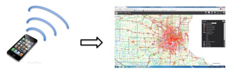
The vendor developed its proprietary approach, combining GPS-based navigation data with location-based service data. The firm normalized these two data sets with U.S. Census population projections, then calibrated and scaled samples with data from 69 MnDOT permanent ATR sites. StreetLight then estimated traffic volumes for MnDOT based on 7,837 short-duration count sites.
What Did We Learn?
On multiple-tube, high-volume roadways, MnDOT expects an accuracy of over 95 percent. The correlation between AADT tube-based data and StreetLight’s data was 79 percent without calibration and scaling, and 85 percent when scaled and calibrated. GPS-linked traffic volume estimations are approaching acceptable accuracy for MnDOT, but are not yet sufficiently accurate to replace tube counting for assessing AADT.
Estimation accuracy varies heavily with traffic volume levels. At high levels of traffic, larger sample sizes of mobile devices seem to drive more accurate assessments. At over 50,000 AADT, StreetLight estimates reached mean absolute percent error levels of 34 percent. At AADT levels below 20,000, the percent error rates ballooned. At all traffic levels, GPS-based data was measured at 61 percent mean absolute percent error.
Low-volume roads and frontage roads where multiple roadways converge had to be removed from count sites for estimating AADT. Overall, some of the GPS-based data fell within 10 to 20 percent absolute percent errors, which is acceptable, but other estimates fell well outside an acceptable range, and the highest errors occurred in low-volume roadway assessments.
What’s Next?
GPS-based data offers granular information that tube counts cannot, like average annual hourly volume estimates, and origin and destination data. With improvements to analytical processes for all data, GPS-based data may provide value outside of AADT estimates.
Currently, MnDOT is evaluating origin-destination data that StreetLight is providing for use in traffic studies and planning analyses. Current research by the University of Maryland and the National Renewable Energy Laboratory is gathering data with better error rates and will be extended in Colorado, Florida and Rhode Island. MnDOT expects volume estimation from GPS-based data will continue to improve and will likely be an acceptable alternative to tube counting in a few years.
This post pertains to Report 2017-49, “Using Mobile Device Samples to Estimate Traffic Volumes,” published December 2017.
