Category Archives: Aviation

Research assesses roles and impacts of Minnesota’s local airports

Reprinted from Catalyst, January 22, 2025

To better understand how Minnesota’s small public airports affect their local economies, researchers from the Transportation Policy and Economic Competitiveness Program (TPEC) at the University of Minnesota’s Humphrey School of Public Affairs chose three to profile from across the state. They shared their findings at the 2024 CTS Transportation Research Conference in a presentation highlighting the complex roles and community impacts of local airports.

The profile study built on a 2018 TPEC project that explored the value of airfreight networks for Minnesota’s medical supply chain. In addition, the researchers aimed to update information from a 2019 Minnesota Department of Transportation (MnDOT) study that examined the economic impact of 126 of the state’s 133 public airports.

“We were prompted by questions from several stakeholders, including TPEC advisory board members, to see if there were any travel changes or other impacts from the COVID-19 pandemic or high levels of inflation that had happened since those other studies were completed,” said Frank Douma, director of state and local policy and outreach at the Humphrey School’s Institute for Urban and Regional Infrastructure Finance (IURIF) and the project lead. The research team also included Barbara Rohde, IURIF researcher and licensed pilot, and Audrey Clark, an urban/regional planning graduate student.

Data for the three airport profiles was gathered through interviews with airport and city officials in February and May of 2024.

Granite Falls Municipal Airport

Plane mounted at entrance to Granite Falls Airport

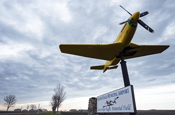
Unique among the three airports studied, the Granite Falls Municipal Airport in west central Minnesota receives no federal funding and attributes its ongoing success to the support of MnDOT and the local business community. A primary user for this 152-acre, one-runway airport is one of the biggest energy and ethanol firms in the Midwest—Fagen, Inc. The company hosts visitors from all parts of the US who travel to Granite Falls in corporate jets for meetings and tours.

The airport is also an active UPS hub—vital for supporting local resident and business needs—and draws tourists with a local bi-annual airshow held in association with the Fagen Fighters WWII Museum that showcases a collection of working aircraft from the era.  

Mankato Regional Airport

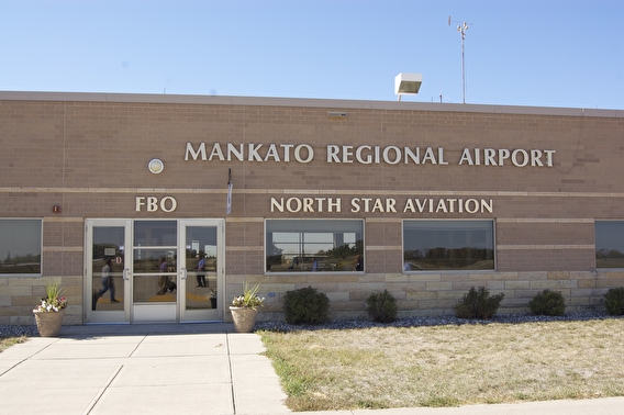
“It may be a surprise to some, but the Mankato Regional Airport is the second busiest in the state, following Minneapolis-St. Paul International,” Douma said of the airport located in south-central Minnesota. 

Most of the operations on the airport’s two runways support and serve student pilots; North Star Aviation, a major US flight school, trains 700 aviation students who log more than 40,000 flight hours annually.  “As a person who has taken many flight school lessons, I was so impressed,” said Rohde. “These kids fly until 11 at night to get their time in.” The school provides a direct recruitment pipeline to Minneapolis-based Sun Country Airlines.

The airport also serves the area’s retail, agriculture, and health care industries, which include:

  • A 450,000-square-foot Walmart Distribution Center that opened in 2015 and is undergoing a major expansion.
  • Veterinarians who board planes every morning to travel the country for swine testing.
  • Mayo Clinic helicopters, based here to take advantage of the central location.

Roseau Municipal Airport

Ten miles south of the Canadian border, Roseau Municipal Airport mostly serves the Polaris company’s 1,500-employee manufacturing facility, ferrying executives and researchers across the US from the airport’s single paved runway. Additionally, the airport focuses on supporting community development and health care access with medevac transportation.

Conclusions and next steps

Local airports contribute significantly to the economic competitiveness, community pride, and identity of the Minnesota cities that host them, the researchers found. However, the nature of those contributions is different for each airport, encompassing transportation links, business facilitation, tourism, and emergency services.

A subgroup of TPEC advisory board members recently formed to further expand this research and seek national, state, and institutional partnerships.

—Jacqueline Bass, CTS program editor

Related resources

Future of Mobility: Urban air mobility

June 26, 2023

What’s next in transportation?

The Future of Mobility series collects the perspectives of top U researchers and other national experts. In 17 articles, the authors scan the horizon and reflect on critical transportation topics. Each article recommends action steps for public officials and policymakers.

CTS is highlighting the articles over the course of the year. This month, we explore two aviation-related articles:  Safety and Urban Air Mobility by Demoz Gebre-Egziabher and Advanced Air Mobility by Susan Shaheen and Adam Cohen.

Autonomous aircraft and drones that can move people and goods in new ways are coming to our cities, writes Gebre-Egziabher. Often referred to as urban air mobility (UAM), these new transportation concepts are the flying equivalent of the autonomous car—and they raise just as many important questions about safety, use, and operations. Local communities and agencies are stakeholders that must have a say in safety and provide clear guidance to those developing technologies for UAM, he says.

Shaheen and Cohen write that aviation is undergoing rapid change around the world. A variety of technological advancements and industry investments in electrification, alternative fuels, automation, vertical take-off and landing aircraft, uncrewed aircraft systems, and air traffic management are enabling innovations in aircraft designs, services, and business models. They recommend driving the industry forward with an emphasis on social and environmental benefits, including humanitarian, aeromedical, and emergency response.

Using drones to inspect bridges

MnDOT is researching how data and images collected by drones, such as the Aeryon Skyranger shown here, could aid bridge inspectors.
MnDOT is researching how data and images collected by drones, such as the Aeryon Skyranger shown here, could aid bridge inspectors.

In recent years, drones made headlines for fighting wars overseas, detecting crop conditions, keeping an eye on power lines and even delivering retail goods.

As the flying electronic devices became easier to use and less expensive, all sorts of individuals, businesses, nonprofit groups and government organizations – including the Minnesota Department of Transportation (MnDOT) – are exploring ways to use them.

This past summer, MnDOT began researching how to employ these unmanned aerial vehicles, or UAVs, to someday help inspect the state’s many bridges.

“That day may still be far off, but our initial project was an encouraging first step,” said Jennifer Zink, MnDOT bridge inspection engineer. “Phase 2 of the project will better provide details as to methods, criteria and cost effectiveness for how to apply drone technology best to bridge inspection.”

Project goal

Using drones could also minimize risks associated with current bridge inspection methods, which include rope systems and special inspection vehicles. (Photo by D.R. Gonzalez, MnDOT)
Using drones could help minimize risks associated with current bridge inspection methods, which include rope systems and special inspection vehicles. (Photo by D.R. Gonzalez, MnDOT)

The research team tested drones this past summer while inspecting four Minnesota bridges (in Chisago County, Olmsted County, Morrison County and near Stillwater) specifically selected for the study after an extensive evaluation and FAA approval.

Zink and her colleagues wanted to investigate whether drones could help MnDOT decrease the rising costs of bridge inspections and collect more detailed information. Drones could also minimize the risks for bridge inspectors, who currently use rope systems and special inspection vehicles to access hard-to-reach areas. Using a drone to gather images could keep inspectors out of harm’s way and inspection vehicles out of active traffic lanes.

“The goal of the project was to study the effectiveness and possibilities of using UAVs to aid in bridge inspection work, typically in gathering images without the use of an under-bridge inspection vehicle and in areas where access is difficult or not safe for an inspector,” Zink said. “There is no substantive guidance in existence for this application of this evolving technology. This initial effort was to gain a better understanding of potential capabilities, processes and planning best practices.”

FAA approval

Before simply launching drones and collecting bridge data, the research team reviewed current FAA rules and applied for the necessary exemptions. Approval was granted, but only for the use of an Aeryon Skyranger drone. Even though exemptions for several models were submitted to the FAA, none were approved in time for the field study.

The team, which included personnel from Collins Engineers Inc. and Unmanned Experts, also worked closely with the MnDOT Office of Aeronautics to plan the project and gain the necessary approvals. The Aeronautics Office recently published an official MnDOT drone policy.

In the air

Once in the air, the drone suitably performed a variety of inspection functions that didn’t require a hands-on physical inspection. Researchers tested the drone’s ability to gather high-quality still images and video footage of bridges. They also collected data from infrared cameras. In addition, the drone provided the ability to capture data needed to construct maps of bridge areas and 3D models of bridge elements.

“The images, including infrared images to detect deck trouble spots, obtained from the drone correlate to the findings in the bridge inspection reports for specific bridge elements,” Zink said.

Missing from the research were images of the underside of bridges. The drone model used in the study wasn’t able to shoot images upward from beneath a bridge, and inspectors identified that as a key feature along with the ability to operate without a GPS signal.

“The drone we used in this project was not completely ideal for an entire gathering of imagery for all bridge inspection elements as it was limited to GPS signal capability,” Zink said. “However, it did give us an idea of what a drone could provide, what the limitations were, and what features we would like to see on newly available UAV models. Unfortunately, our hands were tied with obtaining FAA exemptions only for the particular model used in this project within the funding timeframe.”

Conclusions and recommendations

The project’s final report listed several conclusions, including that drones can be used safely during bridge inspections and that risk to both the inspectors and public is minimal.

“Due to the successful outcome of the initial project, we have a better understanding of the drone capabilities we would like to use during an actual scheduled bridge inspection,” Zink said. “The drone that will be used in Phase 2 is specifically designed for inspection of structures. Several goals exist for the Phase 2 research project, and if we can accomplish them, they will decrease MnDOT’s costs and increase bridge inspection abilities. It could improve inspection data collection for local agencies as well.”

The researchers recently were notified that they received funding for Phase 2 of their project, which is expected to start later this fall.

Related links

Unmanned aircraft systems create buzz of activity, but challenges remain

In late 2013, Amazon.com announced that it plans to someday use unmanned aircraft systems (UASs) to deliver packages. Amazon is not alone in considering these systems—the list of potential uses for this technology is rapidly expanding. Where is this technology headed, and what does it mean for the region, and for transportation?

State and national experts discussed these issues at an April 30 forum hosted by the Airport Technical Assistance Program (AirTAP), a part of CTS.

Often referred to as drones, modern UASs can be used for a broad range of activities, from aerial photography, surveying, precision agriculture, and communications to disaster response, wildlife research, and infrastructure protection.

Potential uses of UASs include precision agriculture.

A hurdle to broader use is the lack of rules and regulations. Last November the Federal Aviation Administration (FAA) released its first annual roadmap outlining policies, regulations, technologies, and procedures needed to safely integrate UASs into U.S. airspace; it plans to issue regulations by 2015.

“The greatest challenge is integrating UASs into the National Airspace System,” said Brigadier General Alan Palmer, director of the Center for UAS Research, Education, and Training at the University of North Dakota. “We want to do this safely, we want to do no harm, and we want to be sure not to violate somebody’s personal space. We do not have any regulations for standards, training, certification, or anything like them. But we will get there.”

Other concerns include privacy issues and the existing aviation/navigation infrastructure, which did not account for a future including UASs when it was built 50 years ago.

To learn more about the forum, read the full article in the June issue of Catalyst. In addition, a proceedings from the event will be available on the AirTAP website this summer.