Tag Archives: Snowplows

New system underway to determine road recovery time during snow events

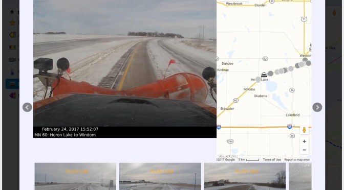
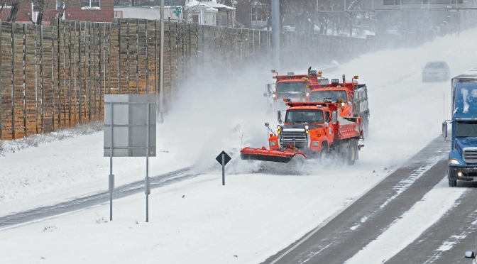
Researchers at the University of Minnesota Duluth (UMD) have developed a system that can use highway loop detector traffic flow and weather data to determine when road conditions have recovered from a snow event. Currently, the Minnesota Department of Transportation (MnDOT) relies on snowplow drivers to estimate when roads are back to normal. The new system aims to relieve drivers of that burden and increase overall fleet efficiency.

In two previous MnDOT-funded projects, UMD researchers looked at using data from loop detectors along with weather station data to develop an automated system that determines normal condition regain time (NCRT) based on changes in traffic flow patterns. The goal is to improve the accuracy of road condition estimates and give dispatchers a big-picture view of traffic flow.

2018-01-p1-image
A line drawing showing a rectangular closed wire loop approximately 6 feet long and 4 feet wide on a road lane beneath the pavement surface. The loop is attached by a length of wire to data collection equipment on the roadside.

“This is a shift to different criteria,” says John Bieniek, Metro District maintenance operations engineer at MnDOT. “The bare lane regain time is now based on judgments from plow operators on the highways and phone calls to dispatchers. We could use the new system to quickly direct trucks to harder-hit areas within and between stations as they are needed.”

The latest project, led by UMD civil engineering professor Eil Kwon, transformed a previously developed computer model into a user-friendly, integrated computer system. The system includes a data management module, a module for target detector station identification and speed recovery function, an NCRT estimation module, and a map- based user interface that allows dispatchers to generate the estimated NCRT for a specified area. Dispatchers and supervisors can also use the interface to assess traffic flow variations, assign plows, and generate reports for past snow events.

The team tested the new integrated system on data gathered from I-494 and I-694 during two snow events in 2015 and 2016. Results show the system was able to successfully generate NCRTs that met or exceeded the accuracy of estimates by maintenance personnel.

“The system developed in this research can provide consistent and objective estimates of the NCRT by utilizing the traffic flow data that are currently available from the existing detection systems in the metro area,” Kwon says.

Another goal of the project was determining a data-derived definition of normal traffic flow for snow-cleared roadways. As part of this effort, researchers found that traffic resumed free-flow conditions after roads were cleared, but always at a slightly slower speed than on normal, dry roads. Researchers then developed a process to determine the “wet-normal” free-flow speed at each detector station based on the traffic flow pattern during a given snow event.

So far, the system has only been used with data from past snow events and has not generated results in real time. Going forward, MnDOT plans to fund additional work that will incorporate big data tools to allow the system to operate in real time—as storms happen—to improve roadway snow operations.

This article originally appeared in CTSs Catalyst Newsletter, May 2018 and pertains to Technical Summary 2018-01TS. The full report, “Development of a Road Condition Recovery Time Estimation System for Winter Snow Events” 2018-01, published January 2018, can be accessed at mndot.gov/research/reports/2018/201801.pdf.

Salt Brine Study Shows Truck Traffic Drives Deicer Effectiveness

Truck traffic significantly improves deicer performance, deicers perform poorly below 10 degrees Fahrenheit, and brine is spread more by traffic spray and snowplow throw than by storm runoff.  This is the outcome of multi-year tests performed in the snow-covered parking lots of two Twin Cities entertainment destinations.

“There is notable airborne removal of deicers from road spray by vehicles and under high wind conditions. For the deicing materials MnDOT uses, little melt is observed below 10 degrees Fahrenheit,” said Tom Peters, Maintenance Research and Training Engineer, MnDOT Office of Maintenance.

MnDOT has conducted several research projects to better understand the performance of both deicing and anti-icing materials (applied to the roadway before a storm to prevent or mitigate ice buildup). Two previous studies evaluated solid materials and liquid brine. In Phase I researchers examined over 50 deicer and anti-icing compounds and blends. They determined that ice melt capacity correlates closely with application temperature, which is the principal factor in effectiveness. Rock salt offers greater ice melt capability, but liquid deicers adhere better to roadways and cause less corrosion and environmental damage to road and bridge environments.

In Phase II, researchers studied deicer performance in the field and considered how traffic levels, truck volumes, weather, pavement type and other factors affect performance. Research showed that deicers work better at warmer temperatures, with little effectiveness below about 10 degrees Fahrenheit. Truck traffic significantly improved deicer performance, contributing to wider and quicker melts. Chlorides were swept off bridge decks by snowplowing, and deicing effectiveness diminished as truck speed rose.

However, severe weather hampered research in Phase II; the winter of 2013-2014 was the coldest experienced in Minnesota in over 30 years. The severity of winter conditions impeded the temperature study of deicer performance and snowplow performance, leaving the research team and MnDOT interested in further study.

What Was Our Goal?

This study aimed to continue the work of Phase II in more representative winter conditions. Researchers evaluated deicer effectiveness, plowing effectiveness, anti-icer persistence in traffic and drains, and pavement shedding of deicers.

What Did We Do?

During the winters of 2015-2016 and 2016-2017, both of which were mild with below-average snow accumulations, the research team followed closely the methods used in Phase II.

Deicers were studied at two facilities in Shakopee, Minnesota. One facility included nine 900-foot lanes on which plow trucks spread deicers at highway speeds. The other facility featured four 500-foot lanes, where deicers were spread by hand in 100-foot segments. Investigators monitored weather and evaluated deicer performance with photography and infrared thermography.

Snowplowing by MnDOT Metro District plow operators was conducted at the two Shakopee facilities as well, at operating speeds of up to 30 mph. Researchers documented performance of various plow configurations in various truck combinations with on-site observation, handheld photography and time-lapse photography.

Anti-icing, in which deicer brines are applied to dry pavement to prevent ice formation, was conducted on an elevated section of U.S. Highway 169 near Mankato that experienced actual traffic. Investigators recorded application rate, time, temperature, precipitation and traffic, as well as deicer flow and concentration in storm drainage runoff over time.

A researcher mixes deicers in bags before spreading by hand at the test site.

Researchers studied pavement shedding of deicers in a lab in terms of storm runoff flow and anti-icer concentration in drainage from artificially induced precipitation. Deicers were applied in brine form, dried, chilled and held at temperatures below the freezing point of water and within the range of effective ice melt temperatures.

What Did We Learn?

Research confirmed that deicer performance varies with temperature, with little benefit from rock salt at 10 degrees Fahrenheit or colder unless the pavement is exposed to sunlight. Deicer accumulated in drains at substantially lower levels than roadway applications suggest regardless of traffic conditions, confirming observations that the majority of deicer loss occurs from displacement by traffic and snowplows.

Plow results were fairly uniform across all lanes and along lane lengths for a given plow type, suggesting truck, plow and driver combinations performed uniformly at each track. At higher speeds, snow rises higher in the curvature of the plow, and snow casts more broadly off plow ends and distributes to greater distances.

“Truck traffic makes a huge difference on deicer performance. If two or three dump trucks that aren’t spreading but have weight in them follow a salt truck, salt use might be cut by two-thirds,” said Stephen Druschel, Professor, Minnesota State University, Mankato, Department of Civil Engineering.

Deicers and anti-icers showed wider and quicker melting capability with traffic, especially by trucks, than without. Prewetting offered no significant observable benefit under most conditions, contrary to reports from snowplow drivers in field operations, unless snow was dry; then significant benefits were observed.

Asphalt and concrete pavements shed salinity at high levels initially and at declining levels at about 0.3 inch precipitation. The type of pavement involved had no apparent effect on deicer runoff.

What’s Next?

The impact of truck traffic on deicer performance is significant and needs to be widely communicated. Reports that prewetting improves deicer adhesion in windy conditions and speeds the initiation of ice melt may warrant further review. Evaluation of atmospheric and off-roadway drainage may help quantify traffic-induced brine spray and plow throw.

View Dr. Stephen Druscel’s YouTube presentation, Winter Plowing and Deicing: Saving Money, Salt and Labor by Distinguishing Best Practices.

This post pertains to Report 2017-45, “Salt Brine Blending to Optimize Deicing and Anti- cing Performance and Cost Effectiveness: Phase III.” The full report and appendices can be accessed at mndot.gov/research/reports/2017/201745.pdf and mndot.gov/research/reports/2017/201745B.pdf.

Adding Snowplow Camera Images to MnDOT’s Traveler Information System

MnDOT installed network dash cameras and ceiling-mounted cameras on 226 snowplows, approximately one-quarter of MnDOT’s snowplow fleet. The cameras, integrated with the onboard mobile data computer and automated vehicle location equipment, automatically captured snapshots of road conditions during plowing. The snapshots were incorporated into several facets of MnDOT’s 511 traveler information system: the desktop and mobile versions of the website and the 511 app. Motorists and MnDOT alike found the project to be valuable, with the up-to-the-minute imagery helping members of the public and MnDOT’s maintenance staff make well-informed decisions during winter storm events.

“The largest barrier to implementation involved the development of the software package for integrating snowplow cameras into the current AVL system. It required a great deal of back-and-forth to get things right,” said oe Huneke, Maintenance Decision Support Systems (MDSS)/AVL Section Manager, MnDOT Office of Maintenance.

“We did research to make sure the cameras did not block drivers’ views, taking state and federal regulations into consideration, and we tested the cameras to make sure they were capturing images at the right resolution,” said Jon Bjorkquist, Maintenance Technology Development/ Implementation Coordinator, MnDOT Office of Maintenance.

What Was the Need?

Reliable information about road conditions during winter weather allows motorists to make informed travel decisions and helps MnDOT responders maintain roads. While meteorological updates on a winter storm and automated status reports on Minnesota’s snowplow fleet are important sources of data, they do not provide visual information about road conditions.

In 2015, a pilot project allowed MnDOT to take road condition pictures from cameras mounted on selected snowplows during winter storms. The system was limited, however. Few snowplows were outfitted with these cam-eras, images were not available to the public, and network infrastructure did not allow for easy scaling. A larger scale program was needed to capture road imagery taken from snowplows across Minnesota and to share the pictures with Minnesota motorists.

What Was Our Goal?

MnDOT sought to install cameras on a sizable portion of MnDOT’s snowplow fleet. In addition to making hardware and network enhancements to collect and compile the image data, MnDOT also set out to make the photos avail-able in near-real-time to its internal maintenance staff and the traveling public.

Camera mounted on the ceiling of a MnDOT snowplow cab.
To capture images of road conditions, MnDOT mounted cameras in the cabs of one-quarter of MnDOT’s snowplow fleet.

What Did We Do?

In 2015 and 2016, MnDOT installed network dash cameras and ceiling-mounted cameras on 226 snowplows, approximately one-quarter of the agency’s total snowplow fleet. The cameras, integrated with the onboard mobile data computer and automated vehicle location (AVL) equipment, automatically captured snapshots of road conditions during plowing. This system included the following key operational features:

  • The dash cameras automatically recorded images whenever the computer-AVL system was on.
  • The cameras recorded an image of the road ahead of the plow.
  • Images were taken once every five minutes and were only retained if the plow was moving at least 10 mph.
  • The cameras were capable of taking operator-initiated snapshots and video clips.
  • Video clips could be classified into three categories: accident, general interest or work zone.

The system sent the plow camera images and metadata (geolocation, plow, camera and conditions) to a MnDOT server upgraded to accommodate the data. MnDOT set a data retention schedule for mobile snapshots and video segments as well as the data server.

Plow images were incorporated into several facets of MnDOT’s 511 traveler information system, including the desktop and mobile versions of the website and the 511 app. Plow images plotted at 10-minute intervals on the 511 maps provided motorists with up-to-the-minute, easily accessible information on road conditions. The images were also incorporated into MnDOT’s internal website called Condition Acquisition and Reporting System.

What Did We Learn?

The project demonstrated the successful integration of various hardware, software and network systems, carrying the road weather imagery step by step from the cameras to the public 511 interface. The project also succeeded in scaling up an earlier, modest effort to furnish snowplows with cameras.

In addition, MnDOT collected input on the value of the cameras from a range of interested parties: the public, snowplow operators and supervisors, and MnDOT management staff.

The public response was overwhelmingly positive, with 319 Facebook users responding to a MnDOT post about the cameras. All the respondents used positive emote icons (“heart” or “thumbs up”). Several members of the public provided responses through Facebook and MnDOT’s “Contact Us” Web page about the value of being able to view actual road conditions, though others expressed concern about the cost of the system.

Surveys of MnDOT snowplow drivers and supervisors and interviews of MnDOT managers revealed that supervisors and managers had a largely positive view of the program as well. Drivers provided mixed reviews. Comments from these groups yielded the following recommendations about implementing a program of this nature:

  • Perform outreach efforts that clearly communicate benefits to achieve broad buy-in from snowplow drivers. Provide training and follow-up instruction on use of the cam-era’s features to encourage drivers to use the manual snapshot and video features.
  • Address drivers’ concerns about privacy (such as “Big Brother is watching”) directly, and understand that these concerns have lessened over time. Supervisors should be advised not to react too quickly to privacy concerns.
  • Address concerns about in-cab distraction by adjusting the system configuration or hardware. This might include making dash camera screens dimmable at the driver’s option, or placing screens and cameras out of critical sightlines.

What’s Next?

This project was a success, with snowplow camera images providing significant benefits to MnDOT staff and the traveling public. Based on this work, MnDOT plans to install camera systems on additional snowplows in the state fleet—as deemed necessary by district management—and to continue displaying snowplow images on MnDOT’s 511 system.


This post pertains to Report 2017-41, “Installing Snowplow Cameras and Integrating Images into MnDOT’s Traveler Information System,” published October 2017.

Deicing treatments tested at Valleyfair, Canterbury Park

Excalibur and the High Roller may be closed for the season, but Valleyfair Amusement Park still has one attraction open for the season: a driving track for Minnesota snowplow drivers.

MnDOT-funded researchers are studying the effects of weather and vehicle traffic on different deicing treatments in the parking lots of Valleyfair and Canterbury Park in Shakopee, Minn.

It’s been a busy winter, but each week MnDOT Metro District snowplow drivers make one last stop before heading home, to apply different combinations of salt and anti-icing chemicals to nine 1,000-foot driving lanes. They also drive over each lane multiple times to test the effect of traffic.

“We’re running trucks up to 30 miles per hour with different speeds, wind conditions, traffic conditions and pre-wetting chemicals,” said Steve Druschel, a researcher with the Minnesota State University, Mankato. “Each lane is its own experimental unit.”

Professor Steve Druschel speaks with MnDOT snowplow driver John Hokkanen.

Professor Druschel’s students will review more than 17,000 photos from time-lapsed cameras to document how the snow melted in each experimental run.

“The influence of factors like pavement type and age, traffic volume, truck proportion, weather conditions and sun presence will be assessed to evaluate which techniques have special advantages for certain situations or roadways,” said Maintenance Research and Training Engineer Tom Peters.

In 2010, Druschel tested 25 anti-icing compounds in 1,500 different combinations in a laboratory to study the effectiveness of different deicers.

“Public work superintendents commented, ‘Great work. It looks good, except it’s all in the lab. Beakers aren’t what people drive on,’ ” Druschel said. “So we’re taking it from the two-inch ice cup to the real world in phase two of this study.”

With rock salt prices quadrupled, finding the most cost-effective methods of treatment is important.

This latest research will help determine the best times for applying anti-icing treatments and examine whether certain chemicals — such as a pre-storm liquid treatment that costs twice as much — melt enough snow to be worth the extra cost.

Test runs in Shakopee are strictly experimental, but in Mankato students are analyzing how real-world salting treatments are working on the North Star Bridge.

An article in the Mankato Free Press tells how Druschel’s team is collecting road melt runoff and documenting bridge traffic. (Big trucks, for instance, squeeze more water out of the snow.)

MnDOT snowplow driver John Hokkanen makes a test run at the research site at Canterbury Park.  (Photo by Nick Busse)
MnDOT snowplow driver John Hokkanen makes a test run at the research site at Canterbury Park. (Photo by Nick Busse)

Students plan to use time-lapsed photos, along with weather data and snowplow records, to determine what chemical treatments worked best – and when.

With the multi-pronged research project, Druschel hopes to put definitiveness to what some snowplow drivers have already tried in the field.

“The key to it is not so much that we’re so smart and we have a better idea or are inventing something new,” he said. “We’re just trying to enhance what they are already doing.”

Helpful resources

Salt Brine Blending to Optimize Deicing and Anti-Icing Performance –Technical Summary (PDF, 1 MB, 2 pages) and Final Report (PDF, 11 MB, 151 pages) (previous study)