

MnDOT owns and maintains approximately 900 buildings across Minnesota, and the Building Services Section is responsible for planning repairs, renovations or expansions. Architects, engineers and other specialists involved in these activities require data regarding building and site conditions. Collecting this data is often a multidisciplinary and laborious effort that can be time-consuming and expensive. Alternative technologies, however, can gather and process large amounts of accurate information more comprehensively, safely and cost-effectively.
With reality modeling, which uses aerial imagery or photographs processed into 3D models, one person can quickly collect a large amount of data. Similarly, 360-degree scanning uses high-definition cameras to capture a space in digital 3D. Using these tools and post-processing software, asset management staff can model and analyze an entire building—interior and exterior—for a variety of purposes.
“These technologies allow MnDOT to very quickly collect a large amount of asset data that can be used for inspections, planning or design. The digital twins of buildings and building sites can be efficiently stored, shared and utilized for ongoing asset management,” said Barritt Lovelace, vice president of UAS/AI/Reality Modeling, Collins Engineers, Inc.
Remote data collection could eliminate the need for multiple staff and site visits to collect measurements and other information, resulting in substantial cost savings, improved safety and more accurate data. MnDOT saw this potential and wanted to better understand the possible uses and benefits of scanning and reality modeling technologies.
What Was Our Goal?
The goal of this project was to explore cost-effective and easily implemented methods to collect, process and share site and building data with imaging and scanning technology.
What Did We Implement?
Previous research reviewed existing scanning and associated technologies, and identified the agencies using these technologies for inspecting and documenting building sites. Although that effort found few state transportation agencies currently using the technology for building asset management, many agencies are interested in applying it to maintenance, repairs and renovations. The compendium of technologies and evidence of private sector uses provided a foundation from which to test the tools on several MnDOT building sites.
What Did We Do?
Investigators identified scanning technologies that can be used for building asset management:
- Data collection. Uncrewed aircraft systems (UAS, or drones), digital and 360-degree cameras with GPS and other features, lidar and laser scanning can create images to process into 3D models.
- Virtual reality. Models can be viewed with a headset, giving a user a better sense of scale than viewing on a computer screen.
- Mixed reality. Using a headset that can incorporate other data, the user can inspect the virtual building or site in a hologram, take measurements and make notes.
- Data processing and sharing. Post-processing software creates reality models, orthomosaics and orthoplanes from raw data that are geospatially accurate to the subcentimeter level. Products can be manipulated and shared widely and easily through cloud platforms.
Investigators used these technologies to scan seven building sites, including truck stations, storage buildings, research facilities and a materials lab. They produced “digital twins,” in which thousands of images form 3D models that can incorporate other data, such as inspection reports and exterior and interior data.
What Was the Result?
Applying scanning and related technologies to MnDOT building sites, the project team identified the quality and quantity of data collected in a significantly quicker and safer manner than traditional methods. From these examples, the cost-efficiencies, shareability and expanded utility of scanning and imaging products were shown.
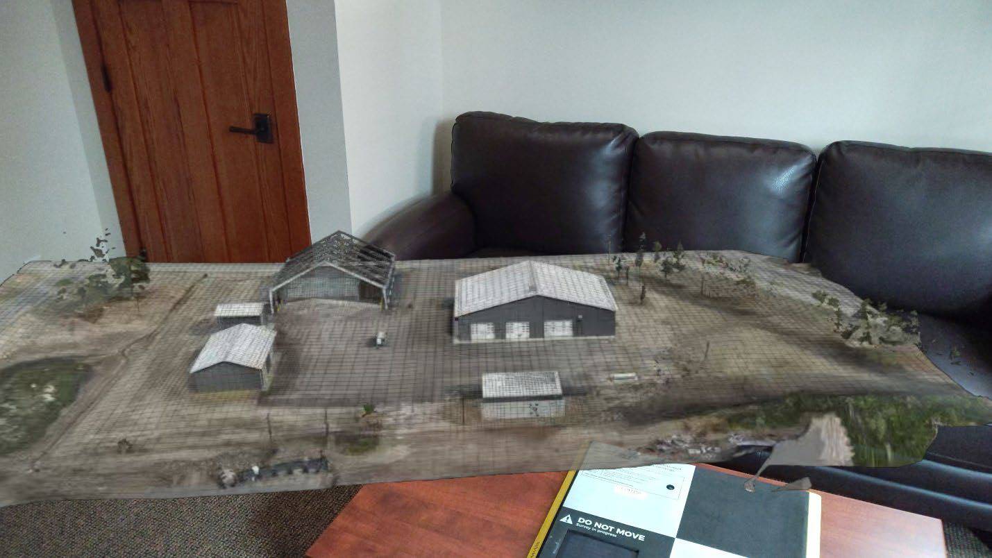
All sites took less than a day—most only two to three hours—to collect all data necessary for 3D maps and other products. While there may be upfront costs for scanning equipment, the time savings in data collection is substantial. Investigators also estimated that scanning technologies can produce 100,000 times the data that can be collected manually. More comprehensive data can be better manipulated and improves asset management decision-making. Historical records are easy to build for monitoring purposes, and all data is easily shared.
“This project helped us identify applications that can really benefit from this technology, such as tracking the condition of assets and generating detailed floor plans, all without multiple staff from different offices traveling to the site,” said Christopher Bjork, building process coordinator, MnDOT Building Services Section.
Additionally, as building sites can be busy with truck traffic and potentially hazardous materials, collecting data remotely is significantly safer for MnDOT staff. Teams can access a virtual world where they can view comprehensive data about a building site (across time periods, if necessary), including hard-to-access areas, without having to physically travel to the site.
Investigators compared results from different tools and tool combinations. They provided links to the processed data for all sites, including, for example, the MnROAD Research Building and the Mendota Heights Truck Station. They also produced an 8-minute video summary of the data collection and post-processing for the Walker Truck Station.
What’s Next?
Through this work, MnDOT identified possible key building asset management uses of scanning technologies. While other MnDOT programs have various scanning and post-processing capabilities, the Building Services program has limited equipment and is considering both coordinating with other programs and potential investments into needed hardware and software. Contracting for these specialized services may be an additional option.

2 thoughts on “Managing Building Assets With Scanning and Reality Modeling”