

Roadside infiltration facilities like wet ponds and swales have been used for more than 30 years to filter roadway contaminants from stormwater runoff, but they have a high rate of failure due to inaccurate determination of soil infiltration rates.
Researchers sponsored by the Minnesota Local Road Research Board have developed new tools and protocols to provide designers and engineers with the accurate infiltration measures they need, from initial site selection through construction.
Background
The Minnesota Pollution Control Agency (MPCA) has stormwater treatment requirements for any new road projects or improvements to existing highways that add 1 acre or more of linear impervious surfaces. One directive is the capture of the first inch of stormwater runoff combined with approved methods to mitigate the effects of roadway contaminants. To meet this obligation, MnDOT and other agencies construct permanent stormwater management devices such as wet ponds, infiltration basins and other engineered infiltration device reduction systems along roadways.
Although infiltration facilities have been used as stormwater control measures for more than three decades, their failure rate is reported to be between 10% and 50%. Two common causes are inappropriate initial siting and improper determination of the site’s ability to infiltrate water. The latter is known as saturated hydraulic conductivity, or Ksat, and is the most important but least understood parameter of an infiltration facility. Facilities fail when Ksat is assumed to be higher than it actually is; actual values are difficult to measure.
MnDOT and local agencies were aware of the likely causes of failure. They wanted to learn about techniques others may use, as well as to investigate new methods that could support cost-effective design, site selection and production of successful infiltration facilities.
“The predesign selection tool leverages existing data to save designers time and effort as they choose potential infiltration sites from their desks with a computer system rather than through multiple forays into the field,” said Dwayne Stenlund, erosion control specialist, MnDOT Office of Environmental Stewardship.
What Was Our Goal?
The goal of this Local Road Research Board project was to develop means to address the principal causes of infiltration facility failure from proper site locations and to determine more accurate Ksat values at plan defined sites. A parallel objective was to develop facility design standards that would meet volume control requirements of Minnesota watershed districts and municipalities.
What Did We Do?
Researchers first conducted a literature review to examine current infiltration facility practices of state agencies. In addition, the research team conducted five interviews with professionals primarily involved in Minnesota state infiltration projects. Both the literature review and the interviews confirmed that establishment of accurate Ksat values remained a widespread, crucial challenge, from early site selection to later design and construction decisions.
Interview results suggested the importance of early infiltration site selection in the roadway design process, allowing it to be integrated into other design elements. Interviewees noted that predesign site infiltration rates were typically determined based on soil texture rather than in situ infiltration measurements. Potential sites were often selected without knowledge or consideration of measured Ksat values.
“This project’s tools—a predesign selection tool, an improved protocol to accurately characterize a site’s subsurface conditions and a method to take fast field readings during construction—addressed all phases of facility development. All will promote facility success,” said John Gulliver, professor, University of Minnesota Department of Civil, Environmental and Geo-Engineering.
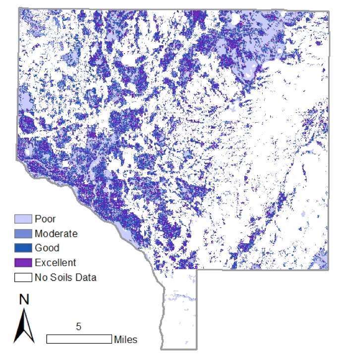
To address these information gaps, researchers developed two protocols to provide essential data. First, they devised a process using desktop analysis for identifying a likely suitable site—and quickly excluding unsuitable sites—for constructing an infiltration facility. The preliminary infiltration rate (PIR) predesign site selection process uses large sets of existing soil and topographic data within a geographic information system (GIS) based site selection tool. In addition to soil data, maps such as MPCA-designated areas where infiltration is forbidden can be overlaid, further guiding selection.
Second, the team conducted extensive experiments and analysis of common infiltration rate testing methods: boreholes, pits and permeameters. Team members developed protocols to accurately characterize the hydraulic conductivity of a site, from initial predesign through construction. Their practical Ksat testing regimen provides a more accurate characterization of site subsurface conditions—essential knowledge for successful facility installation.
What Was The Result?
The study produced two useful products: a GIS-based tool for rapid assessment of suitable locations for infiltration to save time and money during the design phase, and a second product to demonstrate the new Ksat measuring protocol. While most agencies require only one or two permeability tests, spatial variability in soils is very high: Up to three orders of magnitude of permeability have been observed within 3 feet. Multiple infiltration tests are necessary to ensure infiltration facilities will perform as designed.

Researchers developed protocols for common double-ring infiltrometers, specifying tool type, number of tests and the associated level of accuracy. More tests result in greater accuracy. Researchers calculated the number of tests required, considering range of allowable error and percentage of confidence from 67% to 95%. For example, 20 measurements would yield 80% confidence with an allowable error range of a factor of two. Conversely, two measurements would yield results with an allowable error range of a factor of 10. Designers can invest more time and effort establishing a more accurate Ksat measurement early in the process to avoid the later cost and time of a compromised or failed facility.
To assure that compaction or sedimentation has not altered the site’s Ksat, researchers developed a method using a small, lightweight Turf-Tec infiltrometer for rapid testing throughout the infiltration facility construction process.
What’s Next?
The referenced model and data layers described in the study report provide information for incorporation within GIS software programs. Project results will be submitted for publication in appropriate journals for dissemination to a wide audience. Results may be included in stormwater management courses.
